On the banks of the Rhône, by bike
A journey between river and sea! Travel the roads that connect the village of Salin-de-Giraud to Port-Saint-Louis-du-Rhône! Located halfway between Italy and Spain, but also at the estuary of the Grand Rhone, Port-Saint-Louis-du-Rhone is one of the gateways to the Camargue. Stroll along the banks of the Rhone, cross the river with the Barcarin ferry and finish
6 points of interest
Le Barcarin - Marjorie Mercier - PNR Camargue  Water and rivers
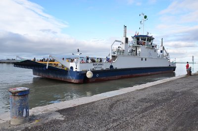
Barcarin's ferry
It was not until 1933 that the first ferry (traille) connecting the two banks of the Grand Rhone was built, replacing the boat. The latter was destroyed during the Second World War and it was not until 1955 for the commissioning of Barcarin II. Today, two ferries make the link between the two banks of the river and take turns to ensure the crossing which lasts only three minutes, just the time to admire the magnitude of the course of the river, which is 500 m wide at this place.
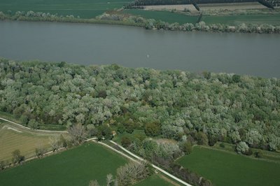
Ripisylve - ©Opus Species - PNR Camargue Water and riversThe ripisylve
Camargue habitats are strongly marked by salt and only the banks of the river and its alluvial ridges escape this influence and develop a denser vegetation. This protection forest, named ripisylve, includes white poplars, ash and elm trees. The banks of the river are colonized by amorphous, reeds and iris marshes. Not very penetrable, the ripisylves shelter species of birds or mammals that find refuge there : beaver, bat, heron, etc.
La tour Saint-Louis - ©Chloé Scannapiéco - PNR Camargue  Patrimony and history
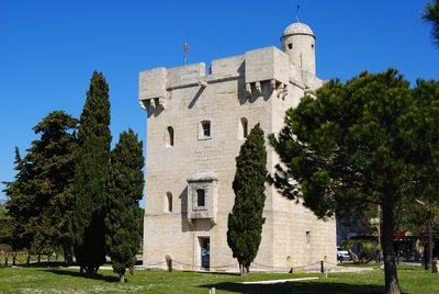
The Saint-Louis tower
This 15m high quadrangular tower was built with the white limestone quarries of Beaucaire or Fontvieille arriving by boat. Built in 1737 on the banks of the Rhone, it served as a lighthouse, customs post and protection against looters. It now houses the Tourist Office and the largest collection of stuffed birds in the Camargue. From the top of the tower, breathtaking 360 ° views of the mouth of the Rhone, the Canal Saint Louis, the city and the salt marshes.
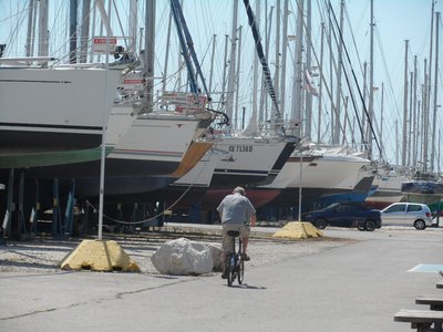
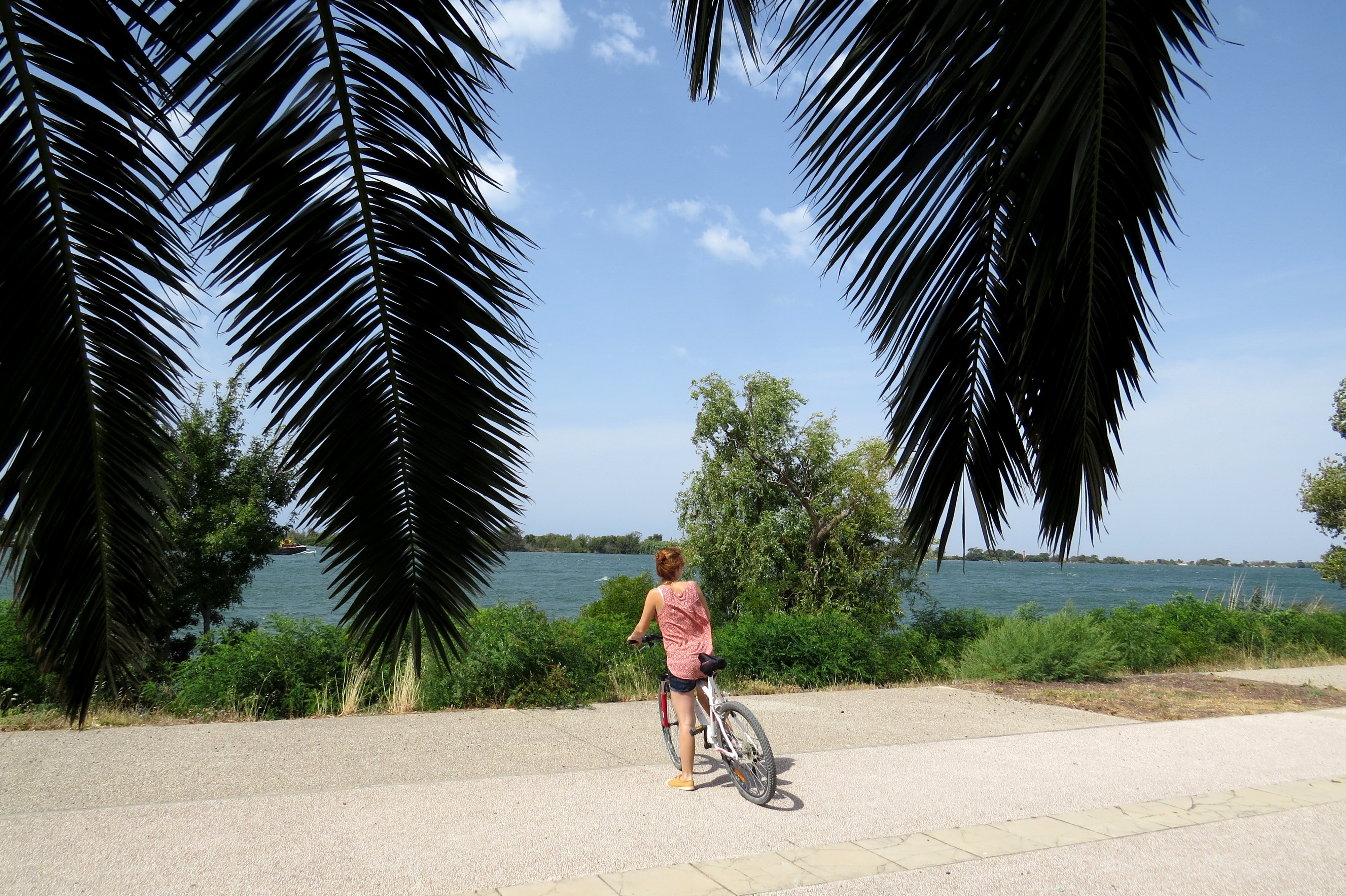
Cycliste à Port Napoléon - ©Juliette Primpier - PNR Camargue Patrimony and historyThe old shipyards
The city of Port-Saint-Louis-du-Rhone was born at the beginning of the century around the port activity. Located both at the mouth of the Rhone and in the industrial-port basin of Fos-sur-Mer, the city offers six ports open to the sea and the Rhone: the leisure port, Napoléon, Navy Service, Plaisance de Carteau, Plaisance d'Olga and Abri du Rhône "Antoine Jover". The former shipyards now welcome companies specializing in boating and yachting.
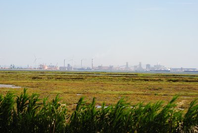
Zone industrialo-portuaire de Fos-sur-Mer - ©Chloé Scannapiéco - PNR Camargue Patrimony and historyThe industrial gulf of Fos-sur-Mer
The industrial-port area of ??Fos-sur-Mer is a vast space integrated in the globalization of the economy by the maritime exchanges which are realized there. The port function and its derivatives (logistic platforms, steel, chemical and petrochemical industry) are crucial and the seaport of Marseille is the main player. The construction of the Fos ZIP at the end of the 1960s was one of the most ambitious land-use operations carried out by the state.
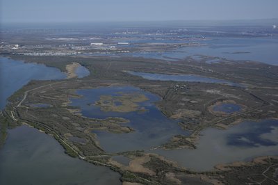
They de Roustan avec le golfe de Fos au loin - ©Opus Species - PNR Camargue Water and riversThe theys of the mouth of the Rhone
A they is a sandy formation modeled by the sea and the river. Around the Port-Saint-Louis-du-Rhone, the theys have gradually become interconnected. They are called ships or captains. The They du Mazet, acquired by the Conservatoire du littoral since 1980 is a feeding, resting and breeding area for many birds and an abundant and original flora. They of the Gracieuse mark the entrance of the Cove of Carteau and that of Roustan leads to the Napoleon beach..
Description
Back to the Tourist Office of Salin-de-Giraud, go on the right then turn left at the intersection of Boulevard de la Gare to join the main road D36. Follow the direction of Bac de Barcarin.
1 - Cross the Grand-Rhône via the Barcarin ferry (free for cyclists and pedestrians).
2 - On the other bank, from the exit of the ferry, take the foot of dike to the right. Follow this path for 4 km along the Bois François area.
3 - On arrival at Port-Saint-Louis-du-Rhône, pass the barrier then take the path on the right. Follow the indications "parcours santé" Bois François along the banks of the Rhone. Follow the main path.
4 - At the intersection, take the path that goes to the right.
5 - Arrived on the Abri du Rhône port, along the banks of the Rhône (picnic areas) to the Tour Saint-Louis (which houses the Tourist Office).
6 - Take the path on the right after the Tourist Office. Cross the small blue bridge and go to the first street on the right towards Napoléon beach. Continue along the Anatole France Avenue along the Rhone and continue straight on Napoleon Road for 6.5 km to the beach.
- Departure : Tourist Office, Salin-de-Giraud
- Arrival : Tourist Office, Port-Saint-Louis-du-Rhône
- Towns crossed : Arles and Port-Saint-Louis-du-Rhône
Forecast
Altimetric profile
Recommandations
Respect the road code on roads open to public traffic.
Stay alert on the D36, dangerous and busy road!
In rainy weather, the health trail at the entrance to Port-Saint-Louis-du-Rhône (reference point 4 and 5) may be impracticable.
Information desks
Domaine de La Palissade
BP 5, 13129 Salin-de-Giraud
OT Port-Saint-Louis-du-Rhône
Tour Saint Louis - Quai Bonnardel, 13230 Port-Saint-Louis-du-Rhône
Transport
Envia transport network : Agglo 10 > Arles/Salin-de-Giraud by Gageron et Villeneuve >> www.tout-envia.com Line 21 > Arles/Port-Saint-Louis-du-Rhône by Mas-Thibert >> www.tout-envia.com; www.pacamobilite.fr
Access and parking
Salin-de-Giraud: 38 km south-east of Arles, by the D570 and the D36.
Port-Saint-Louis-du-Rhône : 40 km south-east of Arles, by the D35.
Parking :
Access
- Emergency number :
- 114
More information
Report a problem or an error
If you have found an error on this page or if you have noticed any problems during your hike, please report them to us here: