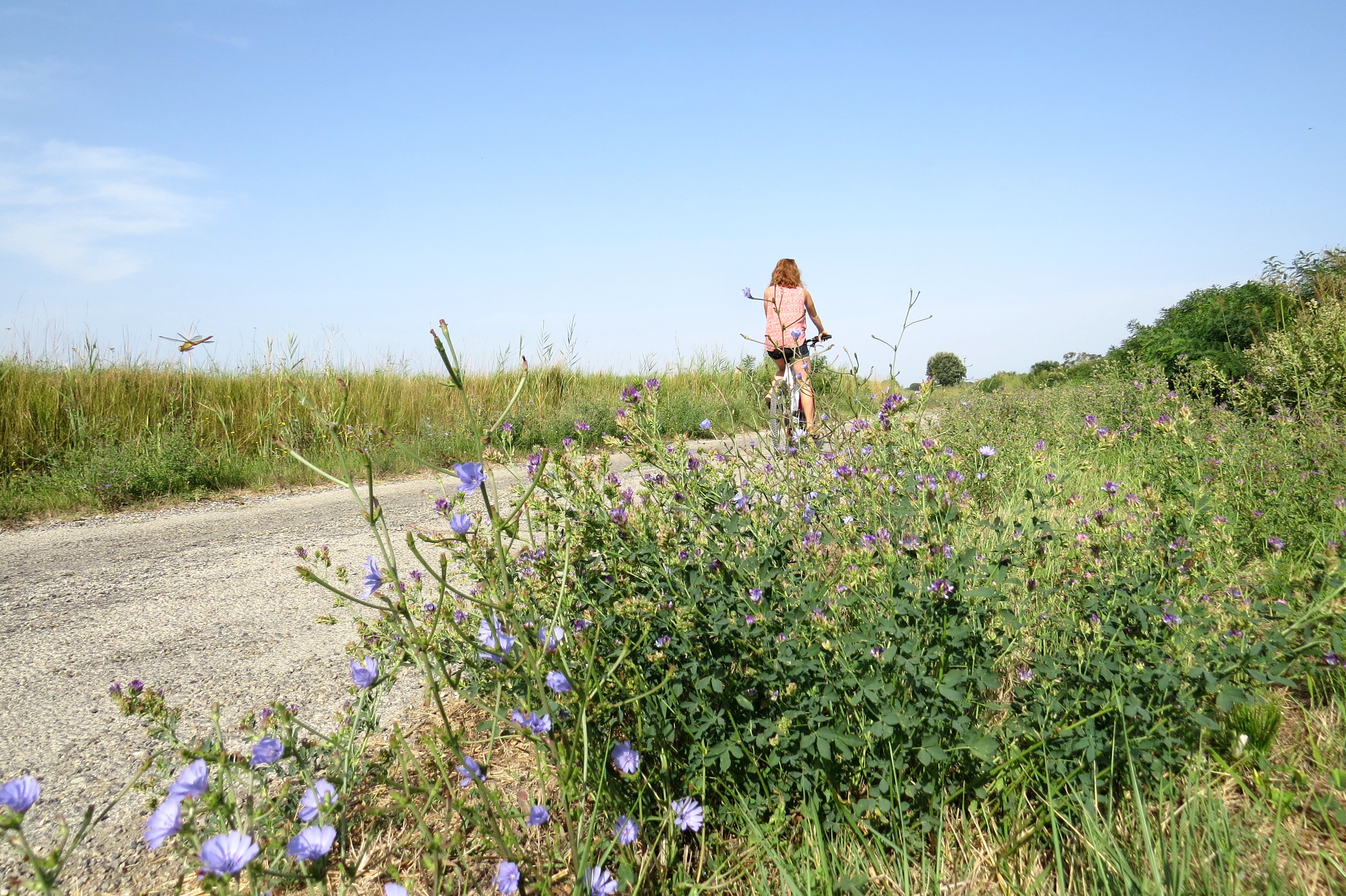
The Albaron marsh in Saliers by bike
From the Saliers marsh to the Petit-Rhône, water is the blue thread of this route interspersed with wooded areas like the wood of Lauricet and landscapes cultivated when passing near the rice paddies! From Albaron to Saliers, passing through Saint-Gilles, the paths used cross Camargue villages and hamlets. A pleasant loop that is an invitation to discover the landscapes of the Camargue lowland but also the heritage and history of the territory.
8 points of interest
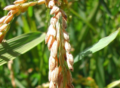
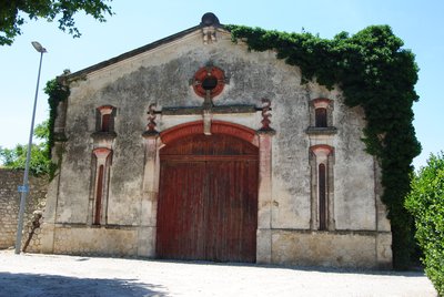
Riz sur pied - ©PNR Camargue  Produits du terroir
La Maison du riz
Rice is an emblematic product of Camargue. The Maison du Riz, an educational space in the heart of the Camargue, presents the evolution of rice farming from its beginnings to the present day. Various spaces have been created to display the specific equipment for rice cultivation and rice milling as well as to present the evolution of the rice grain and its different stages of processing. The Roziere family, passionate rice farmers, welcome visitors to a real farm.
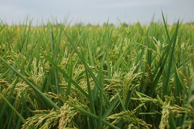
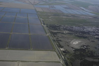
Parcelle de riz - ©PNR Camargue Produits du terroirRice-farming
Rice farming has been present in the Camargue since the post-war period. Complex, this culture follows several stages: lifting, tillering, bolting, return and flowering. The land is flooded to promote the germination of rice grains and prevent the proliferation of fungi. Rice farming therefore requires freshwater irrigation and extensive drainage to develop the saltiest land. Huge amounts of water between the two arms of the Rhône (400 million m3 per year) are needed.
Vue aérienne sur le bois de Lauricet - ©Opus Species - PNR Camargue  Flora
FloraThe Lauricet wood
The Lauricet wood, located along the Petit Rhône, is one of the few wooded areas of the Camargue. The Camargue environment is strongly marked by salt and only the banks of the river and its alluvial ridges escape this influence. These protective forests are called riparian forests. On the banks of the river, the woods survive thanks to the fresh water they need. They develop a much more luxuriant vegetation. These woods are important habitats for local wildlife.
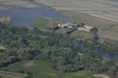
Marais et Saliers, rizières et manade de Thibauld - ©Opus Species - PNR Camargue  Water and rivers
Les marais de Saliers
In the greater Camargue, the marais de Saliers represent one of the main zones of marshes and ponds soft or brackish. This Camargue sector fluvio-lacustrine includes a mosaic of natural habitats such as reed beds, typhids, wet meadows, saladella lawns, but also sansouïres and agricultural areas, mainly rice paddies. The cattle industry is also well represented. Les marais de Saliers formerly occupied a large part of the territory.
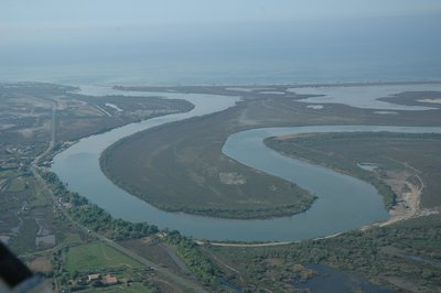
Méandres du Petit-Rhône - ©Opus Species - PNR Camargue Water and riversLe Petit-Rhône
The Petit-Rhône is an arm of the Rhône delta which marks the administrative boundary between the Provence-Alpes-Côte d'Azur and Occitanie regions, between the departments of Bouches-du-Rhône and Gard, and more symbolically between the Camargue gardoise and the great Camargue. It separates from the Grand Rhone north of Arles to reach the Mediterranean Sea near Saintes-Maries-de-la-Mer. The Petit-Rhône is recognized as an important site for the recovery of migratory fish.
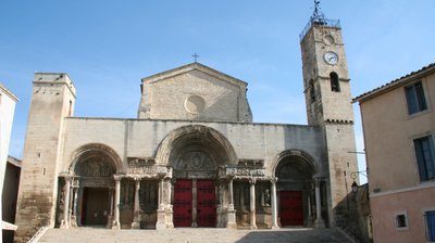
Abbatiale de Saint-Gilles du Gard - ©DR  Patrimony and history
Saint-Gilles
Saint-Gilles, gateway to the Camargue, is located on the Chemin de Saint-Jacques de Compostelle, this is the first step on the way to Arles. Since 1998, the abbey church of Saint-Gilles is a UNESCO World Heritage Site under the Chemins de Saint-Jacques de Compostelle. The old medieval center confirms the rich heritage of Saint-Gilles. Because of its geographical position, between the hillsides of Costières and Camargue, the landscapes that surround the city are changing.
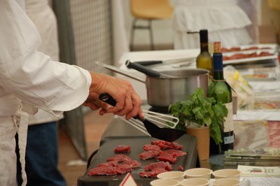
Viande AOP de taureau - ©Marion Fauvel - PNR Camargue Produits du terroirPDO bull meat from Camargue
In 1996, bull meat was the first red meat to obtain the Appellation d'Origine Contrôlée (AOC). It gets the Protected Designation of Origin in 2011. In addition to the delimitation of a strict geographical area where the animal must be born, bred and slaughtered, the farms must meet specifications that impose in particular the exclusivity of breeds of Biòu and Combat and the practice of extensive breeding. Bullfighting in the Camargue is mainly for bull games.
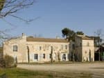
Cave viticole de Saliers - ©Chloé Scannapiéco - PNR Camargue Patrimony and historyThe Saliers village and his Templiers
The name of Saliers (Salliers) comes from the fact that the village was a deposit of salt until 1246. A second etymological hypothesis is based on a Provençal derivative: salo (room, then house, castle). In the Middle Ages, Saliers is one of the largest agricultural estates in the Camargue. Particularly fertile, the whole area was covered with wheat fields, meadows, fruit trees. At this time, les Templiers, then les Hospitaliers de Saint-Jean-de-Jérusalem are the lords.
Description
From the place of the primary school of Albaron, go to the right on the D37 for 1 km, towards Saliers. Turn left towards the Maison du riz and Mas de la Vigne on the Figares road for 9 km.
1 - At the junction of the D572, turn left towards the bridge then cross the Petit Rhône. Enter the Gard department. Continue for 400 m. Turn right towards the D179 towards Fourques. Cross the railway and then take the path on the left. Continue for 1.5 km and cross the canal. Recover avenue Emile Cazelles right, pass the bullring of Saint-Gilles.
2 - At the intersection with Chanzy Boulevard, turn left. Cross the Canal du Rhône at Sète. Continue on the D6572, the road of Arles on 1.5 km. Cross the Petit Rhône again. Leave on the left the Hotel de Cabanettes then turn to the right on the D37 towards Saliers and Albaron then continue for 1 km.
3 - After the Saliérène manade, take the road on the left. Pass through the Saliers hamlet and turn left after the church. Retrieve the D37 on the right, then join point 1. In point 1, join the start of the ride by the same route taken one way.
- Departure : Primary School, Albaron
- Arrival : Albaron
- Towns crossed : Arles and Saint-Gilles
Forecast
Altimetric profile
Recommandations
At the intersection of the D572, dangerous road, caution!
D37, dangerous road, caution!
Respect the rules of the road on roads open to public traffic.
Take the bike to cross the two bridges on the GR653, direction Saint-Gille
Rice house (rice farm that can be visited by reservation: 04 90 97 11 29).
Information desks
the Camargue museum
Mas du pont de rousty, 13200 Arles
Remember to visit the Camargue museum! It is located next to the administrative centre of the Camargue Nature Park.

OT Arles
9 Boulevard des Lices, 13200 Arles
Transport
Envia transport network : Line 20 > Arles/Les Saintes-Maries-de-la-Mer by Albaron (free bikes racks) >> www.tout-envia.com; www.pacamobilite.fr
Access and parking
15 km south-west of Arles, by the D570.
Parking :
Access
- Emergency number :
- 114
Report a problem or an error
If you have found an error on this page or if you have noticed any problems during your hike, please report them to us here: