
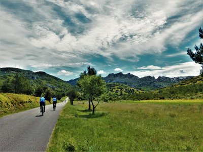
SAINT ETIENNE DU GRES - Cycling tour in Alpilles, in 3 days
Along the roads and paths of the Alpilles Regional Natural Park, the massif makes you enjoy its treasures with the scent of Provence. From village to village, enjoy a rich heritage of history and culture, but also a biodiversity offering beautiful landscapes and delicious local products. A unique experience, for a guaranteed love at first sight!
3 steps
28 points of interest
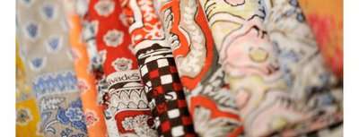
Les Olivades : tradition et innovation textile - ©DR  Savoir-faire
Les Olivades
Léonard Quinche joined forces in 1818 with two Tarasconnais and created an Indian factory in Saint-Etienne du Grès. In 1948, the company is taken over by Pierre Boudin. In 1977, he created "Les Olivades", a family business that perpetuates the ancestral art of printing on fabric from the south of France, while adapting it to the current life. The Les Olivades brand has been a forerunner in terms of high-end products manufactured and sold by the same company.
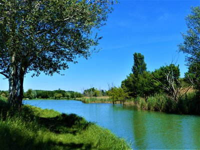
Étang de Rambaille - ©Rémi Sérange - PNR Alpilles  Water and rivers
Rambaille Pond
The Rambaille pond is one of the few lakes of the Alpilles. Artificial and in which one it is forbidden to swim, it draws its water in the Vigueirat canal and has an area of ??2.5 hectares. It makes the happiness of the fishing lovers from the surroundings. Most white-fleshed fish, as well as pike, trout and zander can be caught.

Chapelle Saint-Gabriel - ©Rémi Sérange - PNR Alpilles  Patrimony and history
Saint-Gabriel Chapel
In the early Middle Ages, a first church was erected instead of an old pagan place of worship. Dedicated to the Archangel Gabriel, it is an important step on the road to Santiago de Compostela. The current chapel was built in the 12th century. and testifies to the splendor of the beginnings of Romanesque art in Provence, as shown by its architecture: its facade, its monumental portal, its carved friezes, or its oculus decorated with symbols of the four evangelists.
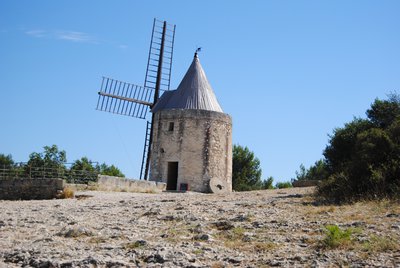
Le moulin d'Alphonse Daudet - ©Chloé Scannapiéco - PNR Camargue Patrimony and historyThe mill of Alphonse Daudet
Between the 18th and early 20th century, Fontvieille lived to the rhythm of the windmills. Built on a rocky promontory, four mills cap the surrounding hills of Fontvieille. Moulin de Daudet, the most recent of the four built mills stopped working in 1914. It was transformed in 1935, paying tribute to the famous writer Alphonse Daudet who portrayed through the tale "Lettres de mon moulin" (Letters from my mill), the consequences of technical changes at that time.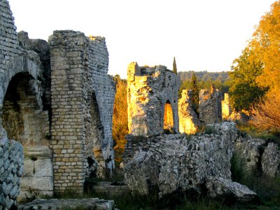
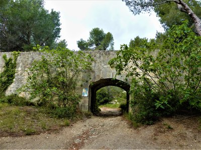
Aqueduc romain de Barbegal - ©PNR Alpilles Patrimony and historyThe Roman aqueduct of Barbegal and the remains of the Roman flour mill
The Roman colony of Arles is endowed itself, around the 1st century AD, with a water supply system using two aqueducts built at the foot of the Alpilles, where you can still find remains today. To the south of the massif, a first aqueduct of about 10km brought water from several springs, collected over Maussane and Paradou. A second aqueduct showing its first remains between Eygalières and Mollégès, went from Fontvieille, where its water mixed with that of the southern aqueduct. The Barbegal flour mill, dated of the 2nd century AD, seems to have worked only a century to supply the population of Arles with wheat.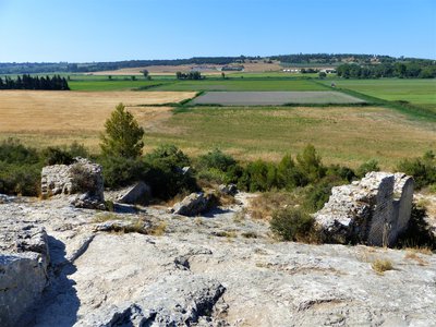
Vestiges de la meunerie de Barbegal - ©Rémi Sérange - PNR Alpilles Patrimony and historyBarbegal hydraulic mill
This mill was built in the 2nd century. and would have served 100 years. Built in a hillside on a slope of 30 ° and fed by the eastern branch of the Barbegal aqueduct, this mill consisted of two parallel rows of eight water wheels that operated sixteen mills. It formed a rectangle measuring 42 by 20 meters and produced about 4.5 tons of flour a day.

Aqueduc de Barbegal - ©Rémi Sérange - PNR Alpilles Patrimony and historyRoman aqueduct of Barbegal
In the 1st century AD, the Romans built two parallel aqueduct bridges, which converged in a basin from which a single conduit leading to Arles. The Barbegal aqueduct was diverted in the 2nd century. AD to feed the Barbegal mill, while the western branch continued to supply the city of Arles. The modified bridge trenched the link of the Pene to feed the mill. The waters were then collected by a channel that evacuated them into marshes.

Centre ville du Paradou - ©Jason Gaydier - PNR Alpilles Patrimony and historyThe village of Paradou
Formerly kniwn as Saint-Martin-de-Castillon, the current name "Paradou" comes, not from "Paradise" although it may seem like one to inhabitants or visitors, but the name of the old water mills of the Arcoule river which enabled weavers to "decorate" the sheets.
Aqueduc du canal de la vallée des Baux - ©Rémi Sérange - PNR Alpilles Water and riversBridge-canal of the Baux valley
In the Alpilles massif, numerous hydraulic structures have been built to supply all municipalities with water. The canal of the Baux valley, put in operation since July 3, 1914, passes along the southern foothills of the massif. The specificity of this environment associated with that of a canal, which must include a gentle slope allowing the good flow of water, led to the development of several canal bridges in the municipalities of Maussane-les-Alpilles and the Paradou.
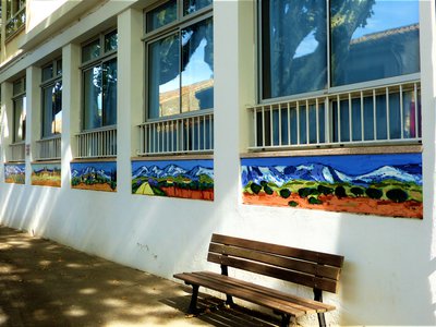
Moitié gauche de la fresque de Jean-Claude Quilici - ©Rémi Sérange - PNR Alpilles Patrimony and historyMural by Jean-Claude Quilici
This mural was realized in 2014 by 35 students under the mentorship of the artist Jean-Claude Quilici. The latter is a painter of Corsican origin, born in Marseille in 1941, who has a workshop in Maussane-les-Alpilles. Specialized in Provencal painting, he exhibited in the largest French, American and Japanese galleries. ;Among other things, he has created a 40m by 4m mural for the University of Corte and a 130m long mural for the Marseille metro.
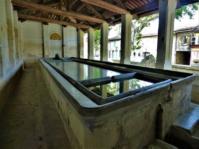
Intérieur du lavoir Napoléon III - ©Rémi Sérange - PNR Alpilles Water and riversNapoleon III wash house
This Second Empire wash house style (Napoleon III), was inaugurated on March 26, 1865, after having been realized by the Avignon architect Louis Astruc. The inhabitants of the town came there to do their laundry, making an important social meeting place. For the period this wash house presented a great particularity : It allowed to do the laundry standing, and no longer on the knees. ;

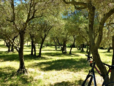
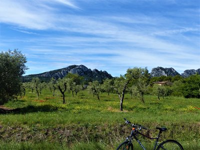
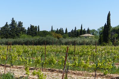
Plantations d'oliviers avec couvert végétal - ©Rémi Sérange - PNR Alpilles  Produits du terroir
The route of the olive groves
On D24a connecting Mouriès to Aureille, you will drive for about 5km on a road punctuated by numerous olive groves. You can then explore all the various activities in relation with the planting of olive trees. These activities range from intensive farming with tight plants and bare soil to organic farming with widely spaced plants and vegetation cover.

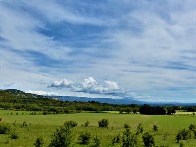
Débroussaillage mosaïque du LIFE - ©Rémi Sérange - PNR Alpilles  Panorama
Mosaic plant
The irregular plant mosaic is the result of clearing work carried out under the LIFE program of the Alpilles. Its objective is to promote the reintegration of species living in the open air environment. The species include small game, such as the wild rabbit and red-legged partridge, that constitues the main food source for predatory birds of the Alpilles such as Bonelli's eagle and the Egyptian vulture.

Notre-Dame de l'Assomption - ©Rémi Sérange - PNR Alpilles Patrimony and historyNotre Dame de l'Assomption
Once you have reached Aureille, I invite you to make a detour in the center of the village to admire the church of Notre Dame de l’Assomption. The construction of this neo-Romanesque church was initiated by the parish priest, named Father Pauleau, who arrived in 1867 at Aureille. The first stone was laid by the Archbishop of Aix, George Chalandon, on 31 March of that year. His plans are the work of the architect Auguste Veran from Arles.

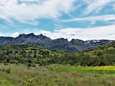
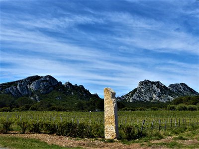
Sommet des Opies et sa tour - ©Rémi Sérange - PNR Alpilles PanoramaView of Les Civadières and Les Opies
Getting out of Aureille, it is possible to contemplate the presence of a set of rocky ridges. They are located southeast of the Alpilles and include Les Civadières and the highest point of the Regional Nature Park: Les Opies 498m high. Some of their rock walls are now the favorite site for many climbing lovers.
Vue sur les Civadières - ©Rémi Sérange - PNR Alpilles PanoramaView of the Civadières
Located in the immediate vicinity of the highest point of the Alpilles, the crests of Civadières, high of 446 m offer a broad panorama on the solid mass of Alpilles, Petit Luberon and Mont Ventoux. They are part of the most ancient geological formations of the Park, dating back from the Jurassic. ;
La plaine de Roquemartine - ©Rémi Sérange - PNR Alpilles PanoramaView on the Roquemartine lowland
This opening of the landscape, which follows a pine forest, reveals the Roquemartine lowland. It is between the eastern end of the Alpilles on the left and Mont Menu and Defens on the right. In the distance, one can also distinguish very clearly the first reliefs of the Petit Luberon. It forms a landscape where each element composes a harmonious whole, of a great serenity.
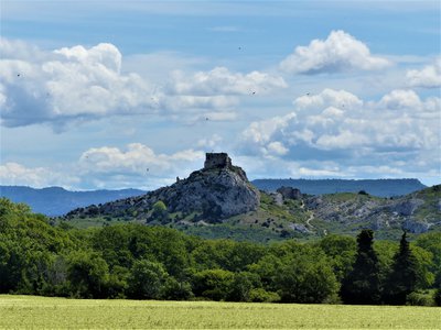
Château de Roquemartine - ©Rémi Sérange - PNR Alpilles Patrimony and historyRoquemartine castle
Also called "Queen Jeanne Castle", it dates from the twelfth century and belonged to the family of Alba. Below is the Church Saint-Sauveur, which was formerly the parish church of Roquemartine village. The castle and the church form an original landscape perched on a spur overlooking the lowland below. At the beginning of the seventeenth century, the castle is abandoned in favor of the New Roquemartine castle, in lowland. This site has been registered with the historical monuments in 1926.
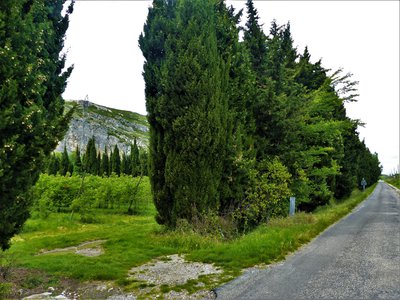
Plantation de fruitiers entourée de haies - ©Rémi Sérange - PNR Alpilles Savoir-faireProvençales hedges
Symbols of Provence, many hedges segment the territory and separate the various plots. Composed of cedar or cypress, these hedges have the primary function of protecting the various crops from mistral and frost. These trees are also known for their wood, very solid and fragrant, and have served to build the framework of many farmhouses of the Alpilles.
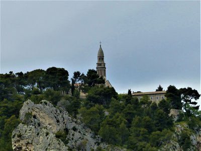
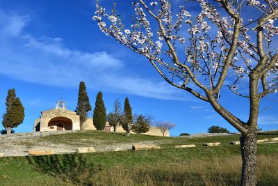
Chapelle Notre-Dame-de-Beauregard - ©Rémi Sérange - PNR Alpilles PanoramaView on the Notre-Dame de Beauregard Chapel
Place of Christian pilgrimage today, this promontory is a place of worship probably since the protohistory. Many vestiges of the altars were found on the site. The current chapel was erected in 1878 on the site of a chapel that had become too small to accommodate pilgrims. Many ex-voto testify to a great religious fervor granted to this place The building below is a former convent built by the Augustinians Déchaussés (17th century).
Intérieur de la porte Sainte-Anne - ©Rémi Sérange - PNR Alpilles Patrimony and historyMedieval Gate Sainte-Anne
West entrance of the second enclosure of Orgon, it is difficult to estimate exactly its age. But we know that it has seen many important personalities since the sixteenth century. Notably, François 1st, who returned from Italy in 1516, stopped a few hours before continuing to Tarascon; Pope Pius VII, who will stay in Orgon and was lodged at the Berne Hotel No. 13 rue Edmond Coste; or Napoleon I, who passed through Orgon to go to Elba island.
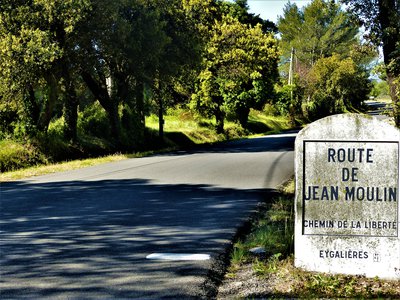
Borne de la route de Jean Moulin - ©Rémi Sérange - PNR Alpilles Patrimony and historyJean Moulin Road, Freedom Road
This road was inaugurated in 1978, nine years after the memorial at Salon-de-Provence which also pays tribute to Jean Moulin. It leaves Saint-Andiol and ends in Salon-de-Provence. Very attached to the Alpilles, where he owned a small country house, Jean Moulin chose this familiar land to be parachuted and to begin his mission of unification of resistance network of the unoccupied France.
Chapelle St Sixte - Nancy01_Adobe Stock Patrimony and historySaint Sixtus Chapel
His name refers to Sixtus II, contemporary of St. Lawrence and pope of early Christian times. The chapel is located on an old place of worship: until the nineteenth century, it housed a pagan stele, which was then used as foot of holy water. The latter reflected a cult dedicated to the water. The first reference that is made regarding the chapel date of 1155. Significant changes were made in the sixteenth century. and seventeenth century, because it served as a lazaretto during the plagues of 1629 and 1720.
Le Calan de Rousset - ©Rémi Sérange - PNR Alpilles PanoramaView on the Calans
Here, the relief of the Alpilles is similar to limestone rocks forming a natural barrier. The latter limits access to the heart of the massif to small passages like the Pas du Suisse. On the left is the famous Calan de Rousset, isolated from the rest of the massif and 275 meters high.
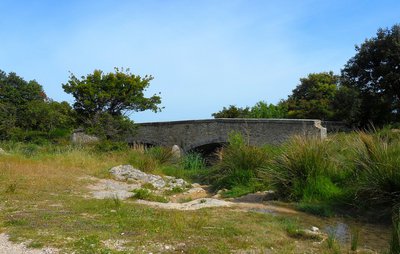
Le pont vu du gaudre de Romanin - ©Jason Gaydier - PNR Alpilles Patrimony and historyPont dit Romain
The bridge called Pont dit Romain does not date from Antiquity but from the Middle Ages. Its name still remains a mystery today. It was built on the chemin des Poissonniers, which was already used during Antiquity, to replace the crossing point that passes through the gaudre of Romanin (a gaudre is a temporary water body). This ancient route started from the chapel Notre-Dame de Piargues (or Notre-Dame-de-Romanin) and joined Mouriès crossing the Vallongue.
Plants de vigne - ©Rémi Sérange - PNR Alpilles Produits du terroirVineyard of Saint-Rémy-de-Provence
The AOC area of Les Baux-de-Provence is one of the hottest AOC areas, watered and early Provence wine. The soils of the AOC appellation of Baux-de-Provence are of stony clay and limestone, sandy gravel, clay and stony type. The grape varieties of AOC Baux de Provence are Grenache, Mourvedre and Syrah, and also Cabernet Sauvignon, Cinsault and Counoise.

Canal des Alpines - ©Rémi Sérange - PNR Alpilles Water and riversNorthern Alpines Canal
From Orgon, the network of the northern Alpines Canal stretches for 119 km and ends in the Roubines of Anguillon and Vigueirat. Begun in 1826, its construction was slowed by conflicts of interest and ended in 1875. At the time, it was intended to complete the Canal des Alpines meridionales finished in 1772, to supply water to 18 towns and 40 additional mills.
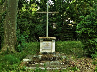
Croix annonçant Notre-Dame-du-Château - ©Rémi Sérange - PNR Alpilles Patrimony and historyCross of Notre-Dame-du-Château Chapel
This cross announces the path leading to the Romanesque chapel Notre-Dame-du-Château. This is mentioned for the first time in 1180 and was restored around 1419. Erected on the hill Saint-Michel-de-Briançon, it dominates the village of Saint-Etienne du Grès, former parish of the city of Tarascon. It was a priory chapel dependent on the Abbey Saint-Laurent of Avignon. Since 1350 she welcomed the "Belle Briançonne", a statue of the Virgin to the Child very famous from the Tarasconnais people.
Description
Back to the car park, follow on the right the D32, direction Fontvieille. At the intersection with the D33, take it on the left. After 500 m, fork right on the Joncs draille At the end, find the D33 and join Fontvieille on the right.
1- At the roundabout, take left, and then at the crossroads continue straight. After 2.5 km, turn left on the road, direction "Aqueduct Romain". . Follow it for 6 km to the village center of Paradou.
2- At the crossing, continue on the avenue Jean Bessat. Take the D17 on the right, then on the left the D78b direction Les Baux. At the end, follow to the right the D78f. 1 km further, turn right on the D27 and reach the town center of Maussane.
3 - at the intersection with the D17, turn to the left. After 800 m, take to the left the D5, direction of Eygalières. At the next intersection, follow the direction "Le Petit Roman" on the right. Continue on this road until the intersection with the D17.
4- Turn left on Alphonse Daudet road, before the D17, and continue to the roundabout. Take it on the left to follow the D24. After 1.5 km, turn right onto the D24a and follow it to Aureille.
5- Take the D25a on the left. After 4 km, go right on the D25 and continue for 7.5 km. At the junction with the D569, turn right. At the roundabout, continue straight for 150 m.
6- Turn left towards Sénas and continue for 7 km. Take the roundabout direction Sénas. After 300 meters, turn left on the path of "Donne", just before the level crossing. Continue to Orgon.
7- Go through Orgon via rue de la Fontaine and Edmond Coste Street. Continue by the Paradis uphill and the avenue Jean Moulin. At the intersection with the D24b, turn left and continue for 7 km to Eygalières.
8- Cross the village and continue on the D24b for 2 km. Turn left on the D24, towards Mouriès. At the foot of Calans, turn right on the GR marked path. Pass by the bridge called Romain, the triangular junction stays on the right and follow this path for 3 km.
9- Continue straight on the Aurelia road to the city entrance sign. Continue to Van Gogh Avenue. Cross it and follow Joseph d'Arbaud Avenue. Continue on the "Chemin Gaulois". Turn left after the canal, then take the old road on the left to Arles until the intersection with the D27. Cross it and continue straight on to St-Etienne du Grès.
- Departure : Parking of the Festival Hall, Saint-Etienne du Grès
- Arrival : Saint-Etienne du Grès
- Towns crossed : Saint-Étienne-du-Grès, Tarascon, Fontvieille, Paradou, Les Baux-de-Provence, Maussane-les-Alpilles, Mouriès, Aureille, Eygalières, Eyguières, Lamanon, Sénas, Orgon, Saint-Rémy-de-Provence, and Mas-Blanc-des-Alpilles
Forecast
Altimetric profile
Recommandations
The itinerary being done in 3 days, think to reserve an accommodation according to the distance to be crossed the first day. Contact the tourist offices of Saint-Rémy-de-Provence, Maussane-les-Alpilles, Eyguières and Orgon.
For your safety, and for the preservation of forest areas, access to natural areas is regulated from June to September. Inquire during the summer period on 08 11 20 13 13 (price of a local call) or on www.bouches-du-rhone.pref.gouv.fr Download the application for free MYPROVENCE ENVIE DE BALADE (available on Appstore and Android Market).
Information desks
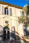
House of the Alpilles Regional Nature Park
2, boulevard Marceau, 13210 Saint-Rémy-de-Provence
Located in the heart of the city centre of Saint-Rémy-de-Provence, the House of the Alpilles Nature Park welcomes you to its completely renovated premises. This new vibrant place is multifunctional: it accommodates the Park's engineering team but also has a public reception space and showrooms. A true resource centre of the Park's heritage, it aims to support and promote locals, visitors and tourists on all 16 municipalities of the Park.
Open Monday to Friday, from 9 am at 12:30 pm and from 1:30 pm to 5 pm.
Free admission.

OTI Alpilles-en-Provence
Place Jean Jaurès, 13210 Saint-Rémy-de-Provence
Transport
Access and parking
Parking :
Access
- Emergency number :
- 114
Report a problem or an error
If you have found an error on this page or if you have noticed any problems during your hike, please report them to us here: