2. MOURIES - Le tour des Alpilles à vélo, jour 2
Cette deuxième journée vous invite à voguer sur les routes de la partie sud-ouest des Alpilles. Après avoir profité de la quiétude des oliveraies, promenez-vous au coeur du massif et de ses reliefs majestueux, dont les Opies, point culminant des Alpilles. Traversez ensuite la plaine de Roquemartine pour rejoindre le village d'Orgon, aux abords de la Durance et du Petit Luberon.
11 points of interest

Façade de l'église Saint-Jacques-le-Majeur - ©Rémi Sérange - PNR Alpilles  Patrimony and history
The Saint-Jacques-le-Majeur
The church is the place of the Saint-Jacques chapel, they found writings dating from the eleventh century. and has been replaced to accommodate the growing number of parishioners. The building in front of you dates from 1783. He has had several downgrades during the Revolution, but also following the 1909 earthquake that caused the collapse of the bell tower.
Oratoire Saint-Roch de Mouriès - ©DR Patrimony and historySt. Roch oratory
Topped on a central pillar in stone, this small chapel was built in 1822, against cholera raging in the region. A niche was built, bullet-shaped, covered by a stone flat roof. A marble plaque was added to the building, where one can read "SAINT ROCH PRIEZ FOR US. 1822-1886 ".

Plantations d'oliviers avec couvert végétal - ©Rémi Sérange - PNR Alpilles  Produits du terroir
The route of the olive groves
On D24a connecting Mouriès to Aureille, you will drive for about 5km on a road punctuated by numerous olive groves. You can then explore all the various activities in relation with the planting of olive trees. These activities range from intensive farming with tight plants and bare soil to organic farming with widely spaced plants and vegetation cover.

Débroussaillage mosaïque du LIFE - ©Rémi Sérange - PNR Alpilles  Panorama
Mosaic plant
The irregular plant mosaic is the result of clearing work carried out under the LIFE program of the Alpilles. Its objective is to promote the reintegration of species living in the open air environment. The species include small game, such as the wild rabbit and red-legged partridge, that constitues the main food source for predatory birds of the Alpilles such as Bonelli's eagle and the Egyptian vulture.

Notre-Dame de l'Assomption - ©Rémi Sérange - PNR Alpilles Patrimony and historyNotre Dame de l'Assomption
Once you have reached Aureille, I invite you to make a detour in the center of the village to admire the church of Notre Dame de l’Assomption. The construction of this neo-Romanesque church was initiated by the parish priest, named Father Pauleau, who arrived in 1867 at Aureille. The first stone was laid by the Archbishop of Aix, George Chalandon, on 31 March of that year. His plans are the work of the architect Auguste Veran from Arles.

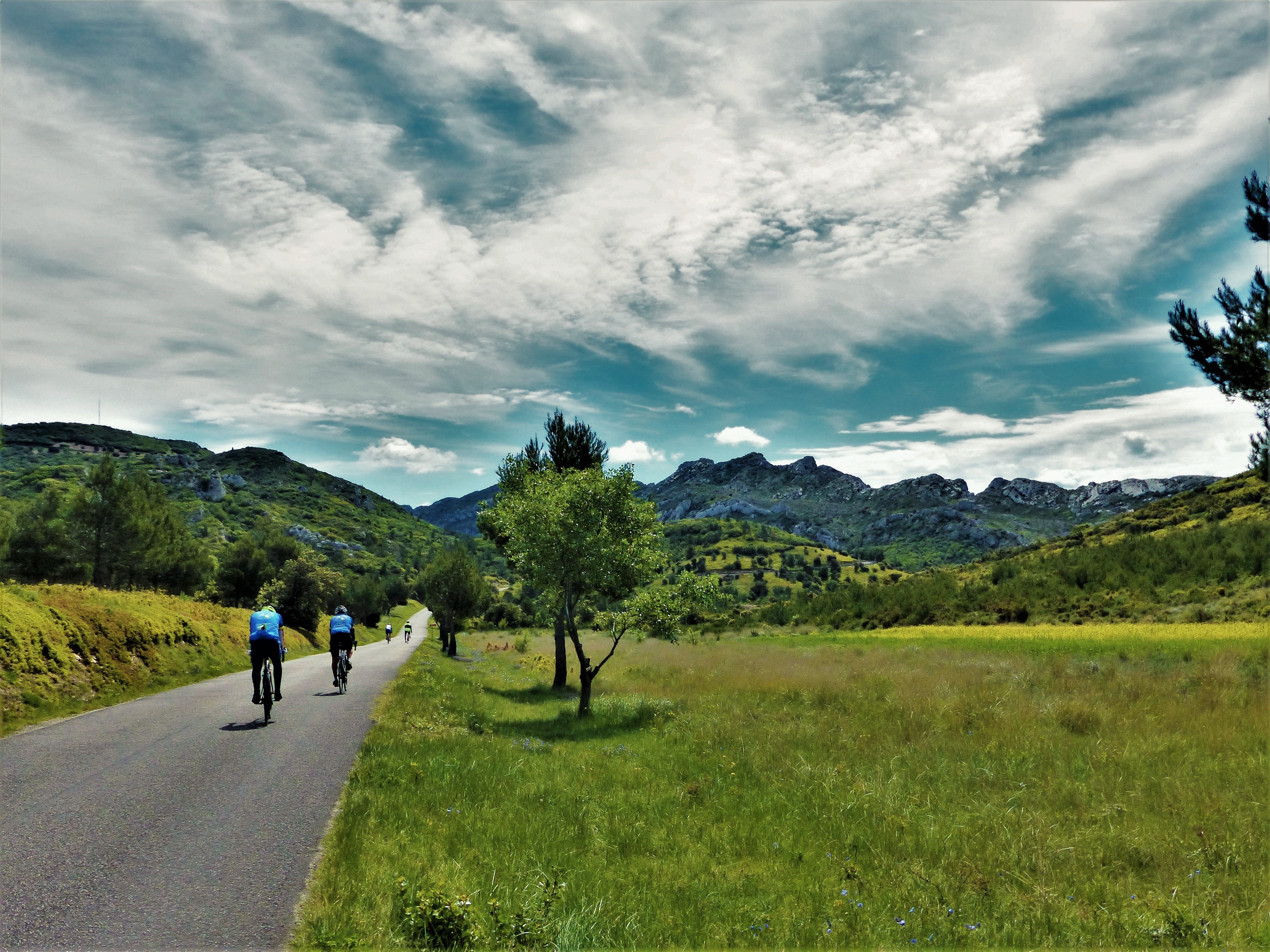
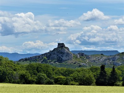
Sommet des Opies et sa tour - ©Rémi Sérange - PNR Alpilles PanoramaView of Les Civadières and Les Opies
Getting out of Aureille, it is possible to contemplate the presence of a set of rocky ridges. They are located southeast of the Alpilles and include Les Civadières and the highest point of the Regional Nature Park: Les Opies 498m high. Some of their rock walls are now the favorite site for many climbing lovers.
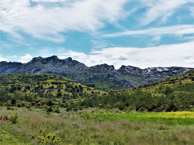
Vue sur les Civadières - ©Rémi Sérange - PNR Alpilles PanoramaView of the Civadières
Located in the immediate vicinity of the highest point of the Alpilles, the crests of Civadières, high of 446 m offer a broad panorama on the solid mass of Alpilles, Petit Luberon and Mont Ventoux. They are part of the most ancient geological formations of the Park, dating back from the Jurassic. ;
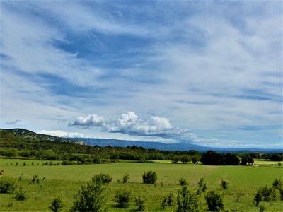
La plaine de Roquemartine - ©Rémi Sérange - PNR Alpilles PanoramaView on the Roquemartine lowland
This opening of the landscape, which follows a pine forest, reveals the Roquemartine lowland. It is between the eastern end of the Alpilles on the left and Mont Menu and Defens on the right. In the distance, one can also distinguish very clearly the first reliefs of the Petit Luberon. It forms a landscape where each element composes a harmonious whole, of a great serenity.
Château de Roquemartine - ©Rémi Sérange - PNR Alpilles Patrimony and historyRoquemartine castle
Also called "Queen Jeanne Castle", it dates from the twelfth century and belonged to the family of Alba. Below is the Church Saint-Sauveur, which was formerly the parish church of Roquemartine village. The castle and the church form an original landscape perched on a spur overlooking the lowland below. At the beginning of the seventeenth century, the castle is abandoned in favor of the New Roquemartine castle, in lowland. This site has been registered with the historical monuments in 1926.
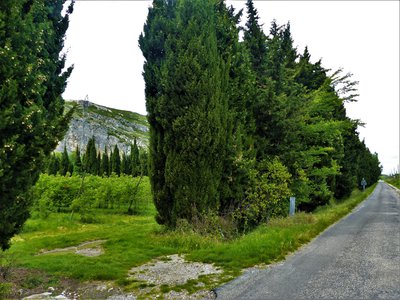
Plantation de fruitiers entourée de haies - ©Rémi Sérange - PNR Alpilles  Savoir-faire
Provençales hedges
Symbols of Provence, many hedges segment the territory and separate the various plots. Composed of cedar or cypress, these hedges have the primary function of protecting the various crops from mistral and frost. These trees are also known for their wood, very solid and fragrant, and have served to build the framework of many farmhouses of the Alpilles.
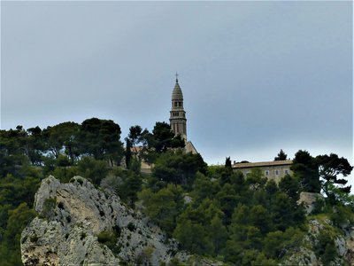
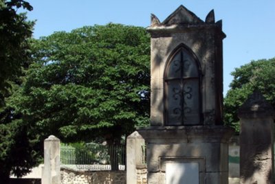
Chapelle Notre-Dame-de-Beauregard - ©Rémi Sérange - PNR Alpilles PanoramaView on the Notre-Dame de Beauregard Chapel
Place of Christian pilgrimage today, this promontory is a place of worship probably since the protohistory. Many vestiges of the altars were found on the site. The current chapel was erected in 1878 on the site of a chapel that had become too small to accommodate pilgrims. Many ex-voto testify to a great religious fervor granted to this place The building below is a former convent built by the Augustinians Déchaussés (17th century).
Description
1- Emprunter à gauche la D25a. Après 4 km, gravir à droite la D25 et continuer sur 7,5 km. Au carrefour avec la D569, prendre à droite. Au rond-point, poursuivre en face sur 150 m.
2- Tourner à gauche en direction de Sénas et continuer pendant 7 km. Franchir le rond-point direction Sénas. Après 300 mètres, prendre à gauche le chemin de « Donne », juste avant le passage à niveau. Continuer jusqu’à Orgon et son centre-bourg.
- Departure : Bureau d'Information Touristique, Mouriès
- Arrival : Orgon
- Towns crossed : Mouriès, Aureille, Eygalières, Eyguières, Lamanon, Sénas, and Orgon
Forecast
Altimetric profile
Recommandations
L'itinéraire se faisant en 3 jours, penser à réserver un hébergement en fonction de la distance journalière à parcourir. Contacter l'Office de Tourisme Alpilles-en-Provence, Maussane-les-Alpilles, et les Bureaux d'Information Touristique d'Eyguières et Orgon.
Pour votre sécurité, et pour la préservation des massifs forestiers, l'accès aux espaces naturels est règlementé de juin à septembre. Renseignez-vous pendant la période estivale au 08 11 20 13 13 (prix d'un appel local) ou sur www.bouches-du-rhone.pref.gouv.fr Téléchargez gratuitement l'application MYPROVENCE ENVIE DE BALADE (disponible sur Appstore et Android Market).
Information desks
House of the Alpilles Regional Nature Park
2, boulevard Marceau, 13210 Saint-Rémy-de-Provence
Located in the heart of the city centre of Saint-Rémy-de-Provence, the House of the Alpilles Nature Park welcomes you to its completely renovated premises. This new vibrant place is multifunctional: it accommodates the Park's engineering team but also has a public reception space and showrooms. A true resource centre of the Park's heritage, it aims to support and promote locals, visitors and tourists on all 16 municipalities of the Park.
Open Monday to Friday, from 9 am at 12:30 pm and from 1:30 pm to 5 pm.
Free admission.

OTI Alpilles-en-Provence
Place Jean Jaurès, 13210 Saint-Rémy-de-Provence
Transport
Access and parking
Parking :
Access
- Emergency number :
- 114
Report a problem or an error
If you have found an error on this page or if you have noticed any problems during your hike, please report them to us here: