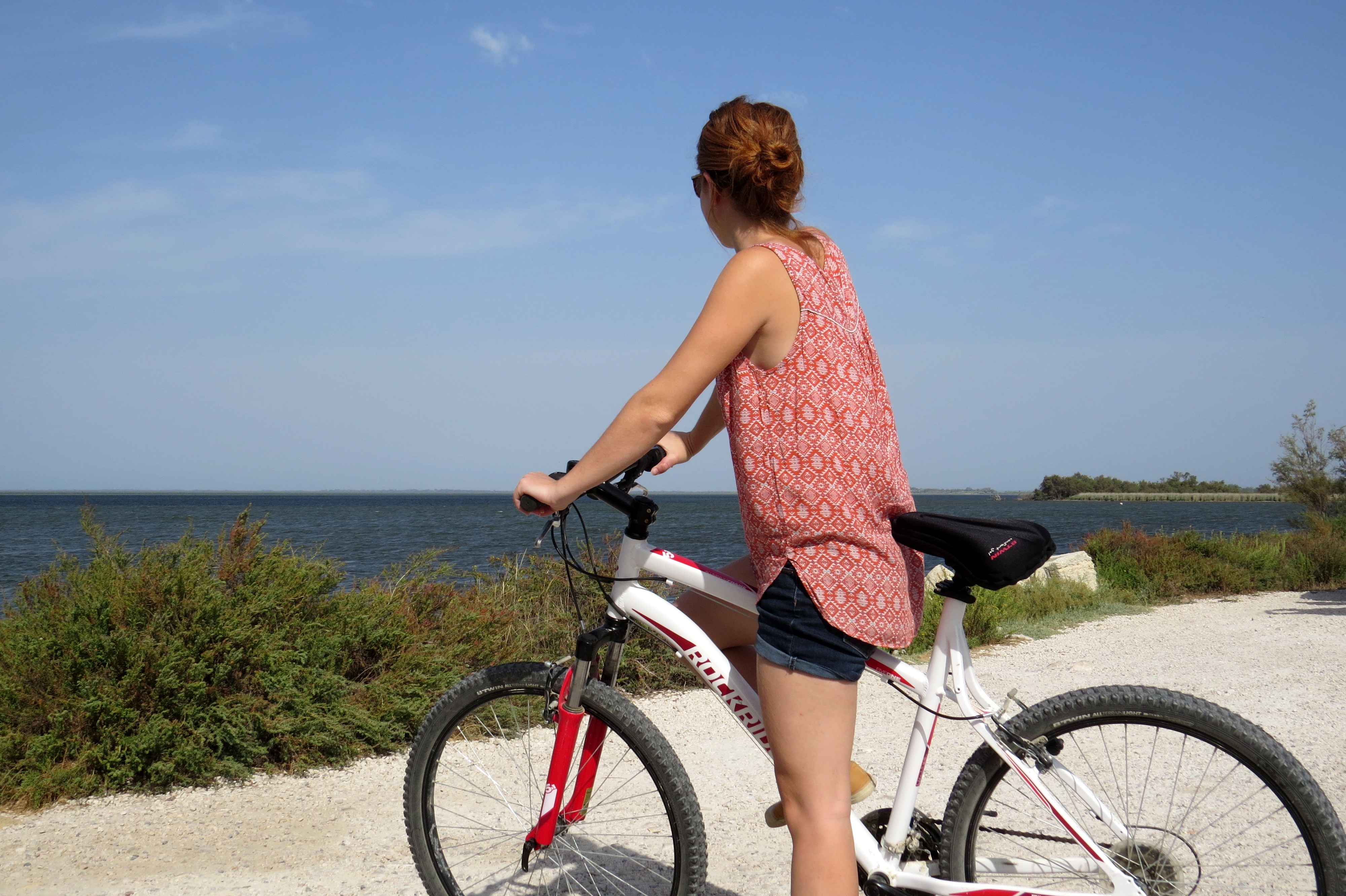
Discovering Vaccarès by bike
Located in the center of the Camargue Regional Natural Park, the Vaccarès pond offers the opportunity to admire many migratory birds and flamingos. Its 6600 hectares make it the largest pond in the Camargue and has a rich diversity both in terms of its fauna and flora. Place of rest and feeding of many birds, you will appreciate its natural setting. To achieve this, you will discover Camargue wildlife, between marshes and rice fields!
10 points of interest
Le canal de Craponne dans Arles - ©Juliette Primpier - PNR Camargue  Water and rivers
The Craponne Canal
In 1554, Adam Craponne is at the origin of the design of the Canal de Craponne which connects the Durance to the Rhône via Salon-de-Provence then Saint-Martin-de-Crau and Arles. Water irrigates the meadows and Crau’s crops. Since its water intake in Lamanon, north of Salon-de-Provence, the flow of the canal is strong then it decreases and is very discreet on arrival in Arles where it is sometimes underground. A few centuries ago, this canal fed the wheat mills on the side of the Alyscamps.
Exutoire du canal de Craponne - ©Juliette Primpier - PNR Camargue Water and riversThe outlet of the Craponne canal
The outlet of the Craponne canal allows the exit of irrigation water from the canal in the Rhône. The water that reaches this outlet is called the "lost blow". This is water that has not been used for irrigation due to excessive rainfall or because a user's water tower has not been respected. Rainwater has run down to the canal that raises the water level.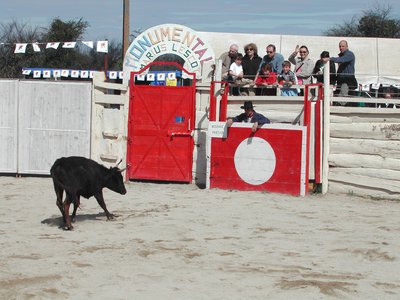
Arènes de Gimeaux - ©Julien Faure - PNR Camargue  Patrimony and history
The wooden arenas of Gimeaux
6 km from Arles is Gimeaux, a small Camargue village where fighting bulls are parked in corrales before the bullfights. Generally attached to the arena, these corrals are located in Nimes and Arles, located outside the city. Bulls can be seen by visitors and aficionados (bullfighting enthusiasts) before the show. They are then brought by truck to the toril, a room adjoining the arena where the bulls are locked before the start of the race or corrida.
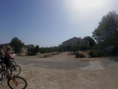
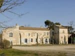
Mas de Sainte-Cécile - ©Juliette Primpier - PNR Camargue Patrimony and historyThe domain of Sainte-Cécile
In the heart of the rice fields and near Arles, close to the Vaccarès pond, the farmhouse of Sainte-Cécile is one of the oldest farmhouses in the Camargue. Dating from the 15th century, the farmhouse has the buildings necessary for the proper functioning of the agricultural domain : the main dwelling, the workers’accommodation, a dovecote, a henhouse, a sheepfold, a shed, cellars and a chapel. This chapel was built in the 11th century. and would be the starting point for the construction of the farmhouse of Sainte-Cécile.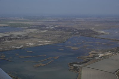
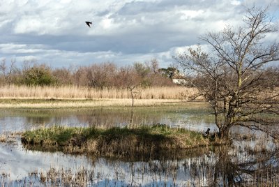
Marais de la Grand Mar - ©Opus Species - PNR Camargue Water and riversThe Grand Mar swamps
From the roadside of the Mas d'Agnon, it is possible to observe the the Grand Mar swamps. They are located north of the Vaccarès pond, which is nicknamed "The Grand Mar" since it is surrounded by the Rhone and the Mediterranean. These freshwater and rice swamps are home to many nesting birds such as herons, stilts, but also water warblers and terns. This is the area of ??Camargue most important for nesting Purple Heron.
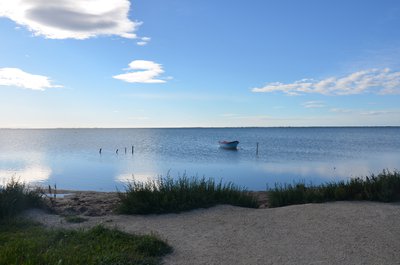
Etang de Vaccarès - ©Marjorie Mercier - PNR Camargue Water and riversThe Vaccarès pond
The Vaccarès pond, brackish water, is located in the center of the Camargue National Nature Reserve and the Rhone delta. Because of its depth, 1.50 m and its area, about 6 600 ha, it is the deepest pond in Camargue but also the largest. Depending on the time of year and the weather, the light changes and the colours vary. Surrounded by the Petit Rhône, the Grand Rhone and the Mediterranean Sea, it is nicknamed "the Grand Mar".
La Réserve de Camargue avec la Capelière au loin - ©Guillaume Caffier - PNR Camargue  Panorama
The Camargue National Nature Reserve
The Camargue National Reserve was created in 1927 by the National Society for Nature Protection (association) to protect animal and plant species. True heart of the Camargue, the Reserve covers 13,117ha, much of which is formed by the Vaccarès pond. The reserve offers many accomodation possibilities and tours: the Capelière, Salin-de-Badon and the lighthouse of Gacholle. The Capelière is the welcome point of the Reserve. You will find exhibitions, documentation, discovery trails. Entry authorizations for the observatories in Salin-de-Badon are issued at La Capelière.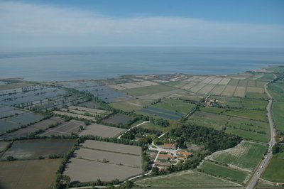
Grand Romieu, Mas Saint-Germain et Vaccarès - ©Opus Species - PNR Camargue PanoramaCultivated environments
The Camargue is both an extensive breeding ground (bulls and horses) but also a field crop area (rice and wheat). Cereal and oilseed crop growing areas occupy the uplands. The strong natural constraints that weigh on these productions require important investments in terms of irrigation and drainage. On the other hand, extensive rangeland systems are spread over natural environments (pastures, reed beds, marshes).
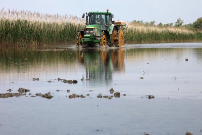
Riziculteur - ©Pauline Daniel - PNR Camargue  Produits du terroir
Rice fields
Rice farming has been present in the Camargue since the post-war period. Complex, this culture follows several stages: lifting, tillering, bolting, return and flowering. The land is flooded to promote the germination of rice grains and prevent the proliferation of fungi. Rice farming therefore requires freshwater irrigation and extensive drainage to develop the saltiest land. Huge amounts of water between the two arms of the Rhône (400 million m3 per year) are needed.
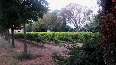
Domaine de Bouchaud - ©Juliette Primpier - PNR Camargue Produits du terroirThe domain of Bouchaud
The Domaine de Bouchaud is an old 16th century country house. acquired in 1679 by the family of the same name who restored it in the 18th century. Since 16 July 1975, it houses the Priory of Notre-Dames fields where a community of monks of the order of the Benedictines lives there and cultivates the vine and the rice. 10 ha on the 85 ha of the estate are vineyards. The Priory has developed the activity of bed and breakfast. The estate has retained a rich heritage : stable, chapel, bread oven.
Description
Back to the Arles Tourist Office, turn left on boulevard des Lices then turn right on Gambetta street towards Trinquetaille. Cross the Rhone via the Pont de Trinquetaille and continue towards Saintes-Maries-de-la-Mer by the streets of the Camargue and the Verrerie. Continue for 1.5 km on the Avenue de la Camargue. At the roundabout, take the C108 direction Gimeaux. Continue on the road to Gimeaux for 3 km.
1- Turn left towards the arenas. Turn left on the C112 after passing the arenas.
2 - Take a right onto the D570 and continue for 250 m. Head to the left on the Dougue road (C125). Continue straight for 1.5 km.
3 - Turn right on the C154, then at the junction, continue on the small path of Sainte-Cécile. Continue towards the Vaccarès pond
4 - Take a right on the intersection with the D37. Continue for 250 m to the observation point of the Mas Neuf Vaccarès set up by the Camargue Regional Natural Park. Go back to step 4. Stay on the D37 towards Arles, for more than 6 km. In Villeneuve, continue straight.
5 - Turn left in the bend, 500 m after the restaurant "Chez Bob", on the road to Romieu (C132).
6 - Continue on the left at the intersection with the Azegat road (C133) for 2 km. Then turn left towards Gageron. At Gageron, continue on the C130, for 8 km
7 - At the junction with the path (C131) of Sainte-Cécile, keep right on Route de Bouchaud and continue straight for 3 km to point 3. Join Arles by the D570 then by Gimeaux on the same route as the outbound.
- Departure : Tourist Office, Arles
- Arrival : Arles
- Towns crossed : Arles and Saintes-Maries-de-la-Mer
Forecast
Altimetric profile
Recommandations
On the D570 and the D37, caution, dangerous passages!
Information desks
the Camargue museum
Mas du pont de rousty, 13200 Arles
Remember to visit the Camargue museum! It is located next to the administrative centre of the Camargue Nature Park.

OT Arles
9 Boulevard des Lices, 13200 Arles
Access and parking
Tourist Office of Arles, Boulevard des Lices.
Parking :
Access
- Emergency number :
- 114
Report a problem or an error
If you have found an error on this page or if you have noticed any problems during your hike, please report them to us here: