The peak of the Chiran Mountain
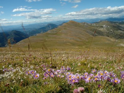
Located just opposite the Mourre de Chanier (highest point of the Regional Natural Park of Verdon, at 1 930m), Mount Chiran (1 905m), topped by its astronomical observatory, and its ascension are the highlights for a hiker. The particular geological formations in this sector have modeled remarkable landscapes. You will reach the alpine pastures and discover the traces of pastoralism throughout the hike.
3 points of interest
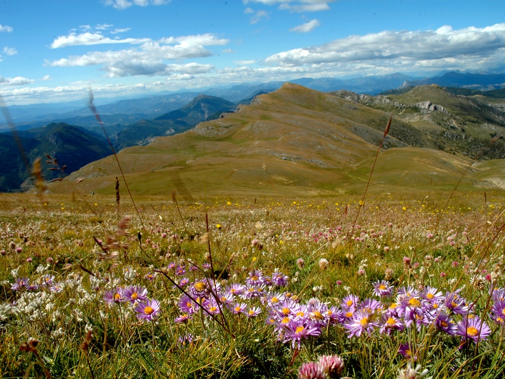
Floraison d'Asters sur le Chiran - Dominique Chavy - PNR Verdon  Flora
FloraA queen at the top
On the slope of Chiran, go discover the Alpine Aster (Aster alpinus), also called the China Aster of the Alps.It is a perennial herbaceous plant of the Asteraceae family, genus of Aster. The Aster alpinus enjoys the sun on dry rocky lawns or in light-wooded areas. It may reach 3000m in altitude. It blooms from June to September.
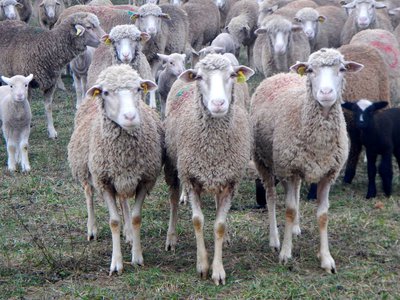
La moutonesse - Stefano Blanc - PNR Verdon  Elevage et pastoralisme
Salt and moutonesso
On these pastures you may find what we call "assaliers", flat stones scattered on the grass. It is here, on these "lauses" (flagstones) that the shepherds lay the salt needed for the ovine. This salt is also useful to the shepherds, especially for the preparation of the moutounesso. It so happens sometimes that a sheep is hurt and it needs to be slaughtered. The flesh is then preserved in salt without a salting tub, in one piece, wrapped, dried for a week, then it is eaten plain or in soup.
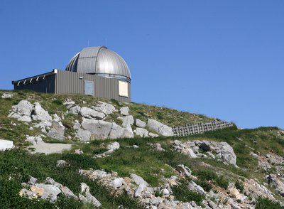
L'observatoire du Mont Chiran - Christian Peuget  Patrimony and history
From the sheeps to the stars
The Chiran is an imposing mountainous area settled at the edge of the Commune of Blieux. It had a pastoral mission for a long time, flocks from the lower Provence came there to graze the summer pastures. But now, since recent decades, Mount Chiran is famous for something else: the sky and the stars. The National Centre for Scientific Research in fact chose this place in 1967 for its upper-air and photometric qualities.
Description
From the parking lot, head down to the village of Blieux for 200m until you reach a wooden sign saying "Portail de Blieux et Sommet du Chiran".
1 - Take the path on the right by a small concrete bridge. Five metres after the bridge, leave the main path leading to the house and take a small trail around it to the right. The climb begins quickly. In a short series of hairpin bends,you will discover the rare lavender fields of the pre-Alpine area. Continue climbing the path which can sometimes be steep, with multiple bends but occasionally flat, then around a corner, we can glimpsethe waterfalls of "la Clue". Pass along the right side of the canyon, after crossing several rocks. After this rocky landscape, pass, at the crest, the Robine canal before regaining further up some grazing areas. Follow the path, on a traverse, towards Portail de Blieux.
2 - At the mountain pass (Portail de Blieux, 1 620m),reach the track at the top and through it, reach the top of the Chiran (300m of elevation over 2.9km).
3 - At the top, a reading table will allow you to enjoy the panoramic views of the Alpine peaks. The same route is used for the return.
- Departure : Le Bas Chaudoul, Blieux
- Arrival : Le Bas Chaudoul, Blieux
- Towns crossed : Blieux and La Palud-sur-Verdon
Forecast
Altimetric profile
Recommandations
We recommend at least 2 L of water per person, a hat and proper walking shoes. Make sure to close the gates, you are on pasture lands. If you cross paths with herding dogs, otherwise known as mountain dogs, go around the herd quietly. (Read the recommendations provided in the web links)
Information desks
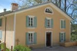
House of the Verdon Regional Nature Park
Domaine de Valx, 04360 Moustiers-Sainte-Marie
House of the Verdon Regional Nature Park

OT la Palud sur Verdon - Rougon
Le Château, 04120 La Palud-sur-Verdon
Transport
Access and parking
At 2km after the village of Blieux on the D 21.
Report a problem or an error
If you have found an error on this page or if you have noticed any problems during your hike, please report them to us here: