The botanical trail of Tréguier
Roaming the botanical trail of Tréguier is to discover twenty information boards on different plant species of the area. It is walking up to a promontory overlooking the valley of Angouire with a remarkable view of lake Sainte-Croix.
4 points of interest

Assiette murale - DR  Savoir-faire
The earthenware from Moustiers
The fame of Moustiers is not only due to its site, as unique as it is. For many connoisseurs, Moustiers is synonymous of pottery and ancient coins made from "Moustiers", which are among the finest earthenware pieces in France and are highly sought after by connoisseurs. Many museums, many castles or aristocratic houses have one or more older pieces from Moustiers. One can admire them at the Sèvres Museum, the Museum of Lyon and the Louvre.
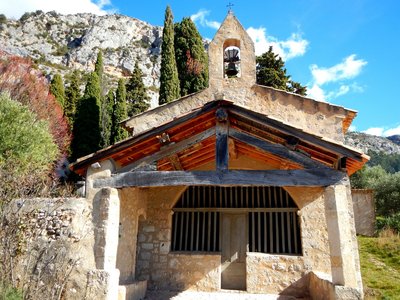
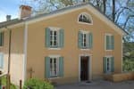
Chapelle Sainte-Anne - Stefano Blanc - PNR Verdon - Stefano Blanc - PNR Verdon  Patrimony and history
Sainte-Anne Chapel
The chapel was built in the 16th century, in the place of a chapel of the 12th century, with recovered materials from the towers and ramparts which were useless.
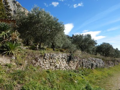
Bancau d'oliviers - Stefano Blanc - PNR Verdon Patrimony and historyThe stone benches of Moustiers
The Provençal term "bancau" (pronounced bancaou) means literally "flower bed", "cultivated bed" and in a broader sense "crop-growing terrace" and here in Moustiers, a beautiful olive grove is cultivated. An olive grove is an orchard of olive trees, mainly for olive cultivation and production of olive oil. The olive groves are mainly located in the Mediterranean countries and in the Middle East. There are olive groves in Provence, in southern France
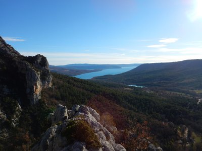
Vue sur le lac de Sainte-Croix - Stefano Blanc - PNR Verdon  Panorama
View from the viewpoint
A plunging view of Lake Sainte-Croix.
Description
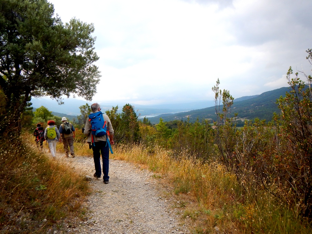
Coming out the car park of the heights of Moustiers, go straight to the cemetery. Pass it and go towards the Chapel of St. Anne. Now head to the terrace crop area. After the olive groves, continue under the oaks in the middle of the restanques. Walk on flat ground for 1km.
1 - Then gradually go up on the left.
2 - At the crossroads, climb the path on the left and roam through a new decking area. Cross the ravine of Courchon and join after a slight rise in the woods, the rocky outcrop overlooking the valley of Angouire. Follow the signs and stay on the ledge to watch the valley of Angouire below (vertiginous path!).
3 - The same route is used for the return.
- Departure : In front of the Chapel of St. Anne, Moustiers Sainte Marie
- Arrival : In front of the Chapel of St. Anne, Moustiers Sainte Marie
- Towns crossed : Moustiers-Sainte-Marie
Forecast
Altimetric profile
Recommandations
300 last metres to go, a difficult path among slippery blocks in wet weather. Vertiginous rocky peak (747m).
Information desks
House of the Verdon Regional Nature Park
Domaine de Valx, 04360 Moustiers-Sainte-Marie
House of the Verdon Regional Nature Park

OT Moustiers Sainte-Marie
Maison de Lucie - Place de l’Eglise, 04360 Moustiers Sainte-Marie
Transport
Limitons les déplacements en voiture, pensons aux transports en commun ! - Prenez la ligne régionale BV1bis entre Riez et Castellane du 1 mai au 30 septembre Depuis Riez, départ 9h05, 10h35 retour 13h50, et 17h15, 19h40 (E1) du 1/07/22 au 31/08/22 Depuis Castellane, départ à 7h15, retour 16h35 et 19h30 (E1) du 1/07/22 au 31/08/22
Access and parking
From the village of Moustiers Sainte Marie.
Parking :
Report a problem or an error
If you have found an error on this page or if you have noticed any problems during your hike, please report them to us here: