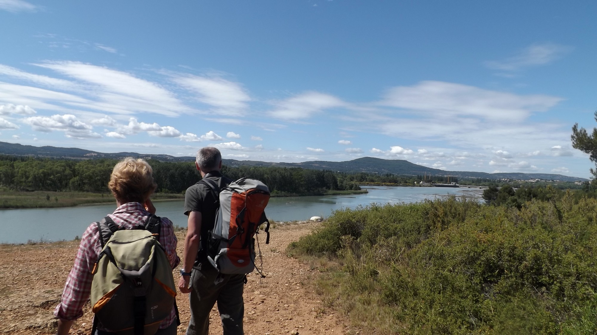
Between the scrubland and the Durance river
« This body of water, upstream of the dam of Mallemort on the Durance, is of prime importance for birds. For example, it is the largest winter dormitory of the region for cormorants.! With its wealthy wildlife and therefore in preys, the Durance offers a prime hunting ground for raptors such as the Grand Duke or the Bonneli Eagle,nesting in the cliffs of the Petit Luberon nearby». Aline Salvaudon project manager of the natural areas at the RNP of Luberon.
4 points of interest
Clue et pont de Mirabeau - ©Stéphane Legal - PNR Luberon  Water and rivers
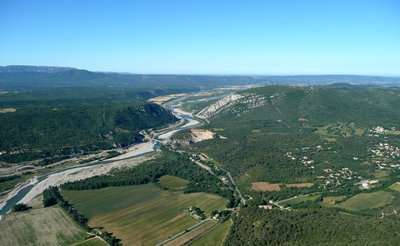
The Durance, a Provençal queen
Taking its source at Mount Genèvre in the Hautes-Alpes, the Durance continues its course in the Alpes-de-Haute-Provence to then establish the border between Bouches-du-Rhône and Vaucluse. The various hydroelectric constructions (like the huge dam of Serre-Ponçon) have significantly reduced its flow and its natural environment. The challenge today is to reconcile the production of electricity from renewable energy and the protection of the ecosystems of the stream.
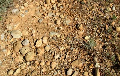
Galets Duranciens - ©DR-nicoulina  Geology
Coloured pebbles
During the tour, you will often find pebbles under your feet. A pebble is a piece of rock torn from erosion and rounded from travelling rivers. There are of all colours and some come from far away, the Alps. We are 20 to 25m above the Durance and yet it has left these pebbles during the last ice age between 60 000 and 15 000 years ago.

Canal de l'Union - ©Emilie Auray - PNR Luberon Water and riversWatering from the Durance
The Union Canal (or mixed channel) draws its water from the Durance EDF (French energy company) channel at the Mallemort dam. This canal supplies the Cabedan-neuf Canal, the Saint-Julien Canal, the Canal de l'Isle and the Carpentras Canal. It is therefore almost 20 000ha which are irrigated from the Union Canal, spread over 56 communes of the Vaucluse.
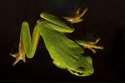
Rainette méridionale - ©David Tatin  Fauna
FaunaThe southern frog
This little bright green frog is very discreet in the daytime when it clings to branches or reed leaves. It lives near bodies of water. When the rainy season approaches or during the chanting of the males from May to July, you can hear it chant from almost a kilometre away.!
Description
Cross the second barrier and go straight into the woods. Continue straight at the first intersection and then at the intersection shaped in a Y, take a right. Reach the point of view of the Durance (do not go beyond reason to the cliff edge).!)
1 - Take a right. Continue straight to the next crossing.
2 - Do not miss on the left the path going down to the valley of the Grand Jardin. Go past a house and crops and upon arriving on a small road, go across under the railway track. Take the second road ahead and then the dirt road across (old car park). Cross the little bridge over the old canal of Carpentras.
3 - .Continue straight Reach to another path. Turn left, climb the dam by the stairs and reach the bird observatory. Retrace your steps and turn left at the foot of the staircase. Leave behind the track taken at the beginning and continue straight the path at the foot of the dam. On the bridle path, continue on the right along a large field and reach the Carpentras canal. Continue to the right until the end of the dirt road.
4 - Just before the road, turn right, go through the woods and follow the path along the old canal. Come back to the small bridge (point 3).
3 - Take a sharp left and go back to the forest of La Garrigue (point 2) by the route taken at the beginning.
2 - At the top of the steep hill, continue straight. Then take a right to return to the starting point calmly.
- Departure : Car park of the Garrigue, Mérindol
- Arrival : Car park of the Garrigue, Mérindol
- Towns crossed : Mérindol
Forecast
Altimetric profile
Recommandations
Do not go too close to the cliff edges (point 1) and irrigation canals (before and after point 4). Be discreet if you want to watch birds from the observatory (after point 3).
Information desks

House of the Luberon Regional Nature Park
60, place Jean Jaurès, 84400 Apt
In the heart the old town centre of Apt, the House of the Luberon Regional Nature Park welcomes you in a town house of the 18th century. The permanent exhibition of the geology museum has a rich collection of fossils evidencing the geological history of the Luberon.
On sale at the shop: books, maps, guidebooks, games, posters...
Open Monday to Friday from 8:30 am to 12:00 pm and from 1:30 pm to 6 pm (and on Saturday, depending on the program). Free admission.

OTI Luberon Coeur de Provence
Place François Tourel, 84300 Cavaillon
Access and parking
At 18km east of Cavaillon, through the D973. The parking entrance of La Garrigue is on the right, 500m after the big roundabout at the foot of the village (towards Lauris).
Parking :
More information
Report a problem or an error
If you have found an error on this page or if you have noticed any problems during your hike, please report them to us here: