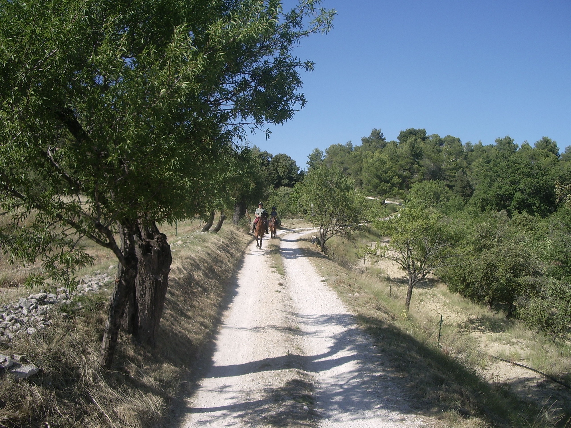
Monts-de-Vaucluse by horseback
To go horseback riding on this great route on the south side of the Monts-de-Vaucluse, is the guarantee of a great trip! From the back of your horse, between paths and stony trails, you will enjoy the view of multiple terraces and dry stone walls, the wild beauty of the place and of the harmony of the landscapes and vast views of Monts-de- Vaucluse, Ventoux and Luberon.
7 points of interest
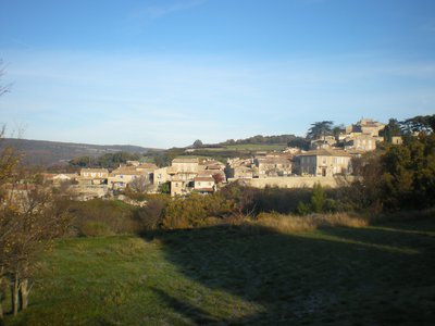
Village de Murs - ©Françoise Delville - PNR Luberon  Panorama
Here, time stops...
Between Ventoux and Luberon, this wooded limestone massif opens onto rare agricultural parcels. Contemporary human presence is discreet but the wealth of the dry stone heritage is a reminder of its historical presence. A network of winding roads and ancient mule tracks serve the hilltop villages alongside the massif. These roads, dotted with remarkable oaks, reinforce the bucolic character of this countryside that seems frozen as if it was timeless.
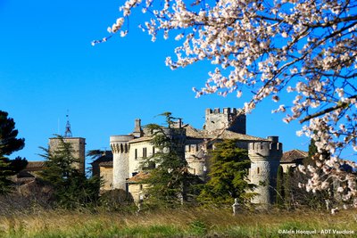
Château de Murs - ©Alain Hocquel - VPA  Patrimony and history
The castle of Murs
It was around year 1.000 that the land of Murs is given to the Agoult family who will build a castle. For four centuries, it was mainly a stronghold for the soldiers of the lord and the dungeon was then built there. After the Agoult family, came the weapons of the Astouaud family which you can see on the castle gate. The church was built in a Romanesque style in the 12th century inside the castle. The building is private and therefore closed to the public.

Louis de Berton des Balbes dit Crillon le Brave - ©DR Patrimony and historyCrillon le Brave, life of a warrior
At the heart of the village of Murs hides the birth house of Crillon le Brave, born in 1543. Born Louis de Berton des Balbes, he will then become Crillon and will continue to wage war. He accompanied 5 kings of France, Henri II, François II, Charles IX, the Duke of Anjou who became Henri III, and it was Henri IV, his comrade, who gave him the name Brave Crillon. His life was made of battles, wounds and victories. He died in 1615 in Avignon, a victim of his countless injuries.
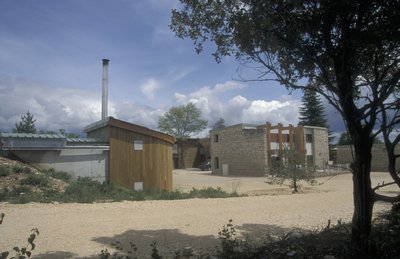
Chaufferie bois-énergie de Murs - ©Hervé Vincent  Savoir-faire
First wood fuel boiler of PACA
All of Remourase houses the very first collective energy wood boiler in the Luberon ... and even in the region! Established in 2000 during the redevelopment of a former holiday camp, it can heat 6 public housing, a lodge, a community hall and 5 local professionals. It is a renewable energy that contributes to the maintenance and the enhancement of the forest land. Since then, more than 40 boiler rooms of this type were carried out in Luberon.
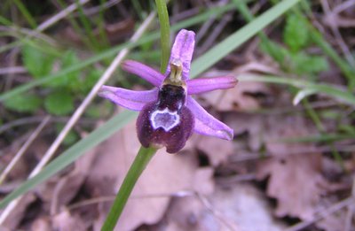
L'Ophrys de la Drôme - Laurent Michel - PNR Luberon  Fauna
FaunaThe Upper Valley of Sénancole
This site spans over 45ha and is a centre for biodiversity. On its dry lawns, no less than 214 species of Mediterranean and mountain plants, including 13 rare species, are present such as Mountain Inula or the Ophrys drumana, 53 species of butterflies and 27 species of crickets and grasshoppers. Breeding birds or few amphibians complete this ecological wealth, hence the need to preserve this Natura 2000 site by joint management.
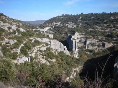
Gorges de Véroncle et Mont-Ventoux - ©Eric Garnier - PNR Luberon  Geology
Gorges de Véroncle
The water flow between the collapsed ditch of Murs located on the heights of the limestone plateau and the Apt basin downstream, dug this impressive canyon called "raccordement". Then the corrosive action of rain water containing carbon dioxide has gradually, through dissolution, enlarged cracks to create true underground networks. The Gorges de Véroncle are not used or hardly used by water, but contain an amazing industrial heritage.
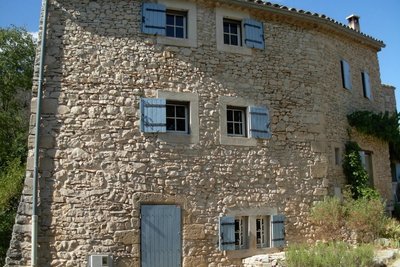
Moulin des Grailles (privé ne se visite pas) - ©Eric Garnier - PNR Luberon Patrimony and historyThe Grailles mill
There are a few remains of this mill dating from the 16th century, deeply restored and transformed into a dwelling. Beyond the changes, it is similar in its operation to the Cabrier mill upstream and constitutes one of the last of the 10 mills along the Véroncle.
Description
When leaving the car park, take a left. Right after the coffee bar, take a right and then a narrow and rocky passage (marked horse routes). At the top, turn left and then right along the road to reach the D102A. Go down to the right for 50 m and rush in on the track to the left. At the intersection “Plantades”, turn on the left, reach the ditch of La Rourette (pole) and take a right on the path leading to the D102A. Cross the road and continue across until the village of Murs.
1- Go through the village towards Venasque (D4), continue straight at the first intersection and turn left on a small road. Below, at the crossroads “Les vallons”, continue straight. Take the rise then turn right onto the old path to the Col de Murs.
2- At the Col de Murs, go left, continue on the main track for 3.5 km and reach the D244. Cross the road and turn right lower down on a trail. Lead back to the D244 and the Col 100 m downstream.
3- At the col des Trois Termes (pole), turn left on the D177, then 50 m further down, go down the path to the left until the creek of Puy Neuf. There, climb the other side and after a steep slope, cross the area of the Dalle des Busans. At the exit of a road, turn right, then 200 m further, turn left on a path along an old meadow. Go straight, turn slightly on the left and then switch until you reach a wider path. Cross a short passage between two walls (can be avoided by taking a right turn) and go straight on the paved road to the D15.
4- At the intersection “Fontanille”, leave the marked horse routes and go up the road to the left for 750 m. Go down a gravel path and reach the heights of the gorges of Véroncle (lectern). Continue straight on the path (PR) that descends to the hamlet of Grailles. Upon arrival on the tarmac, turn left (markup GRP®), cross the small bridge, go along an old mill, then go up the path on the left. Turn right 50 m further, then immediately on the right again, to land on a track (markup PR). Cross and remain across on the small road that leads back to Joucas.
- Departure : car park on the left at the foot of the village of Joucas
- Arrival : village of Joucas
- Towns crossed : Joucas, Murs, and Gordes
Forecast
Altimetric profile
Recommandations
At the start: washed concrete then stony and rocky path.
Before point 2: a passageway with large rocks.
After point 3: successions of slabs, rocky passages.
Between points 3 and 4: a narrow passage in slabs.
Before point 4: two rocky passages.
Between point 4 and the finishing point: a narrow passage in slabs.
Information desks

House of the Luberon Regional Nature Park
60, place Jean Jaurès, 84400 Apt
In the heart the old town centre of Apt, the House of the Luberon Regional Nature Park welcomes you in a town house of the 18th century. The permanent exhibition of the geology museum has a rich collection of fossils evidencing the geological history of the Luberon.
On sale at the shop: books, maps, guidebooks, games, posters...
Open Monday to Friday from 8:30 am to 12:00 pm and from 1:30 pm to 6 pm (and on Saturday, depending on the program). Free admission.

OTI Pays d’Apt Luberon
788 avenue Victor Hugo, 84400 Apt
Du 1er avril au 30 septembre
Ouvert du lundi au samedi de 9h30 à 12h30 et de 14h à 18h.
Juillet et août : Ouvert dimanche et jours fériés de 9h30 à 12h30
Du 1er octobre au 31 mars
Ouvert du lundi au mardi et du jeudi au samedi de 9h30 à 12h30 et de 14h à 18h.
Fermé le mercredi, dimanche et jours fériés.
Access and parking
1 km northwest of Apt by the D900, D201, D4, D60 and D102A.
Access
- Emergency number :
- 114
Source

Report a problem or an error
If you have found an error on this page or if you have noticed any problems during your hike, please report them to us here: