Underground water tanks in Travignon
A long walk without great technical difficulty but with a good vertical drop that initially passes through the beautiful hilltop village of Saint-Saturnin-lès-Apt, then takes the ''Sentier des Aiguiers'' crossing the dome of Mount Cluyer, coming back to the abandoned hamlet of Travignon and finally ending with the large wild valleys of the southern flank of the Monts-de-Vaucluse
8 points of interest
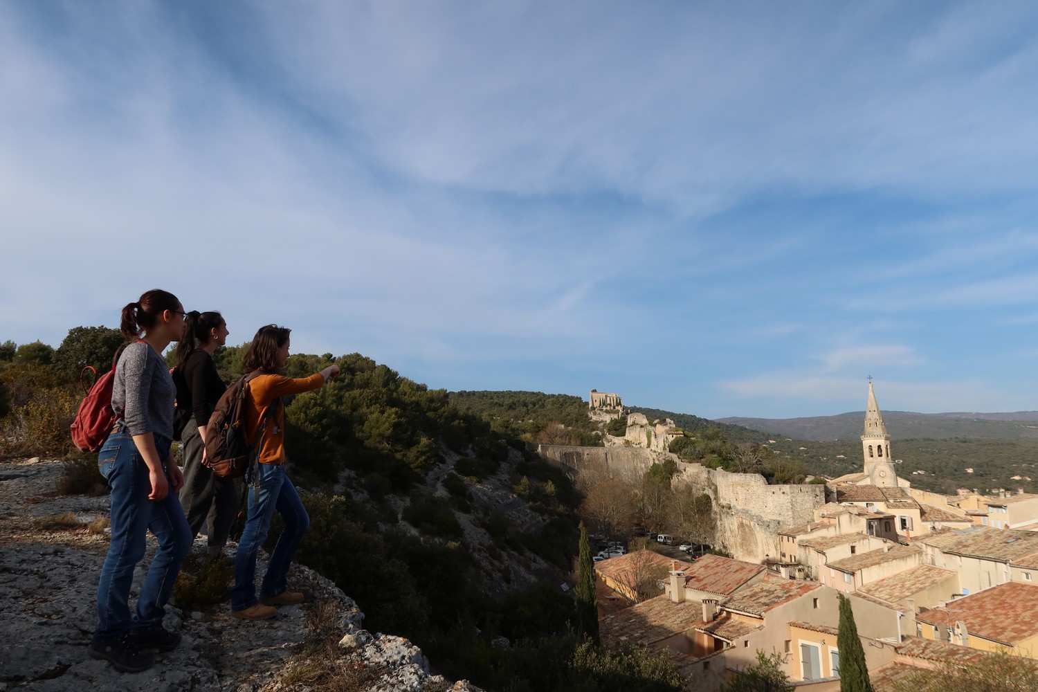
L'éperon, la forteresse, le village, la retenue d'eau et les deux moulins... - ©Marie Grenouilleau - PNR Luberon  Patrimony and history
Saint Sat', a hilltop village
The village of Saint-Saturnin-lès-Apt is one among many hilltop villages, typical of the Luberon. From the beginning, the castle, from which remains the chapel and the medieval village, was built on the rocky spur. The modern village has extended the ruins of the Middle Ages following the topography of the rocky ridge. Two mills, one that is still intact, meets the chapel, or more correctly, the church tower.
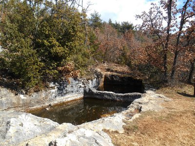
Aiguier ''jumeaux'' de Bessons - Marie Grenouilleau - PNR Luberon  Elevage et pastoralisme
The Aiguiers (underground tanks)
On the hills of Saint-Saturnin-lès-Apt, men have built and maintained many aiguiers (Provençal term for"aigo" meaning water). These basins dug into the limestone and fed by rainwater by an ingenious system of recovery of run-off water, have long allowed the maintenance of rural housing and the watering of cattles on arid land.
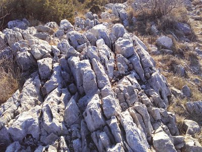
Lapiaz du Cluyer - Eric Garnier - PNR Luberon  Geology
Groove, channel, I am ...
the lapiaz (limestone pavements).! On cliffs, you can see grooves, ridges saturating the rock. These are "lapiés" or "lapiaz" in the singular form. The rainwater has eroded the rock by a process of dissolution to dig the channel in the limestone. The water which continues to rush into these grooves feeds the underground springs.
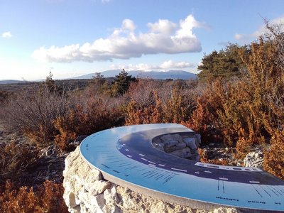
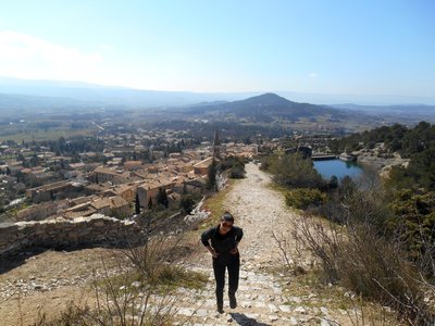
Mont-Ventoux depuis le Cluyer - ©Eric Garnier - PNR Luberon  Panorama
The treasure hunt of underground tanks
Between Ventoux and Luberon, this wooded limestone massif is the witness of an ancient human presence. A real treasure hunt will guide you through the mountains to discover a rich heritage of stone, associated with the collection and storage of water. In contrast, the open view of the Calavon valley shows a more contemporary human activity: recent urbanisation of villages, agricultural activities in the plain ...
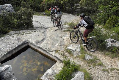
Aiguiers de Travignon - ©William Fautré Patrimony and historyThe country of Apt, Saint-Sat', land of mountain biking
The country of Apt, at the heart of the Luberon, has always been a renowned spot for mountain biking. Many bikers have tested their bike ranges on the rugged trails. In winter, the southern slopes of the Monts-de-Vaucluse, above Saint-Saturnin-lès-Apt, proves to be one of the best places to ride in the dry area, mud-free and protected from the mistral. The Grande Traversée VTT of Vaucluse passes through here, starting from the northern side of Ventoux and towards the Luberon until Mérindol (400km).
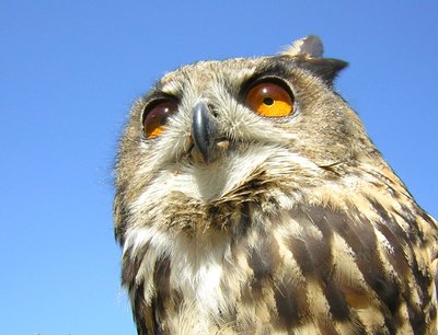
Grand-duc d'Europe - ©PNR Luberon  Fauna
FaunaThe Eurasian-Eagle Owl
The valleys and cliffs of Vaucluse-Monts are home to majestic raptors. They are the territory of the Eurasian-Eagle Owl, the largest nocturnal raptor of Europe (a 1.80m wingspan!). It builds its range in the steep cliffs, where it breeds and rears its young from January to June Like other Luberon raptors, their environment is subject to a prefectural order biotope protection.
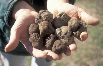
Truffes fraîchement dénichées - PNR Luberon  Produits du terroir
Truffle in the Luberon
The truffle or "Rabasso" in Provençal, is a fungus that lives on the roots of holm oaks; white oaks but also Aleppo pines ... It was a farmer from Saint Saturnin,Joseph Talon, who started the cultivation of truffles by transplanting oak trees known to host truffles in their root system. In winter, truffle hunters and their dog go out in search of the famous black diamond. The Vaucluse department is the first French producer and Provence produces more than three-quarters of the national production.
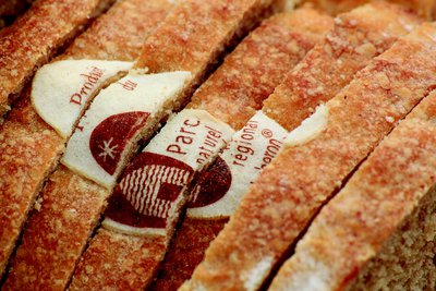
Pain au blé meunier d'Apt - Hervé Vincent Produits du terroirThe Miller wheat from Apt, wheat from Luberon
The Miller wheat from Apt has a strange story to it. After almost vanishing, it was found in 1983 in Buoux at a farm and where the farmer gave it to his hens. This wheat is well adapted to poor soils of the region and to droughts. Providing a meal of high quality and easily digestible, the bread made from it was once renowned in the region. The Luberon RNP, Agribio 04, some farmers, millers and bakers have decided to bring back this long-forgotten flour and bread by certifying them with the Marque Parc, so enjoy!
Description
Back turned to the ''Information Point", next to the post office and pharmacy, go left then right onto the Rue Victor Hugo on 50m. Begin to the left on the Rue de la Combe and take a quick left under the puppet. Climb the cobblestone to the mill. Go up the path to the right on the edge of the plateau. Then take a right, cross the dam, pass through the castrum and turn left into the castle. Bypass the chapel on the left.
1 - At the crossroads, go straight across. Continue to the right and climb to the Chemin des Gavaniols. Continue straight. Leave several roads to your left and right leading to houses. Pass a sloping ledge and reach the Aiguiers Bessons.
2 - Rise to the right onto the path. At the 1st (new alternative route) then 2nd crossing, continue on the path in front. Leave a track going to the right and reach the rocky ledge. Climb the East ridge (markings barely visible), reach a small covered aiguier (Provençal underground water tank) and continue right to the Mount Cluyer dome. Pass the viewpoint and reach the summit plateau (milestone).
3 - Descend the trail due north, continue on the path under the pines and come out on La Liguière track. Follow the track for 150m and at the Y-like crossroad, continue left on the Chemin de la cassette (private pathway!). Bypass the farm to the right (gate) and reach the track below. Turn right (GR®) and after the aiguiers of Gayeoux, turn right. Go down 400m and leave a path to the left.
4 - Take a sharp left (milestone). Climb the small mountain pass of Travignon and switch to the aiguiers upstream the hamlet. Descend to the right on the rocky path, then turn left. Go through the ruins of Travignon, take a sharp right at the exit of the hamlet and immediately a left to go down the winding paths of the old mule track.
5 - Take a sharp left and immediately right (GR®). Hurtle down the trail which is very craggy down below. Continue at the valley bottom. Skip the narrow pass of the Rocher de la Cadière. At the crossroads "Puits du Geay", go straight. Pass the narrow gully of the Portes de Castor and go straight.
6 - look to the right for the 1st orchard along the track. Turn right, go up 100m along the field and climb the trail to the Bois du Defens. At the path, go across, descend and coming out of the scrubland, turn right. Go up the Rue de Fontaine de Guby to the right. Reach the Chemin de Romanet then the Cours de la Liberté to the left to go back to the village center.
- Departure : ''Information Point'' of Saint-Saturnin-lès-Apt
- Arrival : ''Information Point'' of Saint-Saturnin-lès-Apt
- Towns crossed : Saint-Saturnin-lès-Apt
Forecast
Altimetric profile
Recommandations
Be careful with your ankles through the rocky areas (lapiaz) of the dome of Mount Cluyer (between points 2 and 3), then the craggy path going down in the valley of Travignon (between points 4 and 5).
Do not enter the ruins of Travignon; risk of collapse!
Respect the tranquillity, the ancestral heritage and properties (some Aiguiers and Bories are private).
Refrain from picking mushrooms and do not enter the truffle zones.
Although the hiker always has priority, stay alert when approaching bikers, very present on the paths of the area.
Information desks

Luberon UNESCO Global Geopark
60, place Jean Jaurès, 84400 Apt

House of the Luberon Regional Nature Park
60, place Jean Jaurès, 84400 Apt
In the heart the old town centre of Apt, the House of the Luberon Regional Nature Park welcomes you in a town house of the 18th century. The permanent exhibition of the geology museum has a rich collection of fossils evidencing the geological history of the Luberon.
On sale at the shop: books, maps, guidebooks, games, posters...
Open Monday to Friday from 8:30 am to 12:00 pm and from 1:30 pm to 6 pm (and on Saturday, depending on the program). Free admission.

OTI Pays d’Apt Luberon
788 avenue Victor Hugo, 84400 Apt
Du 1er avril au 30 septembre
Ouvert du lundi au samedi de 9h30 à 12h30 et de 14h à 18h.
Juillet et août : Ouvert dimanche et jours fériés de 9h30 à 12h30
Du 1er octobre au 31 mars
Ouvert du lundi au mardi et du jeudi au samedi de 9h30 à 12h30 et de 14h à 18h.
Fermé le mercredi, dimanche et jours fériés.
Access and parking
At 9km from Apt by the D900 and D943.
Parking :
More information
Source

Report a problem or an error
If you have found an error on this page or if you have noticed any problems during your hike, please report them to us here: