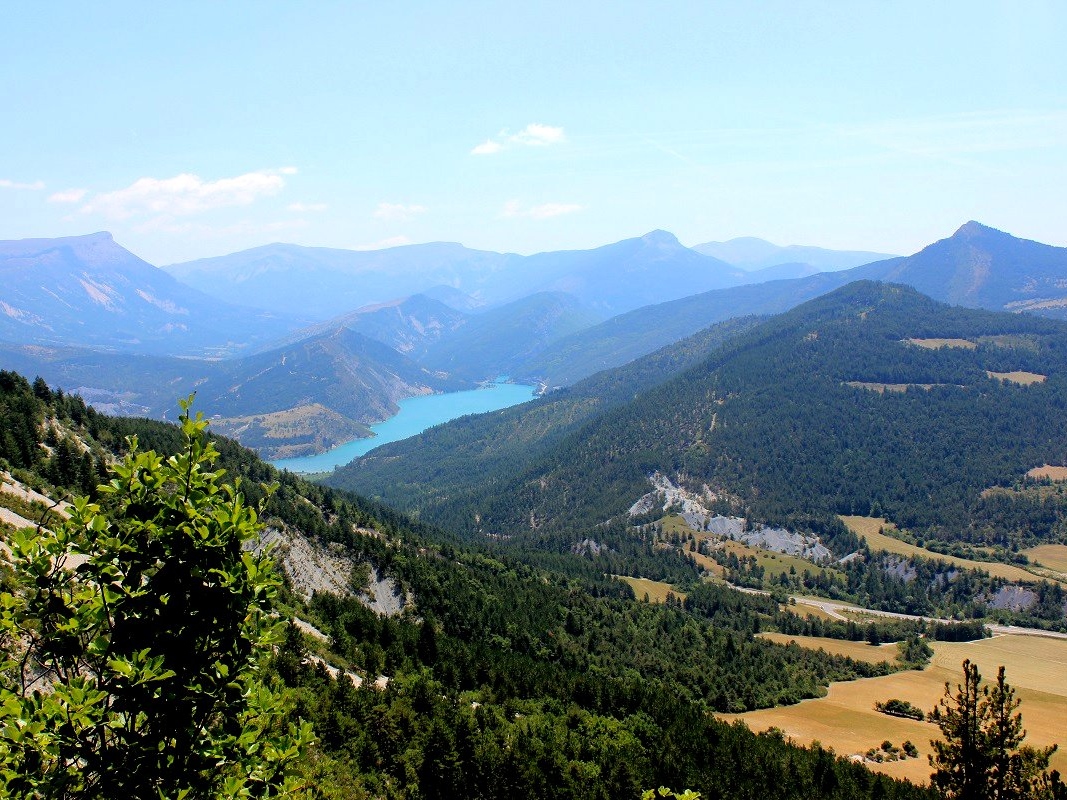
The Chalvet peak
Mount Chalvet (1613m) is an internationally renowned site for the practice of hand gliding, you will most probably see some paragliders in the sky of Saint André les Alpes. On this hike, you may have the opportunity to hear the black grouse, discover the Chalvet hole, the Voie Impériale hiking trail, the Train des Pignes tour and numerous viewpoints of the village and Lake Castillon.
2 points of interest
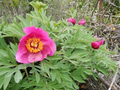
Pivoines officinales - Stefano Blanc - PNR Verdon  Flora
FloraThe Peony
There are lots of Paeonia officinalis (common Peony) at the top of Mont Chalvet and have a preference for clear and deforested areas. They need 4 to 5 years to bloom once the seeds have been planted. This is what makes it a protected flower and unique with its flamboyant colours.
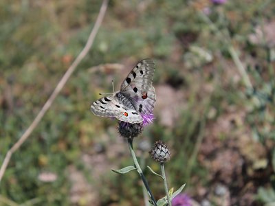
L'Apollon - Guillaume Pluchon - PNR Verdon  Fauna
FaunaThe mountain Apollo
The mountain Apollo (Parnassius apollo), this butterfly with a hairy body is subordinate to the mountainous climate. Its caterpillar eats succulent plants: stonecrops, houseleeks. At the end of the larval period, it forms a loose cocoon slightly buried before turning into a chrysalid. The mountain Apollon hibernates in the egg state.
Description
From the parking lot of the railway station, go up the wooden stairs. Take the street to the right and reach the road leading to the Chalvet at the paragliders' take-off areas.
1 - After a steep section and two winding paths, follow the right path which cuts the road and come out at the St-Jean chapel. Continue on the road for 300m.
2 - Continue for another 50m and take the path going around the curve. Climb gradually, and after eight winding paths, reach a crossroads.
3 - Take the rising trail to the right towards the summit.
4 - At 700m, reach the intersection with the Chalvet hole. This geological curiosity is at 100m, to be done in a round trip tour. To reach the top, keep climbing the trail until the road. Continue the route by a slope in the hill (steep sections!) until the southern side of the take-off area (altitude 1530m). Continue the last metres through the path across and come out directly on the summit of Mount Chalvet (1613 m).
5 - From the top, follow the ridge to the north west and down the mountain pass. Take the path heading to the western slope towards Moriez. Go down the winding path and enter the forest. At the bottom, go along a lavender field to the right and take a path going down the valley to the right. Cross the ford and continue down the path. Reach an intersection 300m from the village. Possibility to go down to Moriez to visit the village and replenish (fountain).
6 - From the intersection, take the path to the east. This path is the former "Imperial Way". Parallel to the road, reach the mountain pass of the Robines at 1.8km and continue straight. At the intersection upstream the mountain pass, follow the path towards the Dindière. Stroll trough the winding paths among pines and reach another crossroads at the tower.
7 - Continue straight and reach through the path, the road leading to the St-Jean Chapel at point 2 - Enter the car park by the same route as the one used to go.
- Departure : From the car park of the railway station
- Arrival : From the car park of the railway station
- Towns crossed : Saint-André-les-Alpes and Moriez
Forecast
Altimetric profile
Recommandations
Avoid high summer temperatures, leave early. We recommend: 2L of water per person, a hat and proper hiking shoes. Careful, snow in the winter. Preferred seasons: Spring, autumn (fall).
Information desks
House of the Verdon Regional Nature Park
Domaine de Valx, 04360 Moustiers-Sainte-Marie
House of the Verdon Regional Nature Park

OT Saint André les Alpes - Barrême
Place Marcel Pastorelli, 04170 Saint-André-les-Alpes
Transport
Access and parking
From the N52 between Castellane and Val d'Allos
Report a problem or an error
If you have found an error on this page or if you have noticed any problems during your hike, please report them to us here: