Stroll of the Petit Calan
"Au pied des Calans”, emblematic crests of the Alpilles, the old quarry of the Mas de Badon, reconverted in Mediterranean Arboretum, invites to stroll on the heights of Eygalières. The discovery of the flora and landscape of the Alpilles, with viewpoints up to the Mont Ventoux, is an opportunity to walk on part of GRS6 Grande Randonnee path that crosses the massif. " Jason Gaydier, RNP of Alpilles.
7 points of interest
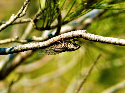
Cigale sur branche - Rémi Sérange_PNRA  Fauna
FaunaThe cicadas song
The cicada is a brown insect measuring 5 to 9 cm in length. It has a rigid proboscis called rostrum, which it plants in roots and plants to feed themselves. It has four long transparent wings. As soon as the temperature is sufficiently high (about 25°C), the male cymbalise (" sings") to attract the females of the same species. While the larvae can live for several years underground, the adult lives only 2 months in the summer to reproduce.
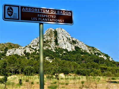
Arboretum du Badon - ©Rémi Sérange - PNR Alpilles  Flora
FloraBadon Arboretum
An old quarry became discharge, it is in 2009 that this one was rehabilitated to revalue this remarkable site in the middle of Alpilles. This project of revaluation goes through the creation of an arboretum, a space of Mediterranean flora adapted to the climate. From 2010, the first trees are planted by the students of the vocational agricultural school of Saint-Rémy-de-Provence. About sixty trees and many shrubs represent the floristic diversity of the scrubland.
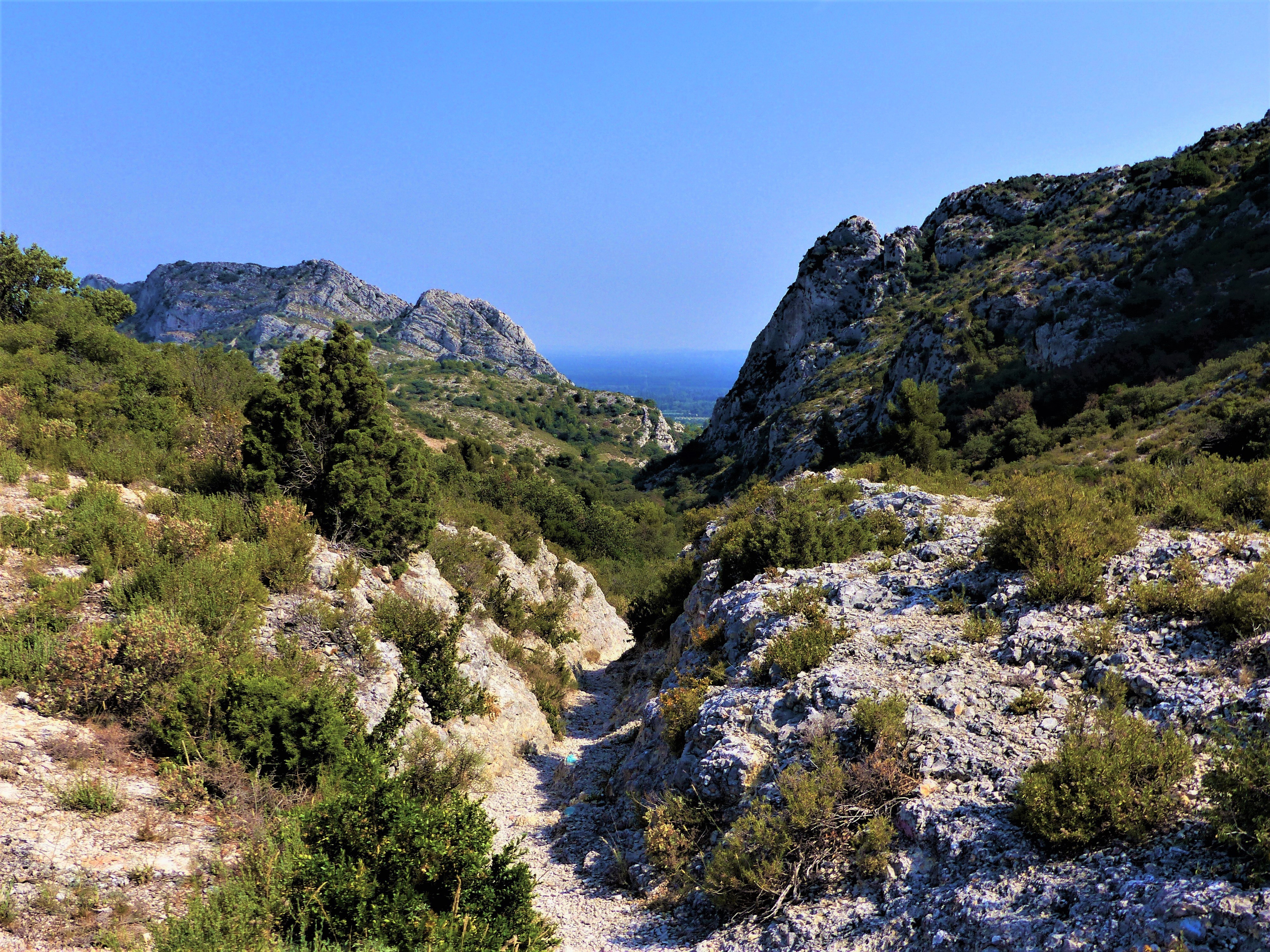
Vue sur la crête des Alpilles - ©Rémi Sérange - PNR Alpilles  Panorama
View on the Alpilles ridge
The Alpilles massif has constantly evolved over 135 million years, to become what it is today. These limestone crests, bordered by the GR®6, date from the Cretaceous and appeared about 70 million years before J.-C. They dominate the Petite Crau. The Montagnette massif, is observed to the north-east, as well as further, Mont Ventoux, which rises to 1912 m of altitude. To the south, there is a wide view of the Alpilles massif.
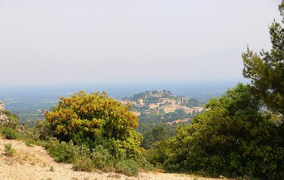
Point de vue sur Eygalières - ©Anne-Catherine Privat-Madelin - PNR Alpilles PanoramaView of Eygalières
The village of Eygalières as well as the ruins of the castle at its summit, are the last vestiges of the castrum of Aigueria, of which the first writings date back to the 13th century. The village was originally built on a small rocky ridge, allowing its inhabitants to protect themselves against possible attacks, before expanding on the surroundings. The name of Eygalières is closely linked to water, as indicates its Latin name "Aquilaria" or in Provencal "Eigaliero".
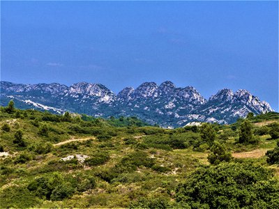
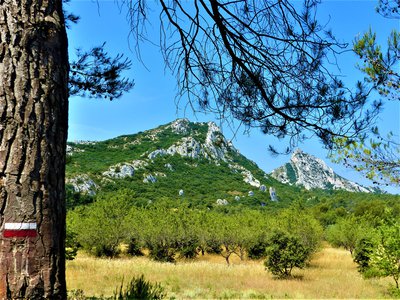
Petit Calan - ©Rémi Sérange - PNR Alpilles  Geology
Le Petit Calan
The Petit Calan, like the Gros Calan, finds its origin from the Barremian. Its rocks formed with the deposition and compression of the remains of organisms living in a shallow sea about 160 million years ago. They gained altitude by constituting a rock ensemble, undergoing fractures and foldings of lesser amplitude. This elevation of the Alpilles chain is directly related to the rapprochement between the Eurasian and African tectonic plates.
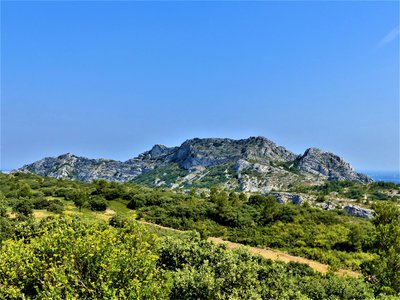
Calan de Rousset - ©Rémi Sérange - PNR Alpilles GeologyThe Calans
A calan is a hard limestone cliffs that formed between 160 and 90 million years BC. These cliffs are the vestiges of an oceanic presence. Indeed, the Thétys Ocean was here during the Jurassic period, the same period that saw the water level decrease. It was then that massifs, like the crests of the Alpilles, or like the calans, were formed. The most famous are the Calan de Rousset, the Petit Calan and the Gros Calan.
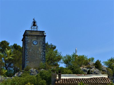
Tour de l'Horloge et statue de la vierge Marie - ©Rémi Sérange - PNR Alpilles  Patrimony and history
View of the clock tower
Built in 1672 with stones from the castle, the Clock Tower is the symbol of the independence of Eygalières. In 1660, the villagers paid the ransom of their lord, the Duke of Guise, taken hostage by the Spaniards. As a reward, they won the seigniorial rights of their village. Next to the 13th century dungeon, there remains only the vaulted ground floor. The Virgin statue was placed on the roof in 1893 to commemorate a miracle, and always seems to watch over the village.
Description
From the parking, follow the D24b towards the city center.
1- At the crossroads, turn right. Follow the red and white markings until the end of the hike. Then leave the town hall on the left. 50 m further, leave the Monument to the dead on the left and continue along the road.
2- Turn left on the path Ludovic Souvestre, and take the first right. Cross the locality of the 4 vents and continue on the path.
3- At the Badon Arboretum (possibility to climb to the point of view), go around it and follow the path. 200 m after the barrier, take the little rocky path.
4- At the end of the track, turn right, leaving the Gros Calan behind. Continue on the forest path to the cistern.
5- At the height of the tank, turn right on the slope which goes down gently. After the bend, continue on the left path at the next junction. Follow this path along the Petit Calan then continue in the forest.
6- Cross the barrier and take the small path on the right that runs along the road for about 700 m.
7- Turn right at the crossroads, and continue on the path. Go past the well and continue on the main road to the D24b. Cross the departmental road and continue on Mario Prassinos road. Go behind the cemetery and enter Eygalières.
8- At the top of the small hill, turn right. Possibility to fork then directly to the parking lot or to walk in the village.
- Departure : Stadium parking, Eygalières
- Arrival : Eygalières
- Towns crossed : Eygalières
Forecast
Altimetric profile
Recommandations
Follow the signs for the Grande Randonnée (GR®6) route throughout the walk.
For your safety, and for the preservation of forest areas, access to natural areas is regulated from June to September. Inquire during the summer period on 08 11 20 13 13 (price of a local call) or on www.bouches-du-rhone.pref.gouv.fr Download the application for free MYPROVENCE ENVIE DE BALADE (available on Appstore and Android Market).
Information desks
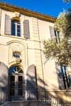
House of the Alpilles Regional Nature Park
2, boulevard Marceau, 13210 Saint-Rémy-de-Provence
Located in the heart of the city centre of Saint-Rémy-de-Provence, the House of the Alpilles Nature Park welcomes you to its completely renovated premises. This new vibrant place is multifunctional: it accommodates the Park's engineering team but also has a public reception space and showrooms. A true resource centre of the Park's heritage, it aims to support and promote locals, visitors and tourists on all 16 municipalities of the Park.
Open Monday to Friday, from 9 am at 12:30 pm and from 1:30 pm to 5 pm.
Free admission.

OTI Alpilles-en-Provence
Place Jean Jaurès, 13210 Saint-Rémy-de-Provence
Transport
Look for public transport times on the site www.lepilote.com in the town of Eygalières.
Access and parking
Arriving at Eygalières, follow the D24b until you see the stadium at the edge of the road. The car park is indicated by a sign : Relais Info Service du Parc.
Parking :
Report a problem or an error
If you have found an error on this page or if you have noticed any problems during your hike, please report them to us here: