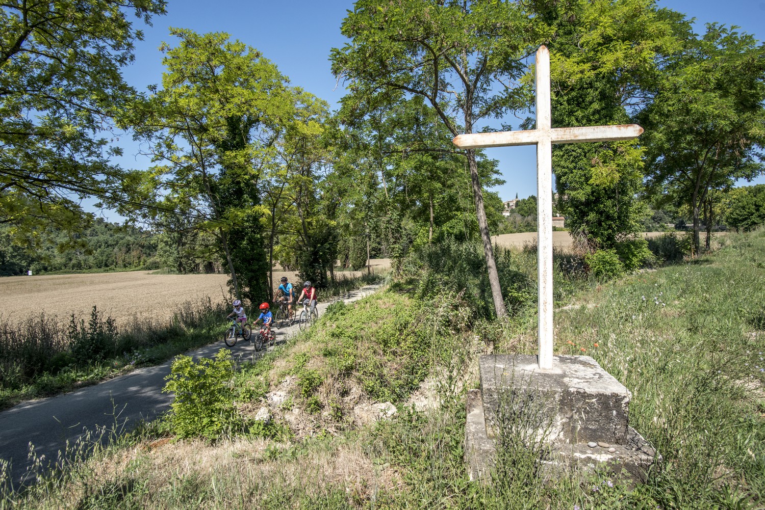
On the trail of the Waldensians (Disciples of the Christian movement founded by Peter Waldo)
"Originally from Germany, arriving in the Luberon, I was passionate about the inspiring story of the Waldensians. From the settling of this Protestant minority in the 16th century in abandoned villages to the massacres a few decades later, their story was tragic. You can notice in the villages the architectural and religious marks testifying to this Protestant presence." says Susanne KühnTourist Office of the Southern Luberon
19 points of interest
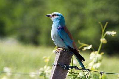
Rollier d'Europe - ©DR-A. Rocha France  Fauna
FaunaThe European Roller, the blue bird
Easy to spot thanks to its intense blue color, it can be seen on utility poles. It enjoys this vantage point in an open and sunny area to locate and dive down on its prey (large insects and lizards). It nests in tree cavities and leaves to spend winter in Africa when prey becomes rare, before returning in the spring.
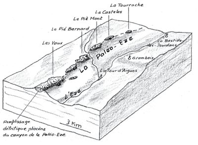
Remplissage de la paléo-Eze - extrait de « De la Durance aux monts de Vaucluse » G. Bronner, Ed. Jeanne Laffitte  Geology
Pié Mont and Paléo-Eze
Between Pertuis and Peypin-d'Aigues, in several places, you can see an accumulation of pebbles, pieces of rock torn from the mountains and slowly worn, rounded by their transport in a stream, a river. These pebbles correspond to the former course of a stream, a paleo-Eze flowing there, parallel to the current Eze but shifted 3 km to the east. We can also notice this ancient fossil valley across the landscape forming hills.
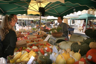
Marché Paysan du Luberon - ©Hervé Vincent  Produits du terroir
The Farmer Markets
For lovers of Provençal flavors: on this great place, the brand "Marché Paysan" has been deposited by the Luberon Regional Nature Park. The goat cheeses are local productions, the fruits and vegetables are from the field "next door" and the honey has just been harvested. In these exhilarating markets, merchants are exclusively producers of the Park selling their own products (St-Martin-de-la-Brasque market on Sundays from May to October).
Saint-Martin-de-la-Brasque - ©JP-Villegas - Luberon Sud Tourisme  Patrimony and history
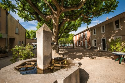
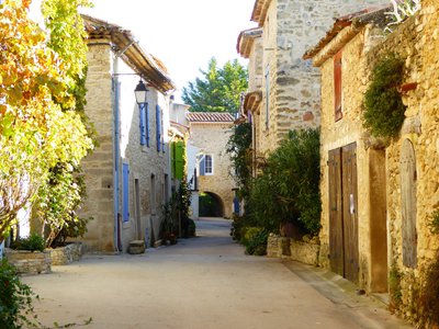
Saint-Martin-de-la-Brasque
The village was built in 1506, and like Peypin-d'Aigues, it originated from an agreement between the lords and about fifteen Vaudoise families who agreed to come and repopulate fallow lands. The two villages complement each other: Peypin having a surplus of forests, and Saint-Martin of cultivable lands. During the persecutions of 1545, the village was looted and burned. St. Martin was one of the towns mentioned in the Edict of Merindol of May 20, 1545: It was enough to be a native of it to be sent to the galleys.
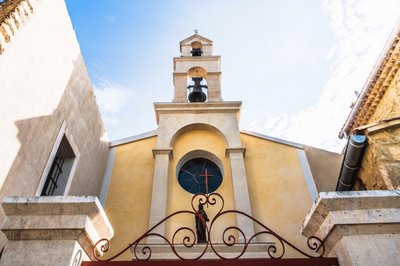
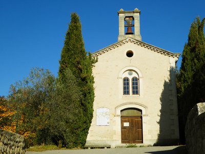
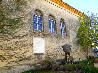
Eglise Saint Martin de Tour - ©JP-Villegas - Luberon Sud Tourisme Patrimony and historyParish Church of St. Martin
This religious building was built between 1626 and 1929 to replace the old ruined church, dedicated to Saint-Martin-de-Tours. Its small size and its remoteness from the village can be explained by too few Catholic families. The majority of the population being from the Canton of Vaud. Inside, the altarpiece dates back to the 18th century. The pointed barrel vault nave, terminated by a semi dome apse, makes it a building of unique architecture.
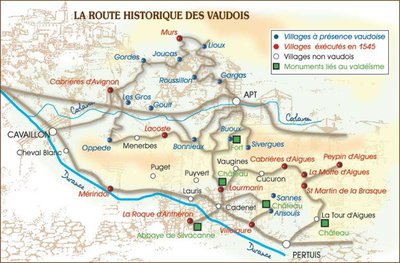
Les Vaudois en Luberon - ©DR Patrimony and historyThe Vaudois's in the Luberon
Created in 1170 by a wealthy citizen of Lyon Valdes (or Vaudes), the Waldensianism is a movement that advocates a simple lifestyle, close to that of the first disciples of Jesus of Nazareth. Having separated from the ostentatious luxury of the Catholic Church, these Vaudois, expelled from Lyon in 1184, settled in the south of France, Provence, Languedoc, Dauphine, and Italy.
Rue caladée du hameau des Roux - ©Marine Alain - OTI Luberon Sud Tourisme Patrimony and historyLes Roux
The Vaudois' re-populated the villages and a new habitat was developed. This village was formed from a bastide, at the time of the refoundation of Peypin (1506). It is obviously a patronym, François Roux, head of the Vaudois family, leaving Piedmont to settle in Peypin. A part of this family settled in Estagnol des Roux (the current Mas de l'Etang), "estagnol" meaning "small pond" in Provençal. Do not look for it, the pond was dried up in the 17th century.
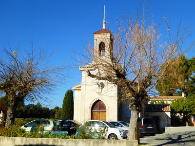
Temple protestant de Peypin-d'Aigues - ©Susanne Kuhn - OTI Luberon Sud Tourisme Patrimony and historyPeypin-d'Aigues, a Vaudois village
Peypin-d'Aigues is a village that was abandoned at the end of the 14th century. In 1506, the joint dwelling with Saint-Martin-de-la-Brasque was signed at the Tour-d'Aigues castle, several families from Pietmond and Vaud settled in the Luberon. The Aix-en-Provence court took a decision on May 20, 1545 "The Edict of Mérindol" establishing a list of fourteen cities of which it was enough to be originated from, to be chained to the galleys of Marseilles as "an alternative to imprisonment". Peypin-d'Aigues was one of them.
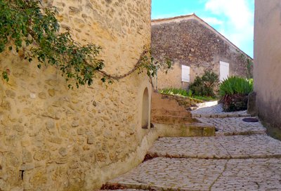
Hameau de Fontjoyeuse - ©Susanne Kuhn - OTI Luberon Sud Tourisme Patrimony and historyFrom the bastide to the hamlet
The bastides were built by farmers on remote land. Former rural houses to operating staff, they later became permanent residences, and sometimes the core of real hamlets. The deed of residence of 1506, authorized the construction of "a house of six canes long and four wide" (12m by 8m or 96 sqm) with a barn and shed of identical size. The bastide of Fontjoyeuse and its hamlet are a good example.
Passage voûté à Fontjoyeuse - Marine Alain - OTI Luberon Côté Sud Patrimony and historyFontjoyeuse
This hamlet was formed in the 16th century and has not changed since then, there is an important vernacular heritage. The architecture is characterized by the high number of vaulted passages, houses with loggias and external staircases but also by the high density of houses. Fontjoyeuse was the meeting point for the magistrates of Peypin and St-Martin-de-la-Brasque who held meetings to discuss common issues to both villages.
Hameau de Belle Etoile - ©Marine Alain - OTI Luberon Sud Tourisme Patrimony and historyBelle Etoile
Belle etoile was an isolated bastide dating from the 16th century whose name would evoke a Vaudois landowner: Estève. Bel Estève, a nickname or the name given to the house, would have ceased to be accepted at a later date. In any case, the current name "Belle étoile" is on the map of Cassini (1762). A name change could have occurred between Belle Estève and Belle Estello; in fact, on the eve of the epiphany (feast of the Three Kings) was the procession of the float of the "Belle Estello" in Pertuis.
Temple protestant de la Motte-d'Aigues - ©Susanne Kuhn - OTI Luberon Sud Tourisme Patrimony and historyMotte-d'Aigues, a Vaudois village
The village, emptied of its inhabitants by the Hundred Years' War, tried to repopulate during the second part of the 15th century. ; At the beginning of the 16th century, some Vaudois of the Italian Piedmont settled there. In 1513, the village repopulated so well that some of the inhabitants moved to La Roque d'Anthéron. A bard denounced the Vaudoise families of La Motte in 1543 and in April 1545, La Motte was part of the 24 villages looted and burned by the troops of Polin de la Garde, applying the Edict of Merindol.
Le Temple protestant et sa statue - ©Suzanne Khun - OTI Luberon Sud Tourisme Patrimony and historyCabrières-d'Aigues, a Vaudois village
In 1495, the Baron of the Tour-d'Aigues signed a deed of residence with 80 families, 75 of whom came from Freissinieres in the Alps. Settling in Provence to escape the justice system of its region, Cabrières-d'Aigues welcomed the largest Vaudoise community of the valley and its series of tragic persecutions... Along the temple, a sculpture symbolizes the hospitality of the "Vaudois briançonnais" in the Luberon: The base is made of the Luberon stone, and the overhead part is made of stones from the Alps.
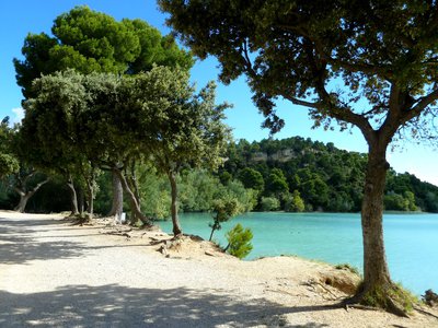
Étang de la Bonde - ©Aline Salvaudon - PNR Luberon  Water and rivers
Etang de la Bonde
The pond was created in the 15th century by Lord Fouquet d'Agoult, Baron of Sault, who decided to create a water reserve for the castle of La Tour d'Aigues, and then has an aqueduct made. The lake thus formed was for a long time the supply point for an irrigation network that supplied the valley of Aigues, contributing to the expansion of agriculture and the growth of the territory. Today, the pond is still used for irrigation and is a popular place for swimming.
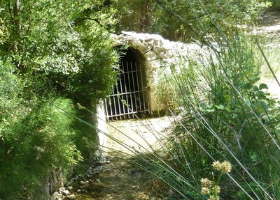
La source du Mirail - ©Aline Salvaudon - PNR Luberon Water and riversThe source of Mirail
Use of the source of Mirail, upstream of the Motte-d'Aigues, dates back to the Middle Ages. Its unexpected presence in the middle of arid land has been the subject of rivalry and lust amongst the riparians of the Aigues. Source of drinking water, it quenches many small streams, direct tributaries on the right bank of the Durance, like Eze. Today it mostly feeds into the pond Bonde and therefore is used for irrigation by the network of the Canal of Provence Company.
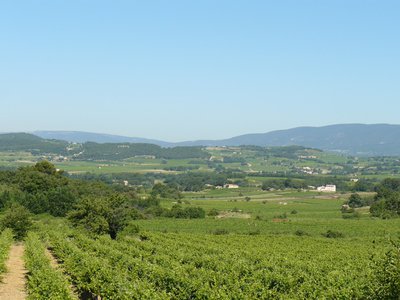
Paysage du Pays d'Aigues - ©Françoise Delville - PNR Luberon  Panorama
Life is sweet in the shade of plane trees ...
Aigues rests on the Luberon to the north and opens up onto the Durance valley to the south. This landscape with a gently rolling basin is energized by the alternating forests and vineyards. The villages of Aigues are located away from flood-prone areas, mostly on cliffs or hills and facing south. The valley, rich in building heritage (farmhouses, domains), highlighted by remarkable trees, is under increasing pressure from the living area of Aix en Provence.
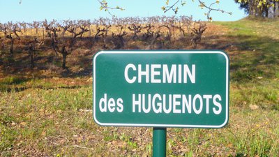
Chemin des Huguenots - ©Séverine Besson - OTI Luberon Sud Tourisme Patrimony and historyTraces of the Reformed
Qualified as heretics and persecuted since their appearance, the majority of the Vaudois officially joined Protestantism in 1532, at the synod of Chanforan. Following the revocation of the Edict of Nantes in 1685, the Huguenots (the name given to the Protestants during the religious wars in France) went to seek shelters on Protestant lands in Europe and in the world. The Vaudois, who adhered to the Reformation, exiled again and followed the same paths.
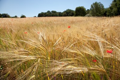
Champ de messicoles - ©Hervé Vincent Patrimony and historyLandscape shapers
In the 14th and 15th centuries, the Luberon was heavily depopulated and the land was abandoned. In the 15th century, with the arrival of the Vaudois (mainly farmers from the Luberon), the land was re-cultivated. The basic crop was cereals, the most lucrative crop was the olive tree. The cultivation of the vine and the production of wine also existed. Fruit production was a complementary resource, while vegetables were for family consumption.
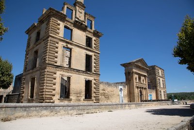
Château de La Tour-d'Aigues - ©Alain Hocquel - VPA Patrimony and historyThe castle of the Tour-d'Aigues
From the 14th century. the castle transferred out of the medieval settlement on the present site. A castle was built in the 15th century around the first dungeon But during the 16th century, the castle and gardens were extensively reworked and expanded to become one of the finest Renaissance buildings in Provence. It was unfortunately looted and burned during the Revolution. The few remains were gradually restored since the 19th century, but nevertheless testify to this rich history.
Description
With your back to the castle entrance, turn right in the Boulevard de la République (D956). 180m away, go left on a pedestrian crossing (cycling sign). Pass the middle school then at the roundabout take the 2nd right (Chemin du Piedmont). Further down, reach the D120 and take a right for 200m.
1- At the intersection, turn right towards Saint-Martin-de-la-Brasque (D165). At the Y, stay on the left. At the entrance of the village, turn right and go through the large car park. At the corner of the town hall, turn left and proceed straight until the D27.
2- Turn right and take the Route de Grambois (D27). 1.5km further, turn left towards Tourrache and take a quick left onto the paved road of the Grandes Terres. Come out on the D42.
3- Turn right on the D42 until Peypin-d'Aigues. Then come back to point 3. Continue straight on 350m and turn left towards Fontjoyeuse (D42a). Take the 2nd intersection to the right, Rue de la Bergerie. Turn right and then left twice. Take the Rue de Vignes to the right. Follow the D42 to the left. After 300m, turn right on the Chemin des Baysses. Continue on the Chemin des Micouliets. Turn left towards Belle Etoile, then follow the Chemin de Langresse. Take the D27 to the right to Motte-d'Aigues. Go through the village and go until the stadium.
4 - Turn right and head towards Cabrières-d'Aigues (D120). 200m after a big left turn, turn right on the Chemin des Grès. At the Y, turn left, go down the Rue des Jourdans, then turn right onto the Rue des Jardins. 100m further, turn left (at the bridge) anc continue to the left. Before the church, go to the right. At the fountain, climb left, then continue to the right on the Rue des Vaudois.
5- At the crossroads, continue across on the Chemin des Palons. At the next intersection, continue straight on the Chemin de Roubian. Further down, stay to the right. After the hamlet of Lataud, take the Chemin des Mascarades to the left. At the Y, turn left and 200m further, turn left on the Chemin d'Entraigues. Before the roundabout (garbage bins), turn left on the Chemin de la Palonne. Come out the D27 and follow it to the left.
6- At the roundabout, continue straight and follow the Etang de la Bonde (D27). At the 1st crossing, turn right on the D37 towards La Tour-d'Aigues. 2.5km further, take the Chemin des Huguenots to the right. Cross the D135 and continue across. Continue straight to the next crossing.
7- At the intersection "l'Archibaude" (sign-post), turn left towards the Tour-d'Aigues. Take the Chemin de Septem and then the Chemin Le Plan. Come out on the D956, turn left on Rue Antoine de Très. After the church, turn right and return to the castle of La Tour d'Aigues.
- Departure : Tourist Office, Place Jean Jaurès, La Tour-d'Aigues
- Arrival : La Tour-d'Aigues
- Towns crossed : La Tour-d'Aigues, Saint-Martin-de-la-Brasque, Peypin-d'Aigues, Grambois, La Motte-d'Aigues, Cabrières-d'Aigues, Sannes, and Pertuis
Forecast
Altimetric profile
Recommandations
This route follows streets opened to public traffic; so under all circumstances, it is therefore essential to respect the highway code. Wearing a helmet is highly recommended, for children as well as for adults!
Information desks

House of the Luberon Regional Nature Park
60, place Jean Jaurès, 84400 Apt
In the heart the old town centre of Apt, the House of the Luberon Regional Nature Park welcomes you in a town house of the 18th century. The permanent exhibition of the geology museum has a rich collection of fossils evidencing the geological history of the Luberon.
On sale at the shop: books, maps, guidebooks, games, posters...
Open Monday to Friday from 8:30 am to 12:00 pm and from 1:30 pm to 6 pm (and on Saturday, depending on the program). Free admission.

OTI Luberon Sud Tourisme
128 chemins des vieilles vignes (siège administratif), 84240 La Tour d'Aigues
Access and parking
At 30km North of Aix-en-Provence, through the A51, D973 and D956.
Parking :
Access
- Emergency number :
- 114
More information
Source
Report a problem or an error
If you have found an error on this page or if you have noticed any problems during your hike, please report them to us here: