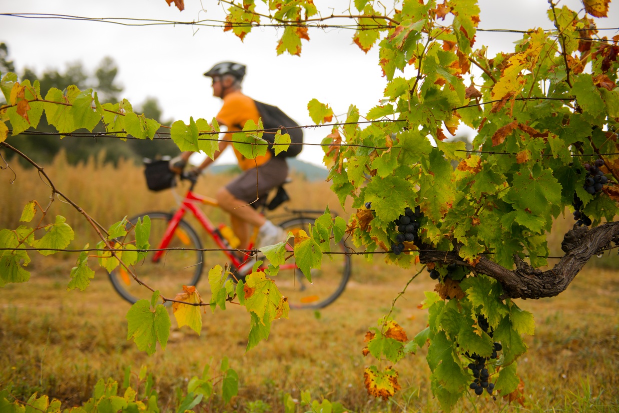
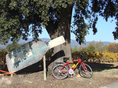
The vines at the mercy of the bike riding season
I love this vineyard which shapes the landscape and its colors that change with the seasons. I admire the winemakers that maintain the vineyard throughout the year to produce a tasty wine. And as they say in Provence, "Doou bouen terradou, bouen vin" (with good soil, good wine). So take advantage of a good refreshment break in one of the many wineries of Aigues". says Mylène Maurel - Agriculture and Tourism Project manager at the Luberon RNP.
22 points of interest
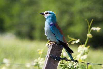
Rollier d'Europe - ©DR-A. Rocha France  Fauna
FaunaThe European Roller, the blue bird
Easy to spot thanks to its intense blue color, it can be seen on utility poles. It enjoys this vantage point in an open and sunny area to locate and dive down on its prey (large insects and lizards). It nests in tree cavities and leaves to spend winter in Africa when prey becomes rare, before returning in the spring.
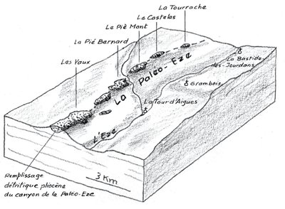
Remplissage de la paléo-Eze - extrait de « De la Durance aux monts de Vaucluse » G. Bronner, Ed. Jeanne Laffitte  Geology
Pié Mont and Paléo-Eze
Between Pertuis and Peypin-d'Aigues, in several places, you can see an accumulation of pebbles, pieces of rock torn from the mountains and slowly worn, rounded by their transport in a stream, a river. These pebbles correspond to the former course of a stream, a paleo-Eze flowing there, parallel to the current Eze but shifted 3 km to the east. We can also notice this ancient fossil valley across the landscape forming hills.
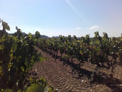
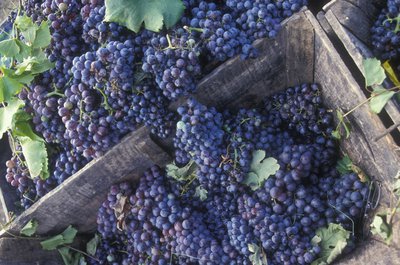
Vignoble du sud Luberon - ©Eric Garnier - PNR Luberon  Produits du terroir
2,000 years of history of grapevines
Contrary to popular belief, grape growing began here in the ancient times! Greek settlers brought the first vine stocks, but the Romans, great wine lovers, really developed viticulture in the Luberon and the Pays d’Aigues. In the Middle Ages, the members of the church among which great monasteries and Avignon popes were involved in promoting the work of the vine. The Luberon gained recognition in the 20th century as a quality local area for wine production.
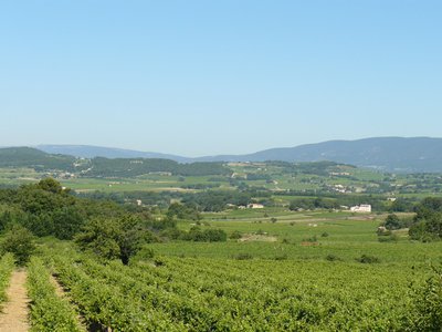
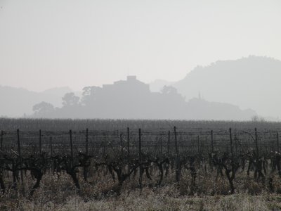
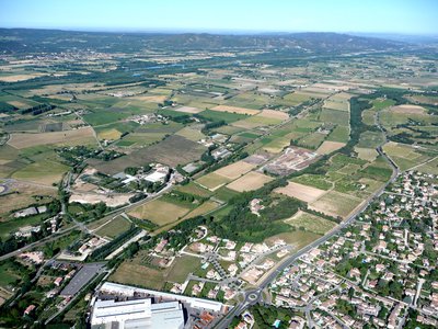
Paysage du Pays d'Aigues - ©Françoise Delville - PNR Luberon  Panorama
Life is sweet in the shade of plane trees ...
Aigues rests on the Luberon to the north and opens up onto the Durance valley to the south. This landscape with a gently rolling basin is energized by the alternating forests and vineyards. The villages of Aigues are located away from flood-prone areas, mostly on cliffs or hills and facing south. The valley, rich in building heritage (farmhouses, domains), highlighted by remarkable trees, is under increasing pressure from the living area of Aix en Provence.
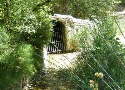
La source du Mirail - ©Aline Salvaudon - PNR Luberon  Water and rivers
The source of Mirail
Use of the source of Mirail, upstream of the Motte-d'Aigues, dates back to the Middle Ages. Its unexpected presence in the middle of arid land has been the subject of rivalry and lust amongst the riparians of the Aigues. Source of drinking water, it quenches many small streams, direct tributaries on the right bank of the Durance, like Eze. Today it mostly feeds into the pond Bonde and therefore is used for irrigation by the network of the Canal of Provence Company.
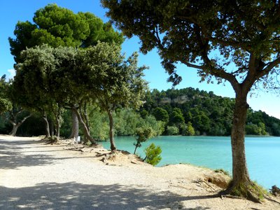
Étang de la Bonde - ©Aline Salvaudon - PNR Luberon Water and riversEtang de la Bonde
The pond was created in the 15th century by Lord Fouquet d'Agoult, Baron of Sault, who decided to create a water reserve for the castle of La Tour d'Aigues, and then has an aqueduct made. The lake thus formed was for a long time the supply point for an irrigation network that supplied the valley of Aigues, contributing to the expansion of agriculture and the growth of the territory. Today, the pond is still used for irrigation and is a popular place for swimming.
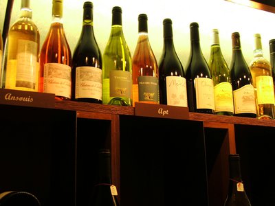
Sur la bonne route... - ©Eric Garnier - PNR Luberon Produits du terroirAOC Luberon, recognised know-how
The AOC Luberon, created in 1988, is the result of recognized and proven know-how which is between very ancient traditions, carefully passed down from generation to generation, and the latest advances in technology and oenology. The appellation produces the three colors of wine: red, pink and white. All the AOC is nestled in the heart of the Luberon Regional Park and represents 3,220ha, and produces about 20 million bottles per year.
En hiver... - ©Françoise Delville - PNR Luberon  Flora
FloraThe cycle of the vine
In winter, the vine enters a sleep-like state. In spring, vegetative buds begin to develop – this is the period of growth for branches and leaves. In July, the leaves continue to grow and the flowers give grapes. In August, green grapes grow and mature, they turn either red or yellow. In the fall, grapes are harvested during the grape harvesting. Late in the season, the leaves will turn red, dry and fall.
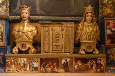
Reliques de Saint-Elzéar - ©Commune d'Ansouis  Patrimony and history
Place Saint-Elzéar
Named Elzéar Sabran who was born in Provence in 1285 and was married to Delphine (Dauphine) sign, which was destined to take orders. They lived their married life in asceticism and virginity. Elzear died September 27, 1325 and was canonized April 15, 1369. Delphine made vows of poverty and ended his life in Apt in the greatest destitution. The Church blessed and proclaimed the popular will, Ste. Ansouis always celebrates in September the Saints.
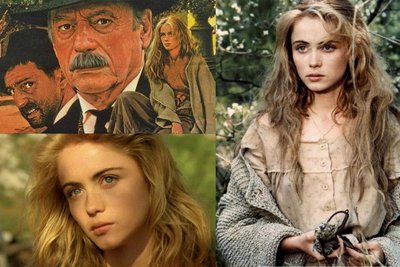
Manon des sources - ©DR- premieres.fr Patrimony and historyAnsouis, movie set
The church of Ansouis has been featured in two cult films of Claude Berri, "Jean de Florette" and "Manon of the Spring" (1986). The scenes of preaching to the Christmas Mass and Manon wedding were all shot in the church. The scenes outside the church happen in Vaugines, at 7 km from Ansouis.
Eric Garnier - PNR Luberon Produits du terroirFruity notes...
Red wines are fruity and delicious, with aromas of blackcurrants, blackberries, raspberries... Some vintages provide spicy notes but without losing the freshness that characterizes AOC Luberon. Rosé wines are marked on the palate by aromas of typical red fruit (strawberry, gooseberry) or more exotic notes. White wines offer a beautiful aromatic palette ranging from grapefruit to peach for fruity flavors, and from honey to toast for more complex wines.
Hervé Vincent Produits du terroirThe different grape varieties
The wines of the AOC Luberon must be produced from the blending of several grape varieties. Most blendings, obtained by mixing different varieties or vintages, of red and rosé wines are produced from Syrah and Grenache, which is a symbol of the Rhone Valley. But also grape varieties of Mourvèdre, Carignan, Cinsault,... Some white grape varieties are used during the blending processes. The grape varieties of Grenache Blanc, Clairette Blanche, Bourboulenc,... allow to obtain white wines.
Plaine de Villelaure - ©Stéphane Legal - PNR Luberon Produits du terroirThe agricultural plain of Villelaure
The plain constitutes more than half the area of the town (1,275ha) which has long been neglected by fear of floods. In the 18th century, it was conquered on the river by building dams in order to control the Durance. A fruit and vegetable agriculture has developed there. 600km of canals allow each plot of land to be irrigated and drained. A mill, a factory (beetroot refinery), a power plant bear witness to the past use of the driving force of the water.
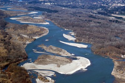
La Durance - ©Jérôme Brichard - PNR Luberon Water and riversThe Durance, a Provençal queen
Taking its source at Mount Genèvre in the Hautes-Alpes, the Durance continues its course in the Alpes-de-Haute-Provence to then establish the border between Bouches-du-Rhône and Vaucluse. The various hydroelectric constructions (like the huge dam of Serre-Ponçon) have significantly reduced its flow and its natural environment. The challenge today is to reconcile the production of electricity from renewable energy and the protection of the ecosystems of the stream.
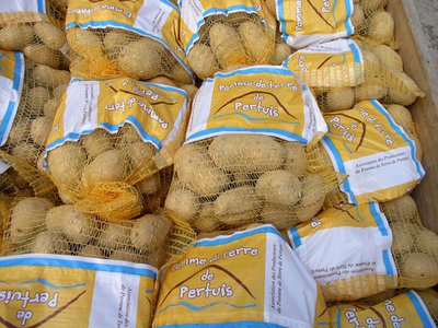
Pomme de terre de Pertuis - ©DR Produits du terroirThe "Pomme de terre de Pertuis" brand
Legend has it that the potato was brought to the region in the late 18th century by a peasant from Tour d'Aigues named Job le rouge, back from Napoleonic expeditions. Before World War II, there were about 2000 ha, which helped feed many inhabitants of Marseille during the occupation. The yellow-fleshed potato is sold unwashed to promote conservation and the most cultivated varieties are the Mona lisa and the Samba.
Canal de Pertuis - ©Emilie Auray - PNR Luberon Water and riversCanal of the southern Luberon
Completed in 1862, it is used to irrigate the plain of the Durance. It takes its water from the Durance upstream Pertuis, near La Loubière, and runs along the hills until Cadenet then Lauris. It supplies about 3200ha of land. You will also see the passing in a siphon under the Eze river, where it also disgorges, if needed.
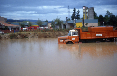
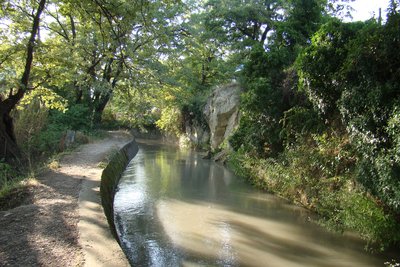
La caserne inondée pendant la crue de 1993 - ©DR-Guy-Marie Gautier Water and riversThe Eze, a torrential river
This river which takes its source upstream of Bastide des Jourdans at about 20km, often dry in the summer, is however torrential and can experience flash floods after severe thunderstorms. The Eze is the natural drain of all the rain fallen upstream in Aigues. This is what happened in September 1993. The fire station that you see from the bridge was blocked!
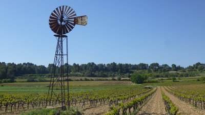
Eolienne de pompage - ©Séverine Besson - Luberon Sud Tourisme  Savoir-faire
One way to use the wind!
Water-pumpers convert wind force into mechanical energy to make a water pump work. The rotating blades of the water-pumpers create a vertical movement of the pump in the water, thus activating the suction mechanism. Water can be pumped when the wind blows at 11km/h. In such a dry and windy region, no wonder that farmers of the Luberon wanted to take advantage of the Mistral and its average speed of 50km/h to irrigate their farmland!
©DR Patrimony and historyEcole-Mairie
In 1833, a law making primary education compulsory. But how to pay the teacher, the house and rent a room for the class? In 1844, the council purchased a house that will house the school and the town hall, the premises are very old. In 1883, the Bastidonne offers her children a sewing school. It is curious that the teachers are paid 900 F to 1200 F year, while teachers receive only 700 F to 900 F ...
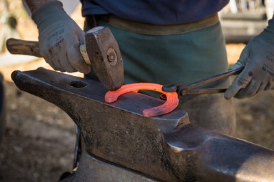
Redressage de ferrure - ©Damien Rosso - Drozphoto Patrimony and historyIn the streets of Ferrages
"Ferrages" can refer to the whereabouts of the blacksmith and most likely here in "wet field" devoted to forage. At the time, the village was limited to heights and all wastewater flowed down the village, creating a wet field. This street has always been an absolute must. The horses could also relax in a barn that was in the current location of the town hall.
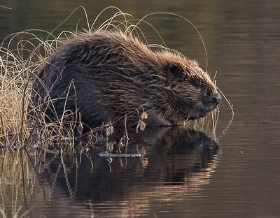
Castor d'Europe - ©DR-Per Harald Olsen FaunaThe beaver lives in the Eze river!
Protected since 1909, the European beaver lives in the Eze river further downstream since several years. 80cm long and 20 to 30kg, this nocturnal and aquatic mammal is a lumberjack, carpenter, joiner, miner and vegetarian, all together! With the construction of dams in drought, it contributes to the maintenance of plant and animal species related to the presence of water.
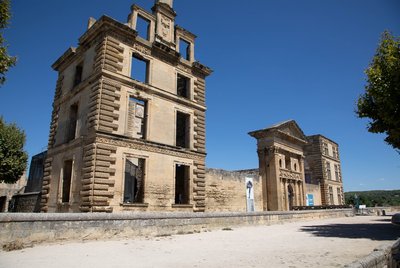
Château de La Tour-d'Aigues - ©Alain Hocquel - VPA Patrimony and historyThe castle of the Tour-d'Aigues
From the 14th century. the castle transferred out of the medieval settlement on the present site. A castle was built in the 15th century around the first dungeon But during the 16th century, the castle and gardens were extensively reworked and expanded to become one of the finest Renaissance buildings in Provence. It was unfortunately looted and burned during the Revolution. The few remains were gradually restored since the 19th century, but nevertheless testify to this rich history.
Description
With your back to the castle and the tourist office, turn right on the Boulevard de la République (D956). 180m away, go left on a pedestrian crossing (cycling sign). Pass the middle school then at the roundabout take the 2nd right (Chemin du Piedmont). Further down, reach the D120 and take a right for 800 m.
1 - Turn left on Chemin des Escabots. At the intersection, turn right on the D37. Come out the D27 and follow it to the left going along the pond. At the roundabout, turn left (D9) over 400m then turn right (D37). Reach Ansouis by the D37.
2- At the roundabout, take a left onto the Boulevard des Platanes. Continue straight up until the Place des Hôtes and go down the Rue du Vieux Moulin. At the stop sign, turn left on the D37 for 300m. After the curve, go right up the paved track. Continue straight for 2km and come out on the D182. Follow it to the left then follow the Route d'Ansouis (D37) to Villelaure. 300m after the village entry sign, turn left on the Cours du Luberon. At the next intersection, continue for 70m and turn left on the Rue de Séguret. At the end of the road, turn right.
3 - At the stop sign, go straight across on the Avenue Jean Moulin. At the roundabout, follow across the marking "Le pays d'Aigues à vélo" (bike arrows with red dots) to Pertuis.
4- Leaving the VC15 of Eze, turn right over the bridge and up the boulevard Jules Ferry (D973). At the roundabout, continue to the right on the Boulevard Victor Hugo and continue straight for 600m on the D973 (marking "Le pays d'Aigues à vélo"). Turn right on Rue Léon Arnoux over 1.5km. At the exit sign of the village, turn left onto the VC12 of Condamines and reach La Bastidonne.
5- Take the Rue des Ferrages to the right. Climb left onto Rue du Pasquier and turn right. At the Y, go left for 600m on the Chemin des Paroites then go left on the Chemin de Pouspeire. At the give-way, reach the D165 to the right. Come out on the D135 and head left to the Tour-d'Aigues. Cross the Eze river and switch to the right onto Rue Sous le Château. Work your way up the ramparts, turn right twice on Rue des Remparts and under the porch to reach the Place Jean Jaurès and the castle.
- Departure : Tourist Office, Place Jean Jaurès, La Tour-d'Aigues
- Arrival : La Tour-d'Aigues
- Towns crossed : La Tour-d'Aigues, Saint-Martin-de-la-Brasque, La Motte-d'Aigues, Sannes, Ansouis, Villelaure, Pertuis, and La Bastidonne
Forecast
Altimetric profile
Recommandations
This route follows streets opened to public traffic; so under all circumstances, it is therefore essential to respect the highway code. Wearing a helmet is highly recommended, for children as well as for adults!
Information desks

House of the Luberon Regional Nature Park
60, place Jean Jaurès, 84400 Apt
In the heart the old town centre of Apt, the House of the Luberon Regional Nature Park welcomes you in a town house of the 18th century. The permanent exhibition of the geology museum has a rich collection of fossils evidencing the geological history of the Luberon.
On sale at the shop: books, maps, guidebooks, games, posters...
Open Monday to Friday from 8:30 am to 12:00 pm and from 1:30 pm to 6 pm (and on Saturday, depending on the program). Free admission.

OTI Luberon Sud Tourisme
128 chemins des vieilles vignes (siège administratif), 84240 La Tour d'Aigues
Access and parking
At 30km North of Aix-en-Provence, through the A51, D973 and D956.
Parking :
Access
- Emergency number :
- 114
More information
Source
Report a problem or an error
If you have found an error on this page or if you have noticed any problems during your hike, please report them to us here: