Aiguille path
Buis-les-Baronnies
Aiguille path
Easy
Difficulty3h
Duration5,9km
Distance+439m
Positive Elevation-439m
Negative ElevationBoucle
Course typePR
NetworkEmbed this item to access it offline
"With its starting path in the middle of olive groves and its path that passes on both sides of the Rock of Aiguille, this hike for young and old gives to see all the Provencal character of the Baronnies. The path climbs a little at the beginning but is really worth it, especially when one enters the ravine of Bourges. The view on Buis is really unique! "Vincent Aubert, technician of nature sports to the Baronnies of Provence RNP.
9 points of interest
 Produits du terroir
Olive groves, the rebirth!
On the slope overlooking the town of Buis-les-Baronnies many olive groves are spread. There are small stone sheds, historically built to house the material needed for crops sometimes far from farms. Abandoned following the 1956 freeze that destroyed much of the trees, the olive groves have returned to service thanks to the creation of a Appelation of Controlled Origin in 1994. Flora
FloraCades: The needle companions
Along the Aiguille path and throughout the walk, a plant companion with many needles will follow you: The Juniper Cade! The cade is this shrub with evergreen foliage whose smallgreen needles have 2 fine white lines distinguishing them from those of the common juniper (1 single white line). Its berries, of violet colour to red, identify easily: their underside has three linesof 120 ° each and converging at a central point. Patrimony and history
Climbing on the rock of Aiguille
The rock of Aiguille is equipped for the practice of sport climbing since the 1990s. Its southern face is equipped with about fifty tracks, some of which, in two lengths, allow climbers to climb the 60 meters high of this cliff and climb to the top of the Aiguille, from whom the altitude is 641 m from the sea. The southern orientation of this wall makes it a popular climbing site for inter-season but also on beautiful winter days.- Flora
The aphyllante of Montpellier
The Aphyllante of Montpellier (or Barjavou) is a typical plant typical of the Mediterranean scrubland. Its name, in Greek, designate it as a flower without leaves (a = private, phullon = leave, anthos = flower: flower without leaf); In fact it has the appearance of numerous stems pushing in clumps, at the end of which come out of the blue flowers from May to August. Despite its apparent absence of leaves, it constitutes an important resource of pasture for sheep flocks, particularly in winter.  Savoir-faire
Agricultural soil of Montlaud
The southern slope of the Montlaud Mountain is a typical example of the agricultural land of the Baronnies. Under the limestone cliff compact, the slope gradually softens to the foot. On the scree of the lower half are installed the orchards. The top was once grazed, but the forest of pubescent oaks and Aleppo pines takes its place there. The valley bottoms, more fresh and exposed to freezing are reserved to the plum or to cognaciers, which are more resistant to the cold.- Patrimony and history
The Ubrieux castle
From the Promontory (711m) overlooking the Ouvèze, The Ubrieux castle dominated the natural lock of the Gorges of Ubrieux. This stronghold, built in 1240, was one of the keys of the defense system of Boxwood, then capital of the Barony of Mévouillon. The strategic position of this fort was partly on its perched position but also on the fact that it was on the edge of anotherBaronnie : The one of Montauban. It remains today only the base of the fortifications of the fort, destroyed in 1590. - Flora
The Sylvester Pine, majority tree
We find it as well in north face as south face in the Baronnies provençales: it's the Sylvester Pine. Typical tree of the Mediterranean mountains, it presents a good resistance in dry period and under cold temperatures. It is easily identified with the red colour that its bark takes on the small branches and on the upper third of its trunk. Some Sylvester pine particularly exposed to the wind take tortured forms, sometimes resembling to the bonsai.  Elevage et pastoralisme
Le Jas du Blanc
The ruins of this jastestify to the presence around a moor pasturein the 18th century. The word jas, derived from "jacere" meaning "lying" in Latin, refers to these small sheepfolds where the shepherd led his flock to spend the night. The Jas du Blanc was a good representative of these rustic buildings, with a unique sloping roof and walls pierced by small openings to keep the freshness of the stones in summer and the heat of the animals in winter. Geology
The rocks of Aiguille and Ubrieux
The spur of the Aiguille is made up of late Jurassiclimestone Despite the compactness of this rock, the cycles of freezing and thawing have overcome some parts of the cliff: Large blocks of rock strewn over the wall in the south face. The land at the base of the cliffs is composed of softer sedimentary rocks, alternating limestone and marl-limestone beds. These marls are particularly well observed when passing through the Bourges ravine.
Description
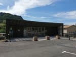
From the center of the village, reach on foot or by car the car park in front of the holiday center of the Annibal fountain.
1 - Go up Cherry Alley, cross the D 546, turn left 50 m then right onto a tarmac road that rises along an orchard of olive trees. At the top of the olive grove, turn left on the dirt track. The slope becomes steeper, continue for 200 m until you reach the 2nd slope of the trail, from where a trail leads to the right.
2 - Leave the track on the left and turn right on the start of the small path. Go up and climb the laces in the pine forest to gain height until crossing at the foot of the East ridge of the Rocher de l'Aiguille.
3 - Go up to the directional sign and then leave the crest trail to take the path on the left going down into the Bourges valley. After two pins, cross the small stream and go up on the left path that crosses the adret side of the valley to join the crossroads with another path.
4 - Turn right to and up this path, past the ruins of Jas du Blanc and continue until you reach the collar on the ridge.
5 - Optional access to and from the ruins of Ubrieux Castle: be careful, steep path passing near the void, reserved for good hikers. For families, go down the climb path again passing the Jas du Blanc to return to point 4.
6 - Continue the descent straight on the path back to Buis-les-Baronnies. Join the trail along the olive groves and go down to find the way to go. Return by the same route.
- Departure : Annibal fountain ; Buis-les-Baronnies
- Arrival : Annibal fountain ; Buis-les-Baronnies
- Towns crossed : Buis-les-Baronnies
Forecast
Altimetric profile
Recommandations
In point 5: Attention, the platform of the Ubrieux castle ruins is on the edge of cliff. Reserved access to good hikers, non-subjects to vertigo.
Information desks
Maison du Parc naturel régional des Baronnies provençales
575 Route de Nyons – La plaine du Pont, 26510 Sahune
Les locaux du Parc naturel régional des Baronnies provençales ne sont pas ouverts au public.

OT Baronnies en Drôme Provençale - Buis-les-Baronnies
14 Boulevard Michel Eysseric, 26170 Buis-les-Baronnies
Access and parking
Buis-les-Baronnies, 25 km east of Vaison-la-Romaine by the D 938 (direction Malaucène), D 54, D 13 and D 5.
Parking :
BUIS-LES-BARONNIES - Parking du Quai de l'Ouvèze, devant la Fontaine d'Annibal
More information
Report a problem or an error
If you have found an error on this page or if you have noticed any problems during your hike, please report them to us here: