Monks' Trail
Serres
Monks' Trail
Easy
2h30
6,4km
+393m
-393m
Boucle
PR local
Embed this item to access it offline
"A beautiful hike that allows you to discover the heritage and the old town of Serres before escaping on the heights and walk in a wilder atmosphere on the crests. Some beautiful points of view largely reward the effort of climbing in the undergrowth. On the way, several religious heritage elements invite you to pause and contemplation and make this loop a complete tour! “Vincent Aubert, technician of nature sports to the Pnr Baronnies of Provence.
10 points of interest

La ville de Serres - Pnr Baronnies provençales  Patrimony and history
Serrres, gateway to the Baronnies
The town of Serres is located at the entrance of a clue Buëch coming from the south This ridge would have given its name to the city, since a "serre" is, in Provençal, an elongated ridge. The city has developed at the foot of a castle. This ensemble was at the same time a point of control of the passages, notably military ones, and a place of reception and trade on the road which connected a part of the Provence and the Comtat Venaissin to Italy by the Buëch.
Rocher de la Pignolette : lieu de la citadelle - Pnr Baronnies provençales Patrimony and historyThe old citadel of Serres
On the rock of Pignolette, overlooking the city, stood a castle, from the tenth century. Around 1580, Lesdiguières transformed it into a citadel and made it the seat of a Protestant garrison. In 1633, it was destroyed by the monarchy to better control the region, against possible revolts. The walls are still clearly visible. In the center of the west rampart, the Auche door, gave access to gardens, vineyards and cultivated land.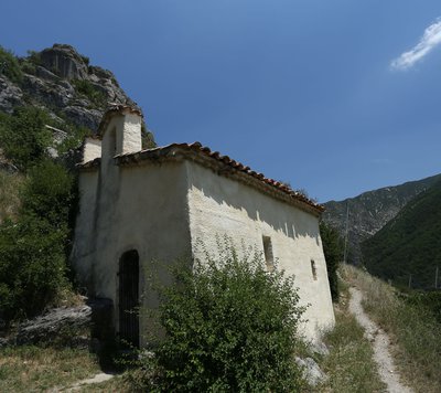
La Chapelle de Notre Dame de Bon-Secours - Pnr Baronnies provençales Patrimony and historyThe Notre-Dame de Bon-Secours Chapel
The church of Notre-Dame-de-Bon-Secours, built in 1730, was partly dug into the rock. It was then located in the district of the High Coste, under the enclosure of the castle and to the side of a private cemetery. The chapel was formerly a place of "relevailles" for the women of Serres, which marked the first return to the church after childbirth.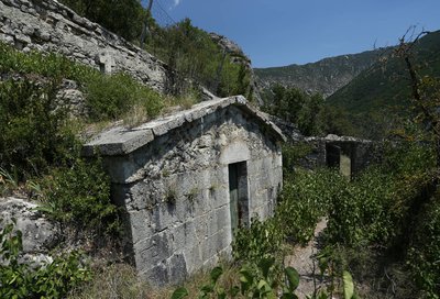
Cimetière de Bon-Secours - Pnr Baronnies provençales Patrimony and historyThe Bon-Secours Cemetery
This private cemetery, caulked in the back of the Bon-Secours Chapel, encircled by an enclosure and resting against the rock of the Pignolette shelters about fifteen dead. In the middle of the vegetation that occupies the place, a tomb built at the end of the 19th century in large cut stones stands out: this is the Itier-Dubois family. The cemetery belongs nowadays to the municipality but retains an intimate and reserved atmosphere because of its antiquity and its small size.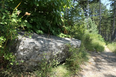
Tombeau juif du XIVème - Pnr Baronnies provençales Patrimony and historyThe Jewish tomb
On the upstream edge of the path is a 14th century Jewish tomb, imposing limestone block of dimensions of 2 meters by 1 meter, roughly squared but flat surface. On its upper side is engraved a Hebrew inscription whose most widespread interpretation is: "Rabbi Joseph son of R (abbi) Nathan May his memory be blessed in the year ..." This stone, listed as a historical monument, testifies to the existence of a Jewish community, settled in Serres in the 13th and 14th century.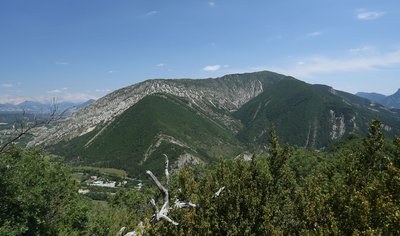
Montagne d'Arambre - Pnr Baronnies provençales  Panorama
View of Arambre Mountain
The Arambre mountain is an eastern part of the syncline of Montmorin. She impressed the spirits so strongly that she was deified by the Romans. A votil altar to the goddess Alambrima, found in La Piarre, is now preserved in the departmental museum in Gap. In the nineteenth century, people exploited the wood for coal but since the forest to regained its territory.
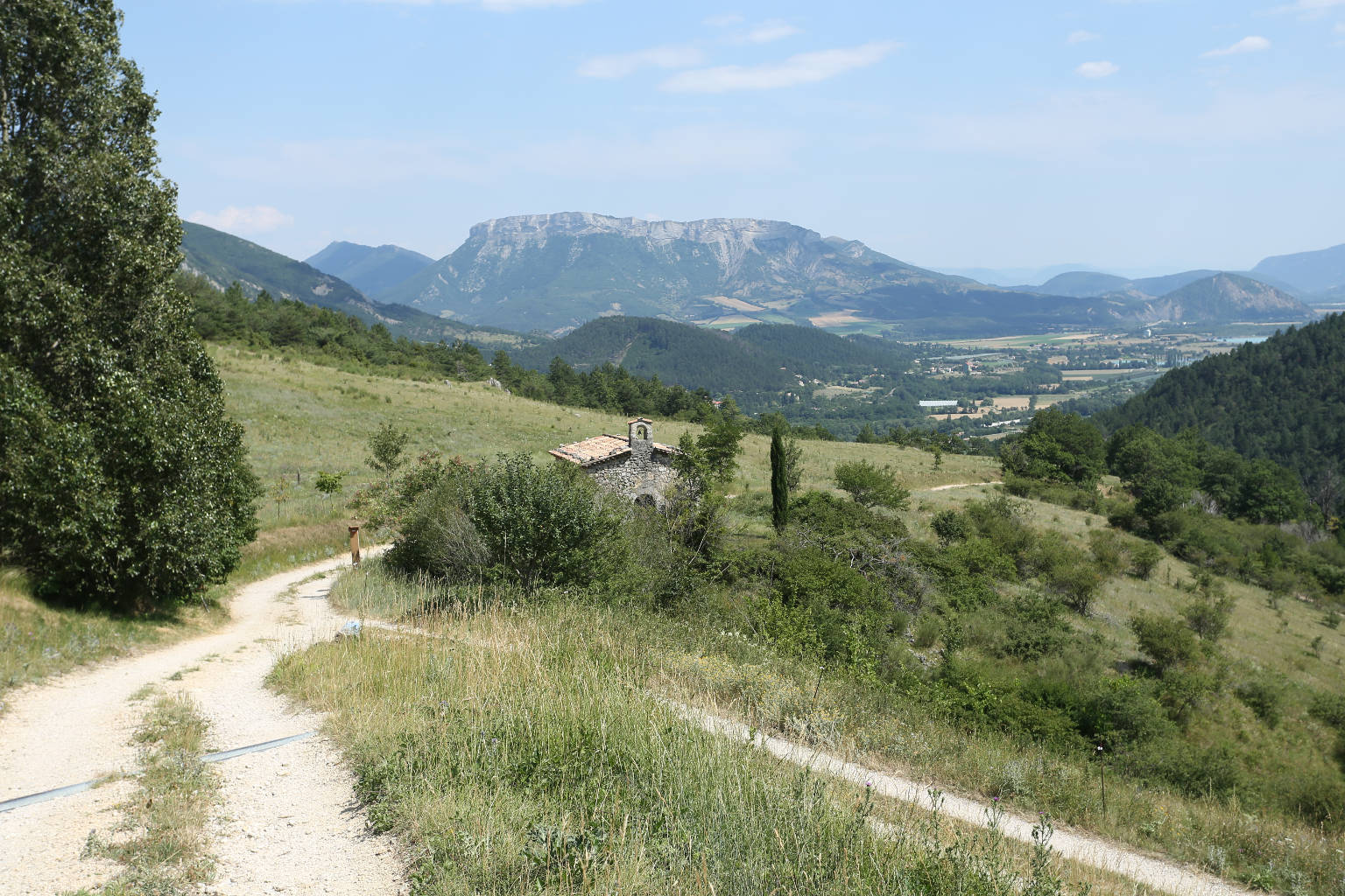
La vallée du Buëch - Pnr Baronnies provençales PanoramaPanorama on the Buëch Valley
From the ridge of Fontarache as the trail goes up, the point of view towards the south makes it possible to embrace the whole extent of the Buëch valley. Marked on the west by the Beaumont mountain and on the east by those of Arambre and Saint-Genis, the point of view on the valley also leaves the rectilinear silhouette of the Chabre Mountain to the south. In the same axis we also distinguish the dam of Saint-Sauveur and the promontoir Marneux de Montrond, giving its name to the adjoining village.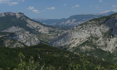
Les falaises de la Clue de Sigottier - Pnr Baronnies provençales PanoramaView of the Sigottier cliffs
Shortly before the Col de Saumane, from the ridge of Fontarache, a point of view is released to the northeast on the Torrent d'Aiguebelle valley. To the north, this tributary of the Buëch has pierced the barrier of the Agnielle Rocks at the place where the village of Sigottier stands today. The cliffs located to the east of this clue are equipped for climbing and present large scales of limestone particularly popular with climbers for their compactness and the mineral atmosphere they bring.
La Chapelle de Saumane - Pnr Baronnies provençales Patrimony and historyThe Saumane Chapel
The Saumane Chapel or Notre-Dame des Anges, existed already in the Middle Ages. It was rebuilt several times, in 1602 after the wars of religion but also in 1741. Around 1500, it seems to be the place of a hermitage where several priests resided and would have served as a clandestine place of worship for Protestants, very numerous in Serres, during the period of the revocation (1685-1787). It was also maintained by a brotherhood of penitents and was a place of processions.
Porte de l'Hotel de ville de Serres - Pnr Baronnies provençales Patrimony and historyThe carved door of the town hall
In the Rue du Portal, in front of the current Town Hall, a magnificent carved wooden door marks the entrance to the building. The door and piers date from the late sixteenth or early seventeenth century, at a time when the house is owned by Gaspard Perinnet, a lieutenants of Lesdiguières. The walnut doors of this door in Renaissance style are similar to those of the old church Saint-Sauveur de Crest, dated 1598.
Description
From the fountain, in front of the Tourist Office, turn right on the lane (Saint-Claude) to join the highs of Serres by following the Guérite path Go up the hairpin path that joins the upper part of the city and follow the road "Chemin du château".
1 - Go right on Chemin de la Chapelle (explanatory panel). Pass at the foot of the Molend tower (14th century) and bypass the small cemetery of the chapel Notre-Dame-de-Bon-Secours. Continue on the trail passing in front of Jewish tomb (14th s), and which rises then in laces under the pines.
2 - Bend the sharp Rock (842 m) to continue on the ridge of Fontarache. After some steep climbs in the rocks, you get to the Saumane pass (1031 m).
3 - At the directional post at the pass, turn left and go down towards Serres. Follow the same route as the GR by a path that crosses several times the forest track. Pass in front of the Saumane chapel.
4 - Continue the track. The track turns into a tarred road to join Serres.
5 - Enter the village of Serres and arrive near the college, turn left to pass on the esplanade Sainte Catherine (along the school). Find the Tourist Office by continuing through the alleys and vaulted passages (soustets).
- Departure : Serres, Tourist Office
- Arrival : Serres, Tourist Office
- Towns crossed : Serres
Forecast
Altimetric profile
Recommandations
Be careful, the path follows steep rocky passages between point 2 and point 3.
Information desks
Maison du Parc naturel régional des Baronnies provençales
575 Route de Nyons – La plaine du Pont, 26510 Sahune
Les locaux du Parc naturel régional des Baronnies provençales ne sont pas ouverts au public.
OT Sisteron Buëch - Bureau de Serres
Place du Lac, 05700 Serres
Transport
Access and parking
17 km north-west of Laragne-Montéglin by the D1075
Parking :
Parking de l'Office de Tourisme (place du lac)
More information
Report a problem or an error
If you have found an error on this page or if you have noticed any problems during your hike, please report them to us here: