The Botanical Trail
Take time to discover the various facets of vegetation. Throughout the route you will find signs naming the main species of trees and shrubs. Be careful and enjoy them without damaging, please do not pick them, such seemingly common species can be rare and protected. This is the case of the fritillaria here present, which is found only in the Southern Alps. A beautiful photo lasts longer. Stefano Blanc Ecogarde at the PNR Verdon.
7 points of interest
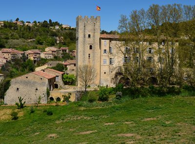
Le quartier de Vière - Stefano Blanc - PNR Verdon  Patrimony and history
Once upon a time, Vière...
Located below the castle of Esparron-de-Verdon, the Vière area, historic heart of the village, did not resist the rural exodus and was abandoned by its inhabitants. It is now in ruins, nature has reasserted itself. After rehabilitation, the site is revived and is now accessible, secured and landscaped. This is an area for strolls, between vegetation and ruins, their stones being a remembrance, which offers magnificent views of the village and the lake.
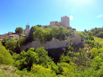
Le donjon du Baron - ©Stefano Blanc - PNR Verdon Patrimony and historyThe Baron's dungeon
The memory of Boniface VI of Castellane, a fierce baron and impetuous troubadour who lived in the 13th century, still hangs over Esparron-de-Verdon, and more particularly in the renowned dungeon of his castle. Because this mighty building with its massive battlements reflects the ardour of Boniface, who challenged the new Count of Provence, Charles of Anjou, whom he called scornfully "franciot" (little Frenchman).
Le pont noyé sous le lac - DR Patrimony and historyEsparron, the small medieval lock
It was easy to cross Verdon to Esparron, the waters were calmer at the mouth of the lower gorges. A bridge, nowadays submerged by the waters of the lake, was built there in 1725. The village had therefore define an important route between Var and Haute-Provence. Its function itself is specified in its name. The medieval "Espar" is a lock. And what is this town locking? The great path, which of course, it is carefully monitoring at this period.
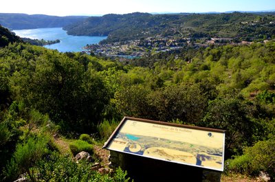
Ne perdons pas le Nord - ©Stefano Blanc - PNR Verdon  Panorama
The Viewpoint Indicator Map
The viewpoint indicator map located 498m high provides views of the lake and the port of the town of Esparron du Verdon. In the distance, we can see the massif of Luberon and the Lure mountain
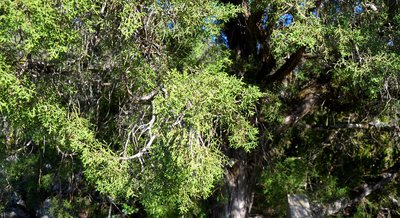
Le Mourven des provençaux - ©Stefano Blanc - PNR Verdon  Flora
FloraThe Phoenician Juniper or Mourven Provencal
It is the second Mediterranean juniper that immediately differs from its cousin, the Cade, by its innumerable ramules covered with tiny tortoiseshell leaves. Its range is also less extensive. Very xerophile, he likes the poorest scrubland, cracks of rocks and even limestone cliffs where his red brick balls defy the most insane sunshine and aridity almost absolute.
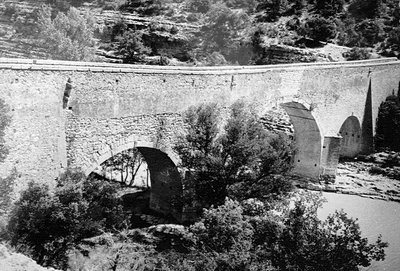
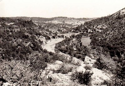
Le Pont Coupé est un Pont Noyé - DR Patrimony and historyLe Pont Coupé
Here the small road seems to flow into the lake. It has not always been the case. In 1967, the water filling of the lake submerged on12m a stone bridge with three arches spanning the Verdon that connected "Le Quartier” to the rest of the town of Esparron. Passing between the Var and the Alpes de Haute Provence. The bridge built in 1725 by the town council of Arles was a passageway for sheep transhumance between La Crau and the Pre-Alps pastures thus avoiding the unpredictable Verdon.
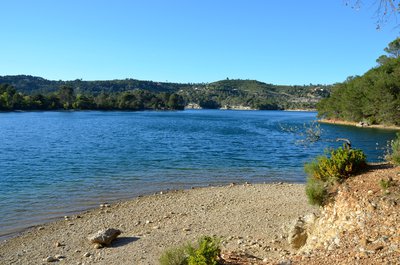
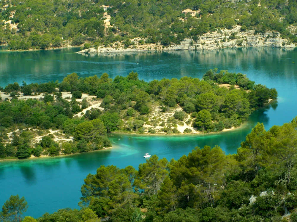
Le Lac d'Esparron - Stefano Blanc - PNR Verdon  Water and rivers
Lake of Esparron
Lake of Esparron, with its 85,000,000m³ has an area of 328ha for a maximum depth of 55m, is used to supply water to a hundred towns of the Var and Bouches du Rhone from Marseille to Toulon. The old canal of the Verdon is visible from the nature trail at the entrance of the gorges. It was built under Napoléon III and provided water supply from the Basse-Provence at that time. A lake in which it is pleasant to bathe in summer.
Description
From the car park of the tourist office, get on the D82 road and turn right towards the castle and its fountain. Turn right in 100m at the intersection between the roads of La Tuilière and Quinson.
1- Take the right route (Lake Road and Tuilière Road). After 50m on the Chemin de Tuilière, turn left onto the GR discovery trail (red and white markings). The entire climb, on a trail, is common with this special course. Pass in front of the viewpoint of the Tuilière. Cross a small valley and reach, to the top, a crossroads of tracks at a place known as Séouve.
2- At the crossroad turn right (yellow signs) and follow "pont coupé 1.5km"
3- Leave the trail that leads to the relay and take the path on the left, follow the trail. (Careful, the descent to the lake is a bit abrupt!)
4- At the bottom of the road turn right and join the paved road Chemin de Tuiliére, follow it to point 1. Continue on the same route as before.
- Departure : From the village center
- Arrival : To the village center
- Towns crossed : Esparron-de-Verdon
Forecast
Altimetric profile
Recommandations
We recommend at least 2L / 34 OZ of water per person, a hat and proper walking shoes. Avoid trail during hot weather. Find out before, the forests are sometimes closed in the summer due to fire risk. The town of Esparron de Verdon had two major fires in 2003 and 2005, BE CAREFUL! FIRE CAN START VERY QUICKLY. (As a reminder, smoking in forests is prohibited).
Information desks
House of the Verdon Regional Nature Park
Domaine de Valx, 04360 Moustiers-Sainte-Marie
House of the Verdon Regional Nature Park

OT Gréoux-les-Bains
7 place de l'hôtel de ville, 04800 Gréoux-les-Bains
OTI Durance-Luberon-Verdon
Transport
Access and parking
12km east of Greoux-les-Bains on the D952, D315, and D82
Parking :
Report a problem or an error
If you have found an error on this page or if you have noticed any problems during your hike, please report them to us here: