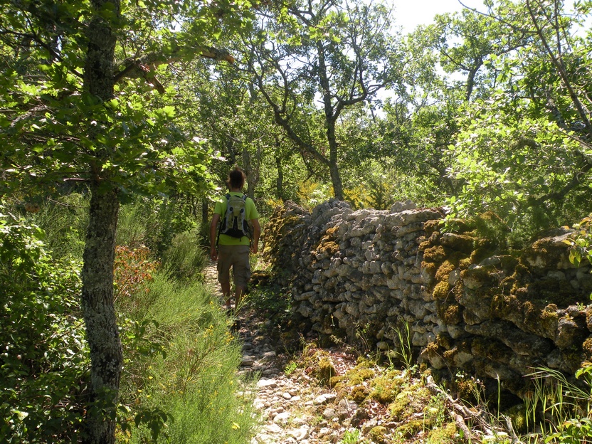
Saignon, La Gardette path
15 points of interest
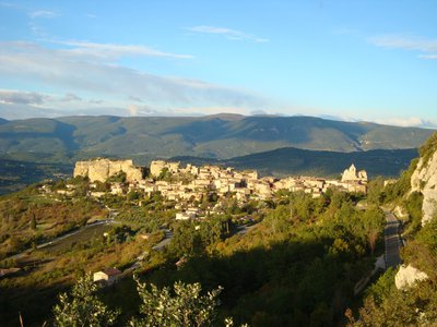
Saignon : rocher, chapelle castrale, horloge et église - ©Eric Garnier - PNR Luberon  Patrimony and history
Saignon, stronghold of history
The strategic situation of observation and defense make Saignon a privileged place of group occupation from the Iron Age (-750 years to -125 years). In Antiquity, with the arrival of the Romans (124 av. JC), Saignon is organized around Apta Julia, Via Domitia and large surrounding farms. At the fall of the Roman Empire (in 476), the feudal society was structured around the Castra (fortified castle) of Saignon and enriched with neighboring religious monuments (St. Eusebius, St. Savior, etc.).
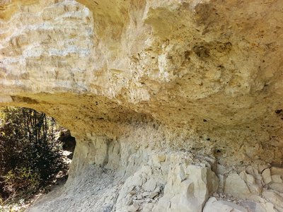
Sables verts, conglomérat de galets et molasse - ©Eric Garnier - PNR Luberon  Geology
The arrival of the sea in Provence
In the Miocene, 20 million years ago, the sea transgresses and covers Provence. We can now visualize its arrival in the geological layers. A first layer of green sands, corresponds to the old coastline. Glauconite, a mineral rich in iron giving this green tint, is formed in shallow waters. These sands are surmounted by a conglomerate of pebbles, sometimes green as well, carried by the arrival of the sea. Above, once the sea settled, a sedimentary rock settled: the molasse.
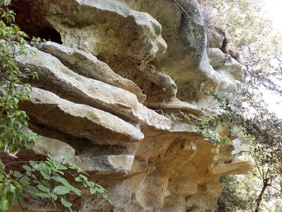
Strates de molasse - ©Eric Garnier - PNR Luberon  Geology
The Miocene molasse
The molasse is a rock: a sandstone limestone biodetitic (which contains grains of sand and also a lot of various fossil debris). This yellowish sedimentary rock settled in the sea, around the Luberon which formed then an island or a shoal. It keeps track of the deposition conditions in agitated environment, in the form of channels and oblique stratifications. Resistant to erosion, it forms vast plateaus like that of Claparèdes!
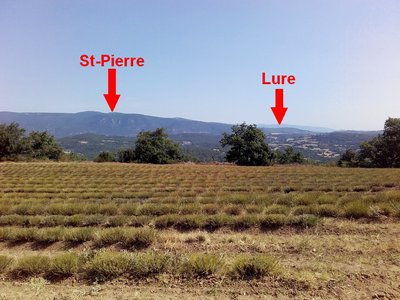
Mont Saint-Pierre (1156 m) et la Montagne de Lure à l'est (1826 m) - ©Eric Garnier - PNR Luberon  Panorama
Saint-Pierre who are you?
On the Claparèdes plateau, the Grand Luberon and the Mourre Negro summit (1,125 m) are very present in the landscape. But here, this promontory offers to the northwest a window on the Mont-Ventoux, then a sight on the Monts-de-Vaucluse, with full north the summit of Saint-Pierre on La-Garde-d'Apt; the real culmination of the territory of the Luberon Park with its 1,256 m of altitude. In the foreground, the Wells hill and the Caseneuve plateau which conceal Colorado Provençal.
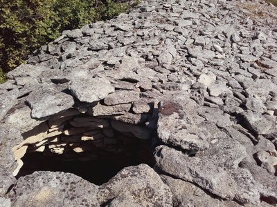
Tas de pierre le long du chemin de la Gardette - ©Eric Garnier - PNR Luberon  Patrimony and history
The Claparèdes plateau
Claparèdes comes from "clapàs" which means piles of stones in Provençal. The peasants have always collected the stones from the fields to improve their land, they remained in heaps or were used for dry stone constructions. Many bories and low walls are present on this part of the plateau which extends between Saignon and Auribeau. La Gardette, former cereal land, is now heavily invaded by woods.
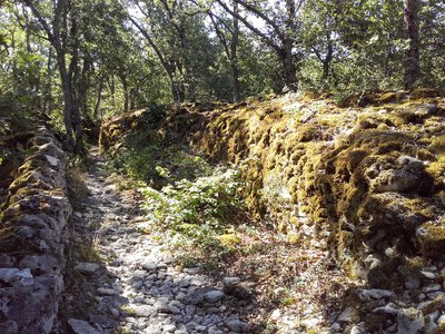
Longs murs de La Gardette - ©Eric Garnier - PNR Luberon  Patrimony and history
A Saignon of the protohistoric period?
On La Gardette, regularly spaced piles of stones with comparable volumes (3 m3), are not collapsed huts of the Neolithic (-100 000 years), nor the ruins of a Saignon of the protohistory (-750 years). These hutches are the result of ancestral terroiring of the soil and have been piled up on sacrificed areas following the exhaustion of the soil. There is nothing extraordinary, then, that Neolithic tools, collected during stone removal, were found in hutches.
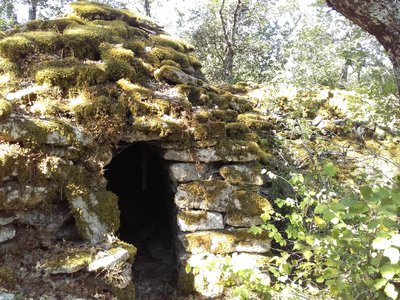
Borie accolée au mur du sentier - ©Eric Garnier - PNR Luberon  Patrimony and history
Bories hide and seek!
Here on each side of the two walls, hides under the underbrush a multitude of small bories. A borie is an original construction by the unique use of stone and its technique of assembly. The covering or the vault is called corbelled; it is a technique that consists of laying the stones in sitting with passing from the top row to the bottom. The oldest would have collapsed following their abandonment. Those still in place would not be more than 3 or 4 centuries old.
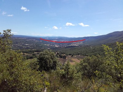
Vue sur le Calavon et la cuvette synclinale de Céreste - ©Eric Garnier - PNR Luberon  Panorama
Cape to the east!
This belvedere open to the east offers a beautiful view of the Calavon Valley which occupies a synclinal basin (= fold form of the layers of land drawing a depression) well marked in the landscape. South of the syncline stands the great anticlinal massif (fold vault) of the Luberon. To the north is the Montagne de Lure, another anticlinal massif. And in the background, to the east, the Prealps, which are snow-covered until spring, block the horizon.
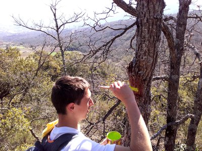
Chantier école de balisage de sentier - ©Eric Garnier - PNR Luberon  Patrimony and history
SOS trails!
This old rural road was brought to light in the 1980s by François and Claude Morenas, tireless pioneers of itineraries. Some traces of old blue markings still persist. In autumn 2016, the Vaucluse departmental committee of hiking with the technical support of the Park, organized a day of clearing volunteers on this path. Then in March 2017, it was with the Lycée Agricole La Ricarde of Isle-sur-la-Sorgue that the signage was completely redone.
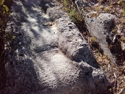
Entaille de roulement de roues de charettes - ©Eric Garnier - PNR Luberon  Patrimony and history
Traces of carts
On this old road that connected the fields to neighboring farms but also Buoux and Auribeau, you can easily notice notches cut and worn in two successive outcrops of rock. An additional testimony of the ancestral agricultural activity taking place on the Claparèdes plateau...
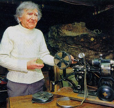
François Morenas - ©DR  Patrimony and history
Morenas, innkeeper but also ...
François Morenas was the owner of the former Regain Youth Hostel, nearby. Today deceased, he is the precursor of the first paths of great hikes of Provence. On the way, you will notice traces of blue paint, remain of his markings. Creator of hiking routes since 1953, he was also a writer and a traveling filmmaker! In Saignon, every summer, in the open air, there are still screenings of old films proudly preserved by F. Morenas and his friends.
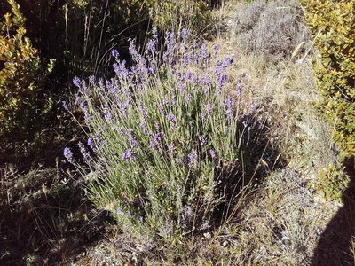
Pied de lavandin - ©Eric Garnier - PNR Luberon  Produits du terroir
Ancestral Lavender
The lavender fields adorn the Luberon landscapes, which they colour at the beginning of the summer with blue-mauve streaks. Coming from the west of the Mediterranean basin, lavender was already used by the Romans to preserve linen and perfume baths. In the dry hills of Provence, wild lavender was used since the Middle Ages for its perfume but also in the composition of drugs. It is harvested during hot weather that promotes the rise of gasoline in the flower.
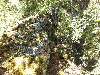
Mur en bord du sentier - ©Eric Garnier - PNR Luberon  Patrimony and history
Walls murmur
Along the path but also everywhere in the undergrowth, you will notice the many alignments of walls following the ancient stonework and dry stone retaining walls. These constructions today neglected, they formerly comforted the terraces cultivated in restanque ("bancaou" in Provençal). These walls let the runoff water while containing the earth for subsistence crops; ? essentially wheat and fodder for the animals.
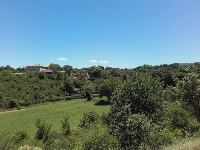
La ferme de Font d'Argéol (privé, ne se visite pas) - ©Eric Garnier - PNR Luberon  Patrimony and history
Traditional building
The large farms are the result of successive enlargements, in function of the needs of the operation. The mas in";L ;shape "is oriented south-east, offering protection against the mistral (which blows north-west). The openings are absent to the north and rather narrow elsewhere to protect themselves from heat in summer and cold in winter. At the bottom of the main body were the living rooms and the animals because of the heat releases. Upstairs, the bedrooms and attics.
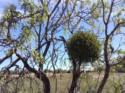
Gui blanc ou Gui du feuillu - ©Eric Garnier - PNR Luberon  Flora
FloraThe guil, toxic and medicinal plant!
The mistletoe (Viscum album album) is a parasitic plant that lives at the expense of a host tree, as here an almond tree. Its toxicity is linked to the presence of proteins. Ingestion may cause diarrhea and abdominal pain. But mistletoe, blessed with extraordinary virtues in ancient and Germanic mythology, was famous until the nineteenth century to cure epilepsy. Today, his preparations find an indication in hypertonia, hypotension, arteriosclerosis.
Description
At the bottom of the car park go up the caladée ramp and join the Bourgades street. Turn right and join the road junction at the entrance of the village (Calvary). Turn left to pass the school then, at the height of the village hall, climb to the right three stone steps and follow the path undergrowth (local PR, markings green lines). Continue the path at the foot of the cliff and continue on a gentle slope in the woods. At the first obvious intersection, turn right, go up a rocky section and join the D48. Take the left on 150 m (caution!).
1- At the height of a large field, go left on the dirt road (local PR, green lines marking). Go up to the plateau of La Gardette.
2- At the Y, turn right and continue the path. Straight ahead get on the path (green lines). Cross a very heavily paved section and then switch to a slight descent on the side of the plateau. Further down, follow the path on the left (green lines). Climb a jump and reach a crossroads.
3- Turn right and then left (green lines). Get higher on the D48. Cross it and take the path that climbs to the left (green lines). Reach a wide path.
4- Turn right on the path (PR) and join the D48 (post "Chemin de la Française"). Take on the left the D48 on 560 m. At the end of a bend (caution!), Turn left on the small Fondons car park.
5- Go to the bottom of the car park on the stony path (PR). Cross a rocky section, continue straight, pass between two lavender fields and reach a crossroads of trails (post "Le Colombier", iron cross).
6- Turn right (GR® and GRP®), slip under the hedge of trees and brambles and reach a road. Turn 20 m to the right and continue the stony path that starts on the left edge of the road (GR® and GRP®). Take the tormented path down to the road and follow it 130 m on the left.
7- At the stop, turn left and follow the D48 towards Saignon. 280 m further down the first path (GR® and GRP®). At the bottom, take the D48 again for 30 m and take the path on the left (GR® and GRP®). Go straight Exit on the D48, go down 60 m on the left and then go down on the right the concrete road that leads to the entrance of the village of Saignon (GR® and GRP®).
- Departure : Pasquier car park, Saignon
- Arrival : Pasquier car park, Saignon
- Towns crossed : Saignon and Auribeau
Forecast
Altimetric profile
Recommandations
Information desks
Luberon UNESCO Global Geopark
60, place Jean Jaurès, 84400 Apt
House of the Luberon Regional Nature Park
60, place Jean Jaurès, 84400 Apt
In the heart the old town centre of Apt, the House of the Luberon Regional Nature Park welcomes you in a town house of the 18th century. The permanent exhibition of the geology museum has a rich collection of fossils evidencing the geological history of the Luberon.
On sale at the shop: books, maps, guidebooks, games, posters...
Open Monday to Friday from 8:30 am to 12:00 pm and from 1:30 pm to 6 pm (and on Saturday, depending on the program). Free admission.
OTI Pays d’Apt Luberon
788 avenue Victor Hugo, 84400 Apt
Du 1er avril au 30 septembre
Ouvert du lundi au samedi de 9h30 à 12h30 et de 14h à 18h.
Juillet et août : Ouvert dimanche et jours fériés de 9h30 à 12h30
Du 1er octobre au 31 mars
Ouvert du lundi au mardi et du jeudi au samedi de 9h30 à 12h30 et de 14h à 18h.
Fermé le mercredi, dimanche et jours fériés.
Access and parking
Parking :
More information
Source

Report a problem or an error
If you have found an error on this page or if you have noticed any problems during your hike, please report them to us here:


