Around the Craponne canal by bike
Arles
Around the Craponne canal by bike
Easy
2h30
30,2km
+66m
-66m
Boucle
Vélo
Véloroute
Embed this item to access it offline
This bike tour invites you to discover the Craponne Canal and this surrounding landscapes! Let yourself be guided by this discreet channel from Arles and its water flowing through the small secondary canals to water the gardens. Walk along the Roman aqueduct then around Raphèle, listen to the bleating of the sheep. You are in the heart of the Crau where you can see the irrigation water in the landscape! Craponne Canal, hammers, marshes, rice fields, Vigueirat canal ... a pleasant route around the water!
12 points of interest
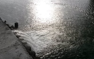
Exutoire du canal de Craponne - ©Juliette Primpier - PNR Camargue  Water and rivers
The outlet of the Craponne canal
The outlet of the Craponne canal allows the exit of irrigation water from the canal in the Rhône. The water that reaches this outlet is called the "lost blow". This is water that has not been used for irrigation due to excessive rainfall or because a user's water tower has not been respected. Rainwater has run down to the canal that raises the water level.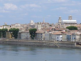
Vue d'Arles depuis les rives du Rhône - ©DR Water and riversThe Rhône
812 km long, the Rhône has its source in the Rhône glacier at over 2,400 m altitude, in Switzerland. It crosses Lake Geneva then Geneva and then arrive in France. It is in the Camargue delta that the river ends its course. In Arles, the Rhône is divided into two arms: the Grand Rhône to the east and the Petit-Rhône to the west and flows into the Mediterranean Sea at Port-Saint-Louis-du-Rhône and Saintes-Maries-de-la-Mer. River navigation on the Rhône is possible thanks to locks.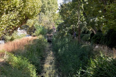
Le canal de Craponne dans Arles - ©Juliette Primpier - PNR Camargue Water and riversThe Craponne Canal
In 1554, Adam Craponne is at the origin of the design of the Canal de Craponne which connects the Durance to the Rhône via Salon-de-Provence then Saint-Martin-de-Crau and Arles. Water irrigates the meadows and Crau’s crops. Since its water intake in Lamanon, north of Salon-de-Provence, the flow of the canal is strong then it decreases and is very discreet on arrival in Arles where it is sometimes underground. A few centuries ago, this canal fed the wheat mills on the side of the Alyscamps.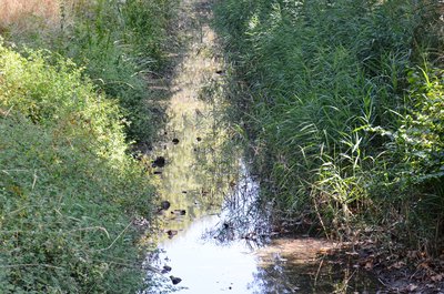
Eau du canal de Craponne - ©Juliette Primpier - PNR Camargue Water and riversThe water of the Craponne canal
Craponne water is used for watering the Crau grasslands. "Water gates" carry water to the farmhouses The number of peri-urban areas has increased and water is also used for watering gardens. The flow of the canal can be very fast from June to August, it can go up to more than 31 000 L / second, is 1 / 6th of the average flow of the Durance. Irrigation of the grasslands recharges the groundwater of Crau which feeds the inhabitants of Crau in drinking water.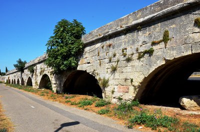
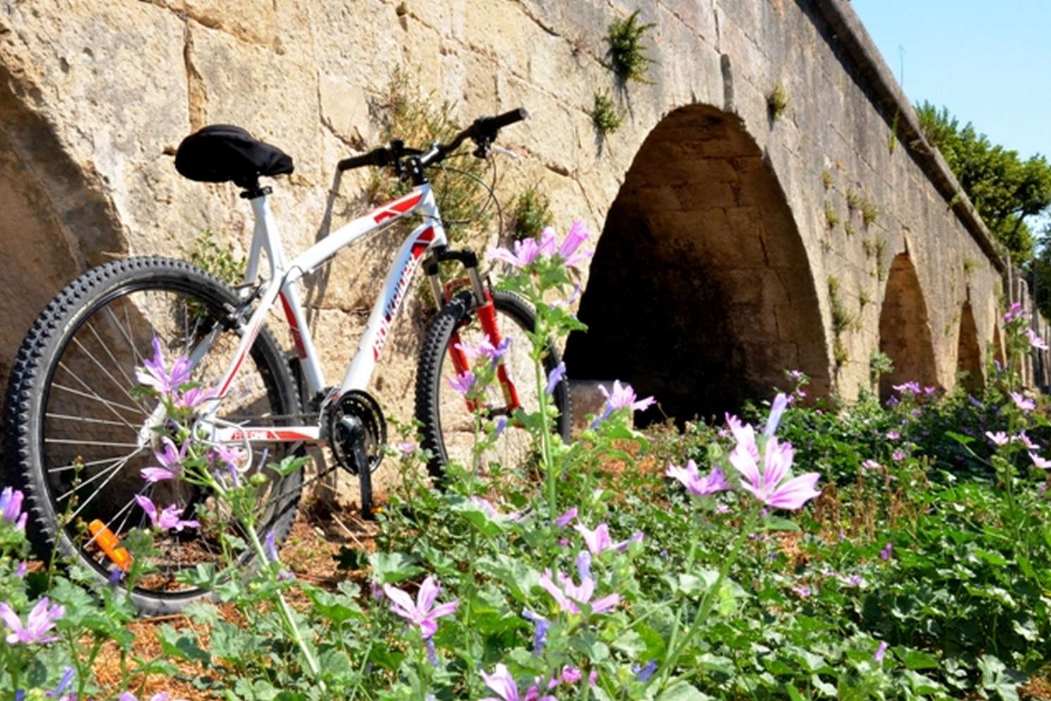
Aqueduc du pont de Crau - ©Juliette Primpier - PNR Camargue  Patrimony and history
The aqueduct of the Crau bridge
The water of the Craponne canal arrives from Crau lowland thanks to the Roman aqueduct which crosses the roundabout of Pont de Crau and continues towards the Alyscamps. The canal then circulates in Arles to reach the Rhône. This aqueduct, built between 1585 and 1587 and classified as a historic monument, allowed to cross the swamp area present at the entrance to Arles. Part of this aqueduct was demolished during the construction of the road, so the canal goes underground at this level.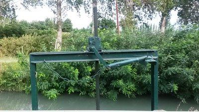
Martelière - ©Juliette Primpier - PNR Camargue Water and riversHammers and water management
The water of the Craponne canal is more and more used. Water is regulated by a watering schedule and hammers, works that allow the distribution of irrigation water from a channel of supply of this water. The sprinkler raises the hammer to flood his plot for a few hours and then closes. These hammers are increasingly replaced by pipes and distribution valves to provide water services "on demand" and save water.
©Juliette Primpier - PNR Camargue  Flora
FloraThe flora around the Craponne
Around the Craponne Canal we find a rich and diverse flora. Before Raphèle, he irrigates the grasslands. Hedges, ash trees, oaks and poplars indicate the presence of water. "La Crau humide" allows the cultivation of Crau hay, fruit growing and market gardening. Then the water is always present in the landscape but it is the Rhône which sprinkles cereals and rice fields. Crau is also the last steppe in Western Europe. The coussoul, a stony steppe with arid character.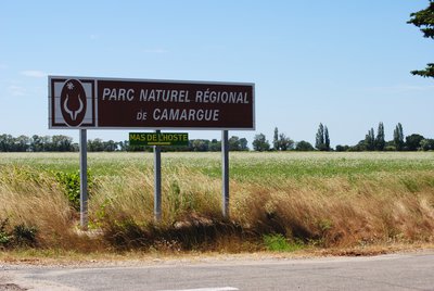
Entrée dans le Parc naturel régional de Camargue - ©Chloé Scannapiéco - PNR Camargue FloraThe Camargue Regional Nature Park
You are entering the Camargue Regional Nature Park! Located in the migration pattern of North European birds who pass through the Rhone valley towards Africa, this area offers to countless species a territory where they can move freely in huge protected areas. Horses, bulls, flamingos, waders ... It is also one of the few parks with a significant coastline sharing borders with a Natural Marine Park.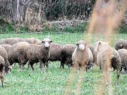
Moutons Mérinos d'Arles - ©DR  Elevage et pastoralisme
La Crau, land of sheep
The Crau is a grazed land, there are about 100,000 sheep that roam the lowland between mid-October and April, most are Arles Merinos. This local sheep breed comes from a cross between the rustic Crau breed and merino. Arles Merino is bred for lambs and its wool is elastic, light and warm. The landscape is composed of many sheepfolds, some of which date from the Gallo-Roman era. Livestock farming has been important for millennia.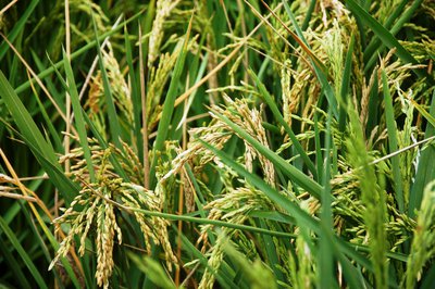
Rizière - ©Marjorie Mercier - PNR Camargue  Produits du terroir
Rice fields
Rice farming has been present in the Camargue since the post-war period. Complex, this culture follows several stages: lifting, tillering, bolting, return and flowering. The land is flooded to promote the germination of rice grains and prevent the proliferation of fungi. Rice farming therefore requires freshwater irrigation and extensive drainage to develop the saltiest land. Huge amounts of water between the two arms of the Rhône (400 million m3 per year) are needed.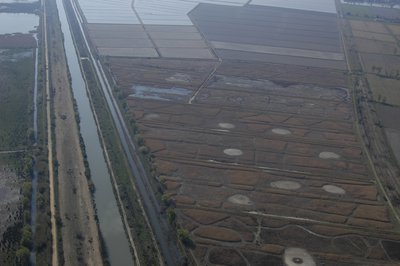
Canal du Vigueirat - ©Opus Species - PNR Camargue Water and riversThe Canal du Vigueirat, from the Rhone to the Mediterranean sea
The canal was built between 1642 and 1647 to clean up the "Vigueirie" (agricultural plain between the Montagnette and the Alpilles) flowing the waste water to the sea. The Canal du Vigueirat, which begins in the town of Tarascon, extends over 46km and is partly classified as a National Nature Reserve of the Marais du Vigueirat. Its outlet is located in the Canal of Arles in Bouc. It is automated since 1996 and managed by the Great seaport of Marseille, also known as Marseille-Fos Port.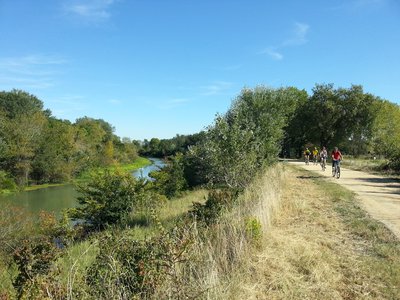
Promenade sur la ViaRhôna - ©Jean-Pierre Boeuf - Office de tourisme Arles  Panorama
The ViaRhôna from Lake Geneva to the Mediterranean sea
The ViaRhôna / Eurovelo 17, is a greenway cycle route of 815km, under construction, linking Lake Geneva to the Mediterranean beaches. Along the Rhone River, the route leads to the Alpine mountains, the Camargue beaches, crossing through the iconic landscapes of Provence. The bike path of the Van Gogh Bridge in Mas Thibert is one of the sections of the ViaRhôna which goes along the Rhone Valley. A section between Mas-Thibert and Port St. Louis will be developed to reach the mouth of the Rhone at the Napoleon beach.
Description
Back to the Hortus garden, facing the river, head towards the Rhone banks.
1 - Under the bridge of the 2x2 lanes and at the outlet, go to the right then take the bike path to reach the city center. Continue for more than 1 km, pass the Tourist Office.
2 - At the crossroads, follow the direction of the Alyscamps on the right.
3 - Then turn left towards the Alyscamps, cross the old railway and then take a left. Continue and go under the bridge of the railway track.
4 - At the traffic light, turn right and continue until the Pont-de-Crau roundabout.
5 - At the roundabout, take the first exit and follow the bike path on the left towards Pont-de-Crau. Walk along the aqueduct then at the end of the bike path, continue on the path of the tops that climbs slightly to the right. Turn left, Chemin du Trabac then continue for 1 km.
6 - At the stop, turn left and continue for 500 m. At the second stop, head to the left. Cross the bridge over the canal. At the roundabout, take the first exit towards Moulès. Continue for 600 m then turn right, Route de Servannes. Continue on this road that becomes a path for more than 4 km.
7 - Turn right, Villarde Communal Road and continue for more than 1 km.
8 - Turn left, Route le Crau then turn right towards Mas-Thibert. Go over the motorway and continue towards Mas-Thibert for about 3 km.
9 - Turn right, Chemin des Canons. At the end of the Chanoines path, turn right towards Arles and after the bridge over the Vigueirat canal, turn to the right to take the ViaRhôna to Arles.
10 - At the Van Gogh bridge, continue Jean Charcot street then at the end of this street, turn left, Pont de Langlois street. At the roundabout, follow the direction of the Ancient Arles Museum. Return to the starting point.
- Departure : Hortus Garden, Arles
- Arrival : Arles
- Towns crossed : Arles
Forecast
Altimetric profile
Recommandations
Respect the rules of the road on roads open to public traffic. The CPIE (Permanent Center of Initiatives for the Environment) Rhône-Pays d'Arles is at the initiative of this project. The project "Autour d’eau (“around water”)" offers routes related to the Craponne canal.
Information desks
the Camargue museum
Mas du pont de rousty, 13200 Arles
Remember to visit the Camargue museum! It is located next to the administrative centre of the Camargue Nature Park.

OT Arles
9 Boulevard des Lices, 13200 Arles
Access and parking
Parking :
Parking du Jardin Hortus (payant), Arles
Access
Hybrid bike
- Emergency number :
- 114
Report a problem or an error
If you have found an error on this page or if you have noticed any problems during your hike, please report them to us here: