The Claparèdes plateau
17 points of interest
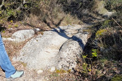
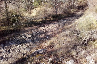
Traces de charettes - ©Eric Garnier - PNR Luberon  Patrimony and history
Traces of carts
On this old road that connected the fields to neighboring farms but also Buoux and Auribeau, you can easily notice notches cut and worn in two successive outcrops of rock. An additional testimony of the ancestral agricultural activity taking place on the Claparèdes plateau...
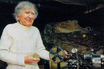
François Morenas - ©DR Patrimony and historyMorenas, innkeeper but also ...
François Morenas was the owner of the former Regain Youth Hostel, nearby. Today deceased, he is the precursor of the first paths of great hikes of Provence. On the way, you will notice traces of blue paint, remain of his markings. Creator of hiking routes since 1953, he was also a writer and a traveling filmmaker! In Saignon, every summer, in the open air, there are still screenings of old films proudly preserved by F. Morenas and his friends.
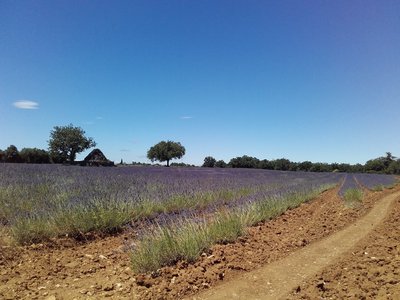
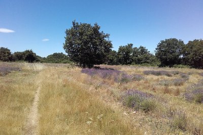
Champs de lavandin - ©Eric Garnier - PNR Luberon  Produits du terroir
Ancestral Lavender
The lavender fields adorn the Luberon landscapes, which they colour at the beginning of the summer with blue-mauve streaks. Coming from the west of the Mediterranean basin, lavender was already used by the Romans to preserve linen and perfume baths. In the dry hills of Provence, wild lavender was used since the Middle Ages for its perfume but also in the composition of drugs. It is harvested during hot weather that promotes the rise of gasoline in the flower.
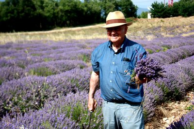
Récolte manuelle de bouquets - ©DR-Distillerie Agnels  Savoir-faire
Hard work and variable return
The yields of lavender essential oil are varied but can reach about 15 kg per hectare and 80 kg for lavandin. Some lavender producers use a mechanized harvesting system where the plant (stem and flowers) is crushed and sent to a towed dump. The fact of distilling milling modifying the quality, this technique is not adapted to obtain an essential oil of fine lavender. Finally, the most beautiful bouquets are still cut manually with the sickle.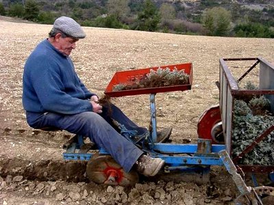
Repiquage de plants - DR Savoir-faireA well orchestrated plantation!
The plot is prepared one year before planting: plowing, weeding. The planting is done after the big frosts. The implantation is more or less mechanized. The density of plants is 12,000 to 15,000 plants per hectare for lavender and 8,000 to 10,000 plants per hectare for lavandin. A lavender plantation remains in place for about 10 years. It is in production from the 2nd year and optimal yields in essential oil are obtained between the 4th and 6th year.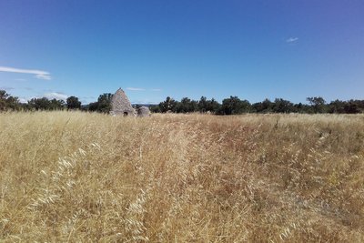
La borie depuis le chemin - ©Eric Garnier - PNR Luberon Patrimony and historyThe '' star '' of the bories!
The nearby borie is one of the most famous of the plateau (private, absolute respect). This type of construction requires real expertise, as much in the choice of stones as in their clever and smart assembly. To build in dry stone, so without mortar, it takes patience, a good look, and good notions of balance. A borie can weigh between 30 and 200 tons and uses 200,000 to 300,000 stones. Each of them has passed 2 or 3 times in the hands of the manufacturer!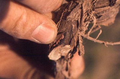
Asticots de cécidomyie sous l'écorce - ©DR  Fauna
FaunaMidge attack
The midge, Resseliella lavandulae is an insect subservient to lavanderaies. The adult emerges from the ground in winter to reproduce, then dies quickly. Females lay their eggs in anfractuosities of bark of branches. These white and pink-orange larvae are responsible for the drying of the attacked branches (silver aspect). Emerging traps often built with drums, allow to capture the adults as soon as they leave the ground.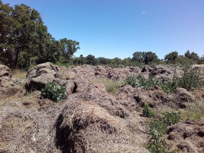
Paille de lavande - Eric Garnier - PNR Luberon Savoir-fairePatience and recycling
Prior to distillation, harvested beans can remain on the field for a time to dry out and lose excess water. This prefanage of about one or two days is essential for fine lavender: it avoids modifying the quality of essential oil. In stills where the vats are equipped with basket with hoist, the flowers are not mixed with water. In the neighboring fields, the lavender straw after distillation was deposited and then used as fuel.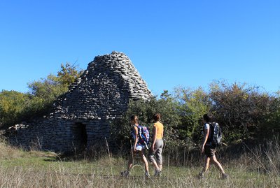
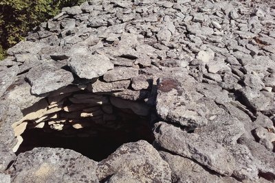
Borie sur le plateau des Claparèdes - ©Eric Garnier - PNR Luberon Patrimony and historyMultiple Bories
The shepherds have probably built the single-celled huts and the peasants the bories of larger dimensions. It seems accepted that most of these constructions were built between the eighteenth and nineteenth century. A borie is an original construction by the unique use of stone and its technique of assembly. The covering or the vault is called corbelled; it is a technique that consists of laying the stones in sitting with passing from the top row to the bottom.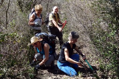
Bénévoles du CD84-FFRP en action - ©Daniel Locci Patrimony and historyLet's save the heritage trail!
This old rural road was brought to light in the 1970s by François and Claude Morenas, tireless pioneers of itineraries. In the 2000s, it was the Park with the help of the department that worked to safeguard it against the real estate pressure. Today it is perennial, registered in the Departmental Plan of Walk and Hiking, it benefits from the maintenance and tagging action of the Vaucluse department, but also by the supervision of volunteers, walkers or mountain bikers.
Forêt, pelouse et culture sèche des Claparèdes - ©Eric Garnier - PNR Luberon  Elevage et pastoralisme
Long live the diversity, long live Life!
Dedicated to a traditional agro-sylvo-pastoral system, the Claparèdes plateau is divided between forests, lawns and dry crops, but also groves surrounded by hedges of old trees, including almond trees and mulberries, witnesses of a past culture. The interface and transition zones between all these ecosystems (ecotonal zones) are very favorable to a diversified fauna: birds such as the lark lulu and the sparrow zizi, but also reptiles such as the grass snake, the worm and the ocellated lizard.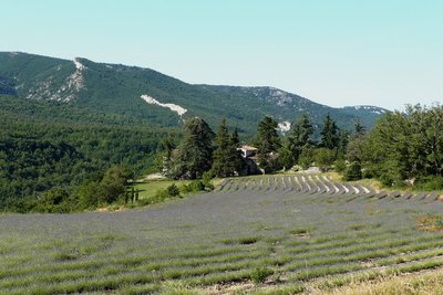
Ferme de Salen et Grand Luberon - ©Françoise Delville - PNR Luberon  Panorama
A postcard scenery...
The Luberon is visible from everywhere and very present in the landscape. It is also a wonderful spur which reveals wide panoramas of Mont Ventoux and the Alps to the north from the Claparèdes plateau. Do not miss the purple mottling of the lavender from June to July. Contemporary human presence is rare but the few farms, bories, dry stone walls resulting from field stone removal are the proof of an earlier human presence.
Abri en ruines dans un clapàs - ©Eric Garnier - PNR Luberon Patrimony and historyThe Claparèdes plateau
Claparèdes comes from "clapàs" which means piles of stones in Provençal. The peasants have always collected the stones from the fields to improve their land, they remained in heaps or were used for dry stone constructions. Many bories and low walls are present on this part of the plateau which extends between Saignon and Auribeau. La Gardette, former cereal land, is now heavily invaded by woods.
Pas dèi ensarris - ©Eric Garnier - PNR Luberon Patrimony and history"Lou Camin Salié"
& Laquo; "Lou Camin Salié" or salt road were the roads used formerly by salt merchants with their caravans of mules from the Etang de Berre. A popular condiment at the time, you had to be cunning and clever to avoid thieves and bandits. Thus, merchants passed through less accessible but more secure paths. A former salt road, the path you are currently on came from Sivergues to reach Apt through this place called "Salen", to the left.
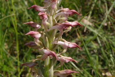
Orchis odorant - ©DR-A. Frangans  Flora
FloraThe Fragrant Bug Orchid
This small crossing of a slightly wet marl hill may be an opportunity, in the months of May and June, to discover a small vanilla-scented orchid: the aptly named Fragrant Bug Orchid (Anacamptis coriophora subsp. fragrans). Quite rare in France where it is found only in the southern part, it is strictly protected there. So let's carry away her scent in our memories!
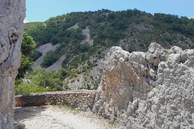
Calade de l'adret de Salen - ©Eric Garnier - PNR Luberon Patrimony and historyThe art of the "calade" (cobblestone pavements)
The public roadway heritage still shows remnants of facilities necessary for important human activity in the valley during the past centuries, the cobblestone path portions are the proof. The remains of the calades, pavings with cobblestones placed roughly, can be seen near the passages in the river or when climbing towards the Claparèdes plateau and Sivergues.
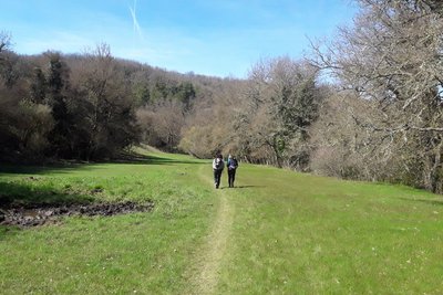
Prairie de l'Aiguebrun - ©Eric Garnier - PNR Luberon FloraMeadows, a rare natural heritage
These meadows scattered over the valley bottom are the legacy of the work of nature and man. This well-watered area benefits a wide variety of plants and insects (butterflies, dragonflies ...). And with a little bit of luck, we can flush out a seps, a kind of slow worm with legs ... Grazing has shaped these clearings at a time when small herds could access easily. Targeted bush clearing must be able to restore them while preserving the surrounding riparian forest.
Description
80 m further ('' Barbe Blanche '' post), turn left onto the undergrowth path (follow the GRP® markings towards '' Sivergues ''). After a stony area, you get to an intersection.
1- Leave the GRP® down in front and turn twice to the left. Follow a dirt road to the north-east (not marked). Pass a bend and, at the first crossroads, turn left onto a path along the fields. A little further, continue to the right. You arrive on a track and take it to the left. Go 45 m further on the D232 and join the stop just to the right.
2- Leave on the path in the undergrowth to the right of the stop. Proceed to a crossroads and continue on the left. Walk along the lavender field and rush a few meters into the undergrowth Go left then continue right to reach the D114 Follow it for 350 m, then turn left on the Sivergues path (sign). Take this dirt road until you cross a road. Turn right and take this little road.
3- At the first crossing, turn right (GRP®) then 350 m further, in a bend (garbage container), continue in front on a dirt road and reach a crossroads of trails (post '' Le Colombier '', cross iron ).
4- Follow the path straight ahead (PR), pass between two fields of lavender and continue straight ahead. You arrived on a small parking ("Les Fondons” post). Go left, take the D48 for 30 m and continue on the dirt road opposite (not marked). At the first crossroads, go down opposite and come back on the D48. Take it straight ahead for 500 m.
5- At the end of the straight line, turn on the left road and 120 m further, turn right on a path undergrowth (GR® and GRP®). Follow this path to torment, pass a very stony section and come back on the road. Take it 20m to the right and sneak onto the path on the left Go under the hedge of trees and brambles, to return to point 4 (post "Le Colombier", iron cross).
4- Turn right and follow the path to go one way (GRP®), then follow the road also to the first point 3 (road crossing).
3- turn right and advance another 100 m. Turn left and follow the dirt road (GRP®). Pass along a field of lavender and continue straight into the undergrowth. Drive on the D232, cross it (caution!) And continue the path opposite. Always go straight, pass near a big borie and reach the D114 (GRP®).
6- At the "Vouliou" pole, turn right and take the D114 for 300 m (GRP®). At the "Plaine Lambertes" post, turn left and rush on the narrow and stony path undergrowth (GRP®). Reach a track and turn left to return to the starting car park.
- Departure : Barbe Blanche car park, Buoux
- Arrival : Buoux
- Towns crossed : Saignon, Apt, Buoux, Sivergues, and Auribeau
Forecast
Altimetric profile
Recommandations
Caution when crossing roads.
Information desks

Luberon UNESCO Global Geopark
60, place Jean Jaurès, 84400 Apt

House of the Luberon Regional Nature Park
60, place Jean Jaurès, 84400 Apt
In the heart the old town centre of Apt, the House of the Luberon Regional Nature Park welcomes you in a town house of the 18th century. The permanent exhibition of the geology museum has a rich collection of fossils evidencing the geological history of the Luberon.
On sale at the shop: books, maps, guidebooks, games, posters...
Open Monday to Friday from 8:30 am to 12:00 pm and from 1:30 pm to 6 pm (and on Saturday, depending on the program). Free admission.

OTI Pays d’Apt Luberon
788 avenue Victor Hugo, 84400 Apt
Du 1er avril au 30 septembre
Ouvert du lundi au samedi de 9h30 à 12h30 et de 14h à 18h.
Juillet et août : Ouvert dimanche et jours fériés de 9h30 à 12h30
Du 1er octobre au 31 mars
Ouvert du lundi au mardi et du jeudi au samedi de 9h30 à 12h30 et de 14h à 18h.
Fermé le mercredi, dimanche et jours fériés.
Access and parking
Parking :
More information
Report a problem or an error
If you have found an error on this page or if you have noticed any problems during your hike, please report them to us here: