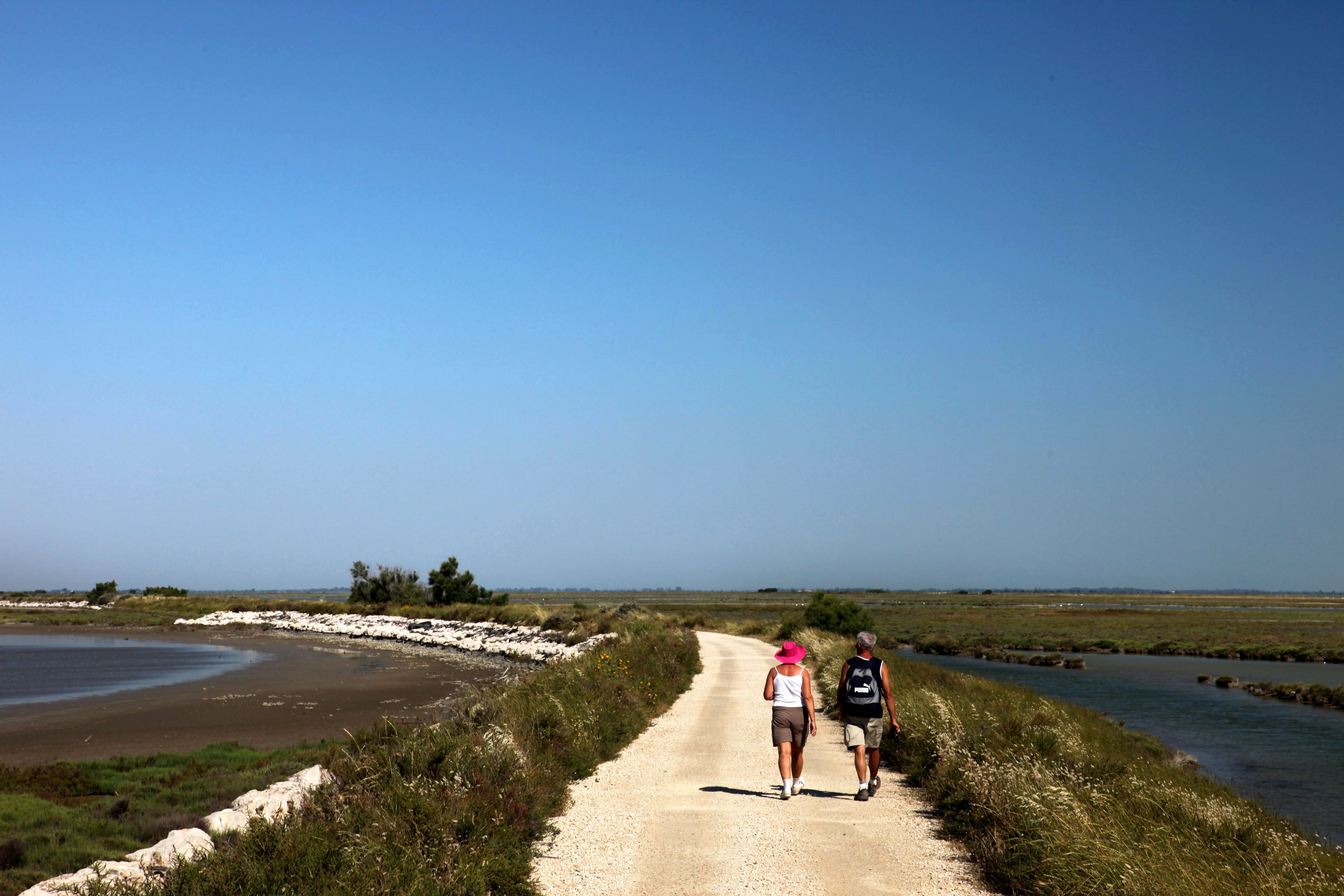
The sea wall
A few passages slightly sandy, otherwise the rest of the route is easy... and so beautiful.! The sea wall that isolates the Rhône delta from the influence of the sea reveals amazing wilderness and beautiful lagoons. At the heartof the National Reserve are busy sea birds and birds of brackish environments:: seagulls, terns, gulls, greater flamingos, ducks, herons, waders...
9 points of interest
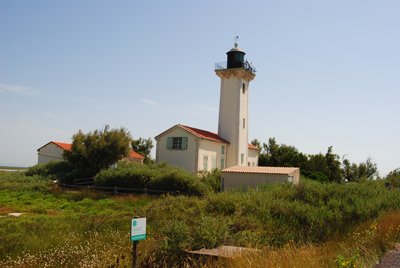
Phare de la Gacholle - Chloé Scannapiéco - PNR Camargue  Patrimony and history
The Gacholle lighthouse
Located at 1500m inland, the Gacholle lighthouse entered service in 1884. It allows access to the anchorage of the Beauduc Gulf whilst avoiding the dangers of the tip of Sablon. 17m high, it is powered by solar panels and is distinguished by its sector lighting in green, white and red. The Gacholle lighthouse is one of the welcoming points of the Camargue Nature Reserve. An exhibition on the Camargue coast is open on weekends and public holidays and during school holidays from 11:00 - 17:00 / 11am - 5pm, free admission. Two other lighthouses were built: Beauduc Lighthouse (1903) and Faraman lighthouse (1840).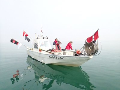
Pêches scientifiques dans la réserve marine - Delphine Marobin-Louche - PNR Camargue  Fauna
FaunaMarine Reserve
The fishing lodgings of the Beauduc Gulf was established in 2013. The goal was to restore this nursery area for fish by creating a "safe area". Covering an area of 450ha and located 700m from the shore, the area is forbidden to all types of fishing, anchorage, dragging and diving. 6 yellow markings enables mark this area at sea. Scientific monitoring is carried out in partnership with fishermen and all the actors of the marine world. The surveillance of the sea and awareness are carried out by officers of the Park.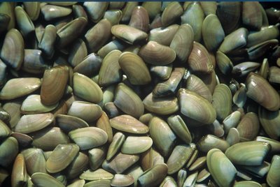
Les tellines - Emmanuel Vialet - PNR Camargue FaunaTellin
Tellin is a small shell that lives buried a few centimetres on coastal sand, close to the shore. Its colour varies from brown to lemon yellow, through a salmon pink. It takes its name from its two valves spread like butterfly wings when it's washed-up and stranded. In the morning, the tellin shell gatherers collect this bivalve using a small trawling net shaped like a fishing net rake. The exploitation of this resource is subject to licensing in the Camargue. Amateur fishermen, anglers, respect the resource and the instructions (1.5kg / day / person. ; min. size: 2.5cm).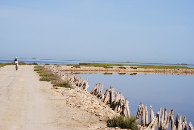
Sur la digue à la mer - Chloé Scannapiéco - PNR Camargue  Water and rivers
The sea wall
During the 19th century, Camargue has faced frequent floods, causing considerable damage. Thus, the sea wall was built between 1857 and 1859 to protect Camargue from sea ingression onto the land during fall and winter which stop any agricultural development in southern Camargue. 2m to 2.50m high, this structure extends over a length of over 40km. It separates the lagoons from the central ponds of Camargue, forming a visual boundary in an infinite landscape.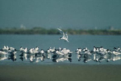
Sternes caugek - Emmanuel Vialet - PNR Camargue FaunaThe Sandwich tern
Terns are long-distance migratory birds which travel thousands of kilometres during their travels. Their final destination is West Africa. The sandwich tern is characterized by a fully black head with a shaggy crest on the neck, a long slightly curved black and yellow beak, an ash gray slender body and long wings. This migratory species, especially present in the sea and lagoons, is observable during the breeding season (spring/summer).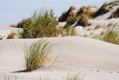
Dunes et oyats - Chloé Scannapiéco - PNR Camargue  Panorama
The beach and dunes
Sandy, Camargue beaches extend on about 70km. The coastal dunes which make up the setting are of great landscape and botanical value with a specific flora and rare species of insects. These animal and plant species which have adjusted to the sandy soil, to drought and salt, live in the dunes (lizards, sand lilies, dune grass ...). Rich but fragile, so be careful when you pass not to uproot the dune grass that are hanging on. Accessing the dunes is strictly prohibited, even on foot.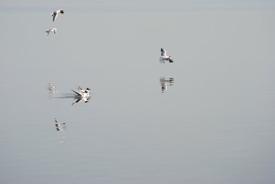
Mouettes rieuses - Chloé Scannapiéco - PNR Camargue FaunaThe black-headed gull
The feathers of the black-headed gull is white on the entire body, except for its which are gray and black in the ends, from August to December. The adult is recognizable by the dark spots behind the eyes. Its white head sports a breeding plumage of chocolate colour. Its short beak, sharp and pointed, is red and black at the tip, as its legs and fingers. Its diet consists of insects, worms, crustaceans but also plants and household waste.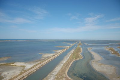
Étangs et marais salants - Elen Le Roux - PNR Camargue PanoramaPonds and salt marshes
Located in the lower Camargue, shallow ponds are separated from the sea by a sand bar. With intermittent communication with the sea through the valves, these lakes are brackish or salty. Privileged shelters for birds and fishes, they also play an important role in water management. Because of their stretch and the richness in invertebrates, they are areas appreciated by birds, including the Greater flamingo.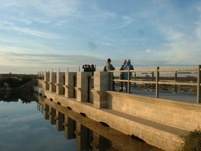
Pertuis de Rousty - PNR Camargue Water and riversHydraulic structures
Camargue is a place of constant exchanges between the sea and the ponds. To regulate the exchanges between these two environments, three openings (or valves) have been positioned along the sea wall. The Fourcade opening is the only functional exchange zone, continuous between the ponds and the sea. It allows the flow of water and fishes and plays a major role for migratory exchanges, wildlife, salt and water levels, fishing, fish rearing and flood management.
Description
From the parking lot of la Gacholle, go along the sea wall towards the lighthouse, following the marked trails. Stay along the sea wall and the indicated paths (Camargue National Reserve).
1- At the Pertuis de Rousty, continue along the sea wall for 6km and reach to the village of Saintes-Maries-de-la-Mer.
Alternative route: proceed to the crossing in the other direction, from Saintes-Maries-de-la-Mer.
- Departure : Parking area of la Gacholle, south of Arles
- Arrival : Tourist office, Les Saintes-Maries-de-la-Mer
- Towns crossed : Saintes-Maries-de-la-Mer
Forecast
Altimetric profile
Recommandations
A dirt road on 2/3 of its length, the track is impassable in rainy weather. Taking this route at windy times is not advised.
No water points nor snacking services,: remember to take drinks and food. It’s possible to buy water and the necessary supplies for puncture repairs at the lighthouse of Gacholle (weekends and school holidays from 11.00 to 17.00).
Accessing the dunes is strictly prohibited, even on foot. Access to the sea is through the marked paths.
Information desks
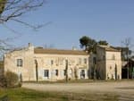
the Camargue museum
Mas du pont de rousty, 13200 Arles
Remember to visit the Camargue museum! It is located next to the administrative centre of the Camargue Nature Park.

OT Saintes-Maries-de-la-Mer - Tourisme en Camargue
5 Avenue Van Gogh, 13460 Saintes Maries de la Mer
Transport
Envia transport network: Bus line 20 > Arles/Les Saintes-Maries-de-la-Mer through Albaron (free bicycle rack)...
Access and parking
The lighthouse of Gacholle is 30km south of Arles towards Salin-de-Giraud. At Peaudure, turn right towards Grand Badon then another right towards Mas Saint-Bertrand (D36c). Then turn left and drive to the parking lot of the lighthouse.
Parking :
More information
Report a problem or an error
If you have found an error on this page or if you have noticed any problems during your hike, please report them to us here: