Cycling along the ViaRhôna
From Arles to Napoléon beach, passing through Port-Saint-Louis, this course along the Rhône offers a beautiful panorama of the Camargue. A complete itinerary punctuated with rice fields, salt marshes, heritage and natural sites in the image of the protected natural area of ??Vigueirat marsh, the Mas Thibert tower but also the Saint-Louis tower. A succession of points of interest and a hike rich in discoveries!
12 points of interest
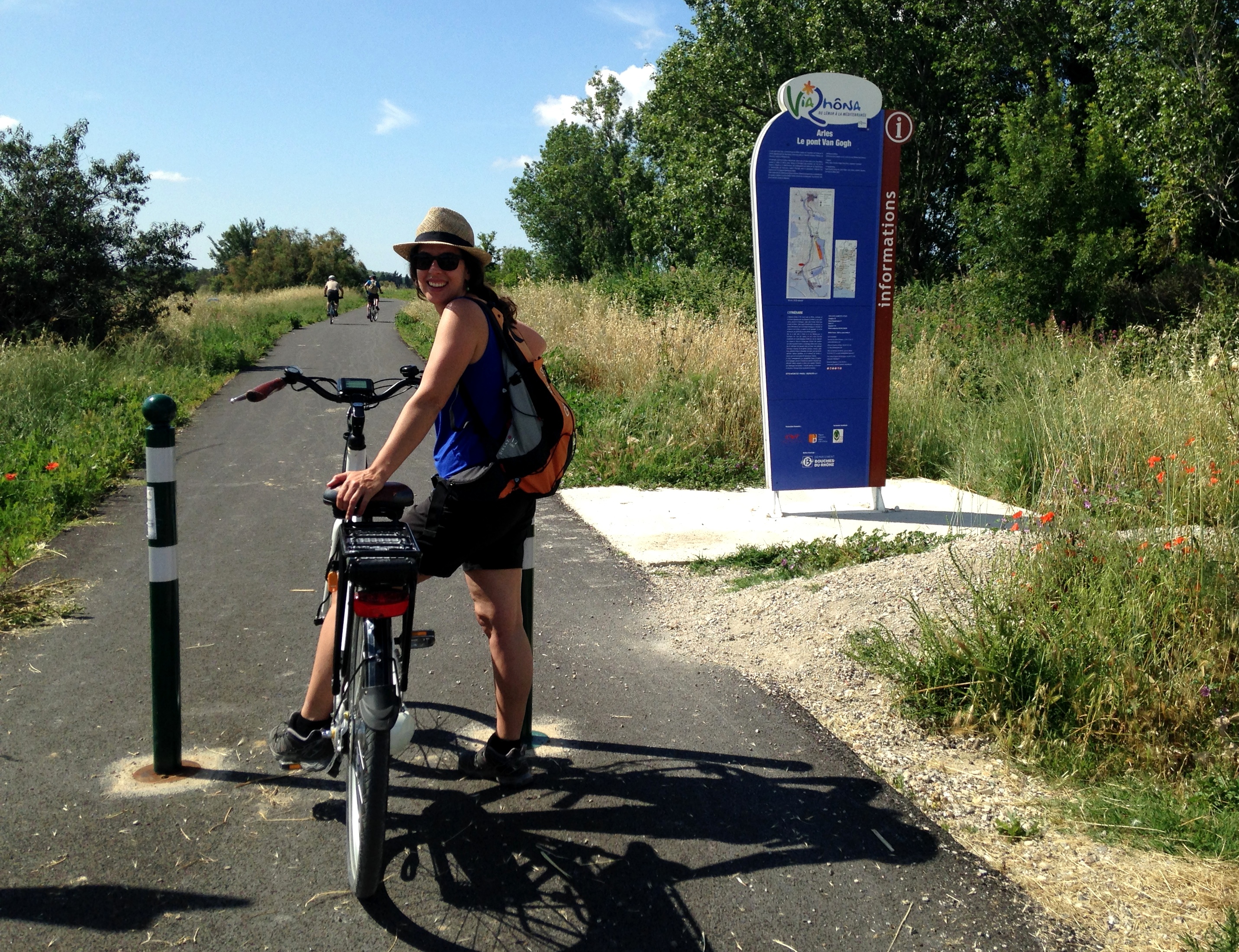
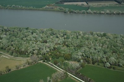
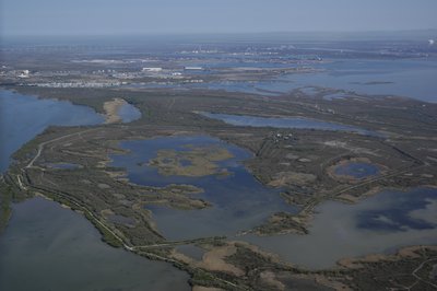
Promenade sur la ViaRhôna - ©Jean-Pierre Boeuf - Office de tourisme Arles  Panorama
The ViaRhôna from Lake Geneva to the Mediterranean sea
The ViaRhôna / Eurovelo 17, is a greenway cycle route of 815km, under construction, linking Lake Geneva to the Mediterranean beaches. Along the Rhone River, the route leads to the Alpine mountains, the Camargue beaches, crossing through the iconic landscapes of Provence. The bike path of the Van Gogh Bridge in Mas Thibert is one of the sections of the ViaRhôna which goes along the Rhone Valley. A section between Mas-Thibert and Port St. Louis will be developed to reach the mouth of the Rhone at the Napoleon beach.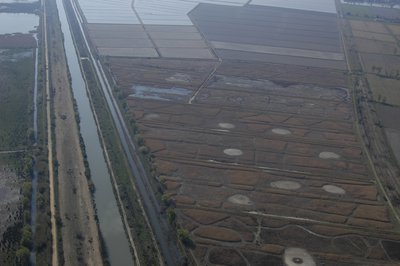
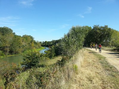
Canal du Vigueirat - ©Opus Species - PNR Camargue  Water and rivers
The Canal du Vigueirat, from the Rhone to the Mediterranean sea
The canal was built between 1642 and 1647 to clean up the "Vigueirie" (agricultural plain between the Montagnette and the Alpilles) flowing the waste water to the sea. The Canal du Vigueirat, which begins in the town of Tarascon, extends over 46km and is partly classified as a National Nature Reserve of the Marais du Vigueirat. Its outlet is located in the Canal of Arles in Bouc. It is automated since 1996 and managed by the Great seaport of Marseille, also known as Marseille-Fos Port.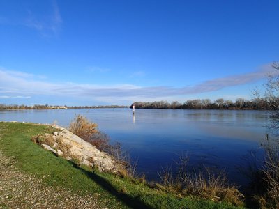
Le Grand-Rhône - ©PNR Camargue Water and riversThe Great Rhône
Formed over 5,000 years ago, the Rhône has continued to transform over time and the heavy floods in 1711 created its present riverbed. With a flow at the mouth of 1,700 m3/s, it is the most powerful flow in France. It borders Camargue with both of its streams: the Great Rhône which is almost in a straight line, separates from the Little Rhône up north of the city of Arles. This iconic river and its banks keep an important ecological role as a habitat for many animal species including the European pond turtle, beavers and otters.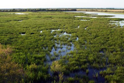
Marais de Vigueirat - ©PNR Camargue Water and riversThe Vigueirat marshes
The Vigueirat marshes is one of the largest territories (958 ha) acquired by the Conservatoire du littoral in the Provence-Alpes-Côte d'Azur region. This area is a mosaic of wetlands characteristic of the Camargue and offers a great diversity in terms of flora (more than 400 plant species) and fauna (more than 270 bird species). The marshes are composed of natural environments typical of the ecosystems of the Rhône delta: sansouires, ponds, sculpies and reed beds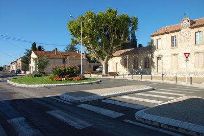
Village de Mas-Thibert - ©Muriel Cervilla - PNR Camargue  Patrimony and history
The village of Mas-Thibert
Mas-Thibert joined the Camargue Regional Nature Park in 2011. In the 1960s, a Harki (Algerian soldier who fought alongside the French during the Independence War) community settled in the village, which has now become one of the largest communities of harkis in France. Crossed by the ViaRhôna, the bike path connecting the Swiss Alps to the Mediterranean sea, the village is the only existing cycling stopover between Arles and Port-Saint-Louis. Having the Marais du Vigueirat, a protected nature site of the Conservatoire du littoral (Coastal protection agency) at a few kilometers from the village allows visitors to discover the local natural heritage.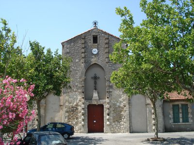
Eglise de Mas-Thibert - ©PNR Camargue Patrimony and historyThe Saint-Honorat de Mas-Thibert church
The Saint-Honorat de Mas-Thibert church was consecrated in 1857, under the term of Saint-Honorat. Before this implantation, the Saint-Honorat de Mas-Thibert church changed three times of place. The one we see today was built at the end of the 19th century and consecrated in 1900. Still in exploitation today, it houses many remarkable statues and relics. In 1995, a wooden Christ from the 14th century was discovered in the Réattu museum in Arles.
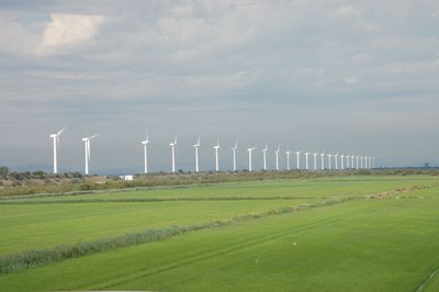
Eoliennes de Port-Saint-Louis - ©Marjorie Mercier - PNR Camargue PanoramaThe wind turbines
Composed of 25 wind turbines installed online along the riverbank of the Rhone navigation channel at the port of Fos-sur-Mer, this wind farm is the first built in the Provence-Alpes-Côte d'Azur region (2002-2008). The entire development, with a capacity of 21.25 MW, produces 52 million kW / h per year, the consumption of more than 21,000 households (63,000 people). The municipality of Port-Saint-Louis, initiator of the project, contributes to the production of green energy and fights against the greenhouse effect.
Ripisylve - ©Opus Species - PNR Camargue Water and riversThe ripisylve
Camargue habitats are strongly marked by salt and only the banks of the river and its alluvial ridges escape this influence and develop a denser vegetation. This protection forest, named ripisylve, includes white poplars, ash and elm trees. The banks of the river are colonized by amorphous, reeds and iris marshes. Not very penetrable, the ripisylves shelter species of birds or mammals that find refuge there : beaver, bat, heron, etc.
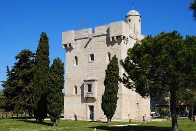
La tour Saint-Louis - ©Chloé Scannapiéco - PNR Camargue Patrimony and historyThe Saint-Louis tower
This 15m high quadrangular tower was built with the white limestone quarries of Beaucaire or Fontvieille arriving by boat. Built in 1737 on the banks of the Rhone, it served as a lighthouse, customs post and protection against looters. It now houses the Tourist Office and the largest collection of stuffed birds in the Camargue. From the top of the tower, breathtaking 360 ° views of the mouth of the Rhone, the Canal Saint Louis, the city and the salt marshes.
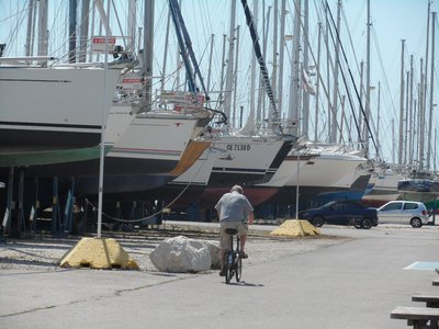
Cycliste à Port Napoléon - ©Juliette Primpier - PNR Camargue Patrimony and historyThe old shipyards
The city of Port-Saint-Louis-du-Rhone was born at the beginning of the century around the port activity. Located both at the mouth of the Rhone and in the industrial-port basin of Fos-sur-Mer, the city offers six ports open to the sea and the Rhone: the leisure port, Napoléon, Navy Service, Plaisance de Carteau, Plaisance d'Olga and Abri du Rhône "Antoine Jover". The former shipyards now welcome companies specializing in boating and yachting.
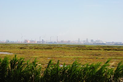
Zone industrialo-portuaire de Fos-sur-Mer - ©Chloé Scannapiéco - PNR Camargue Patrimony and historyThe industrial gulf of Fos-sur-Mer
The industrial-port area of ??Fos-sur-Mer is a vast space integrated in the globalization of the economy by the maritime exchanges which are realized there. The port function and its derivatives (logistic platforms, steel, chemical and petrochemical industry) are crucial and the seaport of Marseille is the main player. The construction of the Fos ZIP at the end of the 1960s was one of the most ambitious land-use operations carried out by the state.
They de Roustan avec le golfe de Fos au loin - ©Opus Species - PNR Camargue Water and riversThe theys of the mouth of the Rhone
A they is a sandy formation modeled by the sea and the river. Around the Port-Saint-Louis-du-Rhone, the theys have gradually become interconnected. They are called ships or captains. The They du Mazet, acquired by the Conservatoire du littoral since 1980 is a feeding, resting and breeding area for many birds and an abundant and original flora. They of the Gracieuse mark the entrance of the Cove of Carteau and that of Roustan leads to the Napoleon beach..
Description
From the Van Gogh Bridge, head towards the bike lane towards Port-Saint-Louis Mas-Thibert. Go along the canal from Arles to Bouc This route is an old railway line rehabilitated.
1 - In Mas-Thibert, continue straight, follow the sign ViaRhôna.
VARIANT : At Mas-Thibert, turn left, cross the bridge and then turn right towards the Vigueirat marsh. Continue on the bike path. In the Vigueirat Marshes, return to the village of Mas-Thibert. Retreat the bridge and head to the left. Follow the ViaRhôna.
2 - At the wind turbines, continue to the right and continue until the D35.
3 - At the intersection with the D35, turn left and turn right towards Salin-de-Giraud.
4 - At the Barcarin ferry boat, take the foot of the dike on the left. Follow this path for 4 km along the Bois François area.
5 - On arrival at Port-Saint-Louis-du-Rhône, pass the barrier then take the path on the right. Follow the indications "parcours santé" Bois François along the banks of the Rhone. Follow the main path.
6 - At the intersection, take the path that goes to the right.
7 - Arrived on the Abri du Rhône port, along the banks of the Rhône (picnic areas) to the Tour Saint-Louis (which houses the Tourist Office).
8 - Take the path on the right after the Tourist Office. Cross the small blue bridge and go to the first street on the right towards Napoléon beach. Continue along the Anatole France Avenue along the Rhone and continue straight on Napoleon Road for 6.5 km to the beach.
- Departure : Van Gogh Bridge, Arles
- Arrival : Napoléon Beach, Port-Saint-Louis-du-Rhône
- Towns crossed : Arles and Port-Saint-Louis-du-Rhône
Forecast
Altimetric profile
Recommandations
The route is best to go with a city bike or a mountain bike (VTC).
To get to Van Gogh Bridge:
- 3 km from the Tourist Office of Arles. Back to the Tourist Office, turn left, follow Port-Saint-Louis by Sadi Carnot Avenue and at the roundabout after the bridge, follow Pont de Van Gogh. At the traffic lights, turn left and at the end of Philippe Lebon street, turn to the right.
- Or by bike, back to the Tourist Office, turn left and follow the bike path that leads to the Van Gogh Bridge. Caution on the D35, busy road!
In rainy weather, the health trail at the entrance to Port-Saint-Louis-du-Rhône (reference point 4 and 5) may be impracticable. On foot, it is rather advisable to stay on the dike. The Symadrem, managing company of the dikes formally prohibits access to the 2 wheels. By bike, go through the city, join the Gabriel Péri Avenue and Jules Guesde street to find the bike path at Port Abri du Rhone. 3
Possibility to make only a part of the ViarRhôna (example: Arles-Marais du Vigueirat).
Information desks
the Camargue museum
Mas du pont de rousty, 13200 Arles
Remember to visit the Camargue museum! It is located next to the administrative centre of the Camargue Nature Park.

OT Arles
9 Boulevard des Lices, 13200 Arles
OT Port-Saint-Louis-du-Rhône
Tour Saint Louis - Quai Bonnardel, 13230 Port-Saint-Louis-du-Rhône
Access and parking
3 km from the Tourist Office of Arles, take the bike path that leads to the Van Gogh Bridge. (See "Recommendations")
Parking :
Access
- Emergency number :
- 114
Report a problem or an error
If you have found an error on this page or if you have noticed any problems during your hike, please report them to us here: