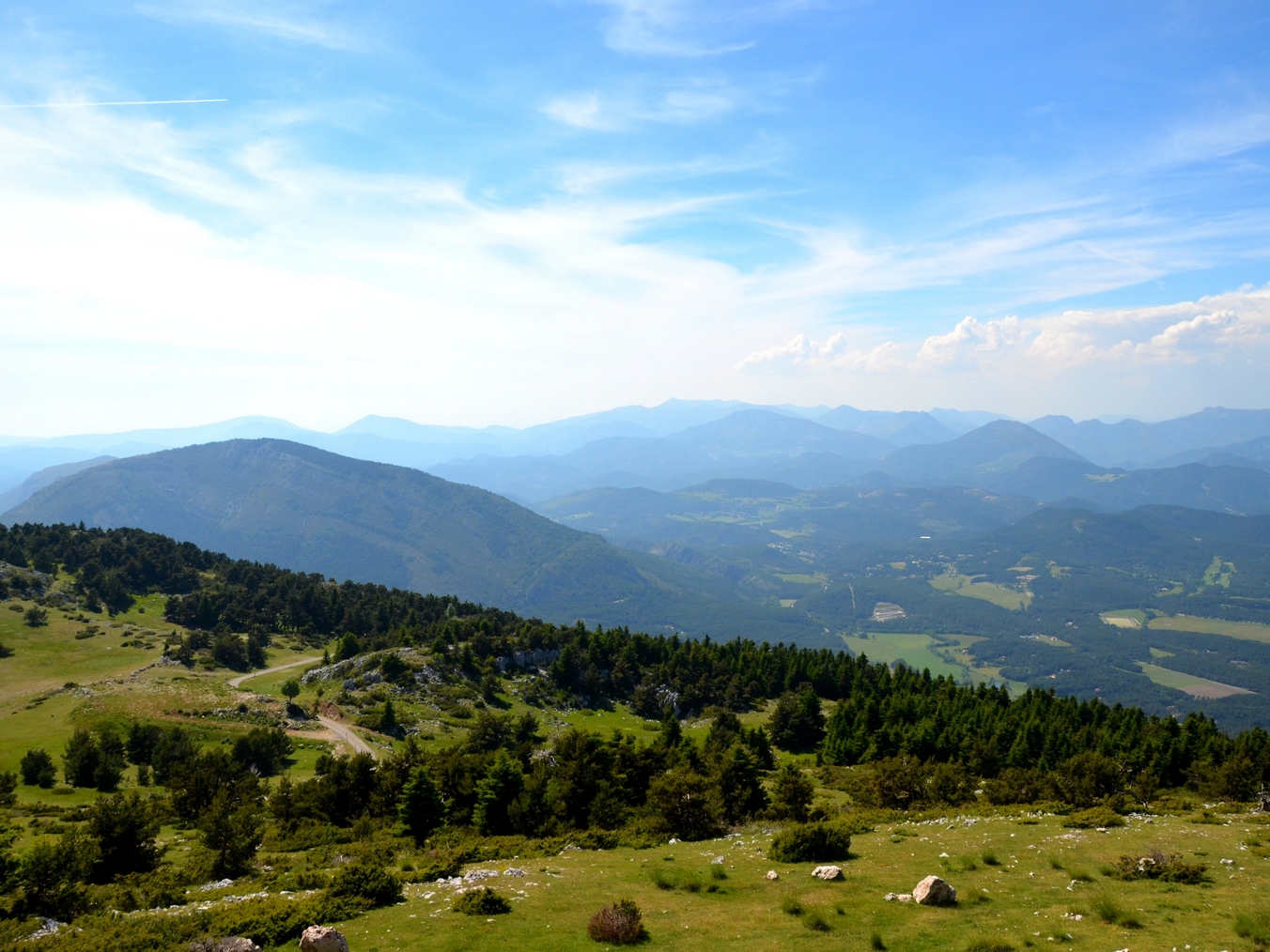
The peak of the Lachens Mountain
This athletic trek will make you want to reach for the sky while taking you to heights allowing you to contemplate exceptional panoramas. On this route you will see the pine forests, the flora of Haute-Provence and perhaps at the top, sheep herds grazing. At the top of Mount Lachens, Var's highest peak (1 715m); panoramic views of the Mediterranean Sea to the Alps. You will find a viewpoint allowing you to identify the main peaks of Provence.
3 points of interest
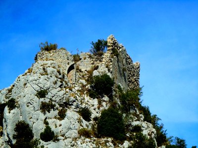
Castrum de Sainte-Madeleine - Annie Robert - PNR Verdon  Patrimony and history
Sainte-Madeleine Castrum
Hanging on the western slope of Mount Lachens stands the rock of Sainte-Madeleine. This rocky peak is covered by almost inaccessible ruins which were once a castrum, built in the 11th century. This is all that remains of the original village, besieged in the 14th century by Raymond de Turenne and destroyed during the religious wars. The residents have then decided to descend into the plain to create the municipalities of La Bastide and La Roque-Esclapon.
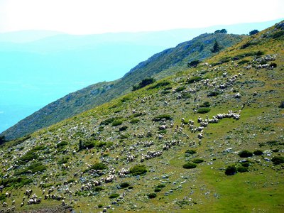
Moutons sur le Lachens - Stefano Blanc - PNR Verdon  Elevage et pastoralisme
A flock of sheeps on Mount Lachens
Sheep farming is still very present in Artuby and helps to maintain the landscape. You will definitely come across the flock while at the top of Mount Lachens.
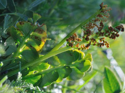
Botriche Lunaire - Dominique Chavy - PNR Verdon  Flora
FloraIn the moon
Less than 1% of the surface of the Var exceeds 1500m. With its 1713m, Mount Lachens therefore has a dual climate originality. The first mountainous area to intercept depressions coming from the Gulf of Genoa, it is much wetter than the rest of the department, which enables, combined with low temperatures due to the altitude, the development of a remarkable mountain flora. This is how we are able to find the moonwort in the lawn which covers the top of Mount Lachens.
Description
From the church square, go up the lane "Chemin de l'Aire" by following the markings of the GR49 (white and red marking). To the top of the village, at the end of the paved section, at 300m.
1 - Leave the GR and follow the path going left towards the top of Mount Lachens. Walk on the shaded path (light blue marking of the local RP), along the stone walls to the clearing. Leave it on the right and continue up the main road on the left towards the Ste-Madeleine rock (steep climb!). Quickly take the well-marked trail under the pine trees and exit the woods a little before the rock. Walk again under the pine trees and at a crossroads, reach the route leading to the top of Mount Lachens.
2 - Do not take the trail leading to the ruins of the castle (300m round trip) on the left and continue on the route marked in blue on the right. The winding trail rises above the plain of the Bruyère then rapidly goes into the woods, among boxwood, brooms (plants) and scots pines, until reaching a track (some steep sections!). Continue on this track 500m after passing a collar and just before a corner, take the poorly outlined path marked in blue, going up on the right. Reach further up the path leading to the peak of Mount Lachens
3 - Follow the road (white and red markings). Pass over a picnic area in front of a tank and take the path cutting the corner. Cross the road and continue up the path. Near the forest, continue the route on the ridge of Mount Lachens amid pastures and limestone pavements. Follow the ridge to the viewpoint.
4 - The tour ends at the top located at 1 685m, just opposite the peak of Mount Lachens (1 715m). The same route is used for the return.
- Departure : Place de l'église, La Bastide
- Arrival : Place de l'église, La Bastide
- Towns crossed : La Bastide and La Roque-Esclapon
Forecast
Altimetric profile
Recommandations
Information desks
House of the Verdon Regional Nature Park
Domaine de Valx, 04360 Moustiers-Sainte-Marie
House of the Verdon Regional Nature Park
Access and parking
Route from the village of La Bastide.
Parking :
Report a problem or an error
If you have found an error on this page or if you have noticed any problems during your hike, please report them to us here: