Marassan - la Bleue on mountain bike
This easy and pleasant hike enables you to walk the Mélézin through easy paths. A small alternative path can be followed to reach Abriès and Aiguilles.
4 points of interest
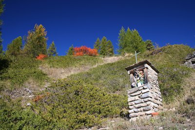
Oratoire La Maire Maria - ©Benjamin Musella - PNR Queyras  Patrimony and history
The Maire Maria Oratory
Often attached to Catholicism, oratories have their roots in pagan religions. In fact, the menhirs, totems, Roman lararia, fountains and sacred trees are certainly their ancestors. It was not until the Middle Ages that the transition began. In fact, the locals were not inclined to give up their beliefs in favour of a new religion. The church emissaries, looking to convert the population in a gentle manner, will at first build a cross on the sites of existing cults. This is the beginning of the integration of the new religion which took centuries.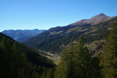
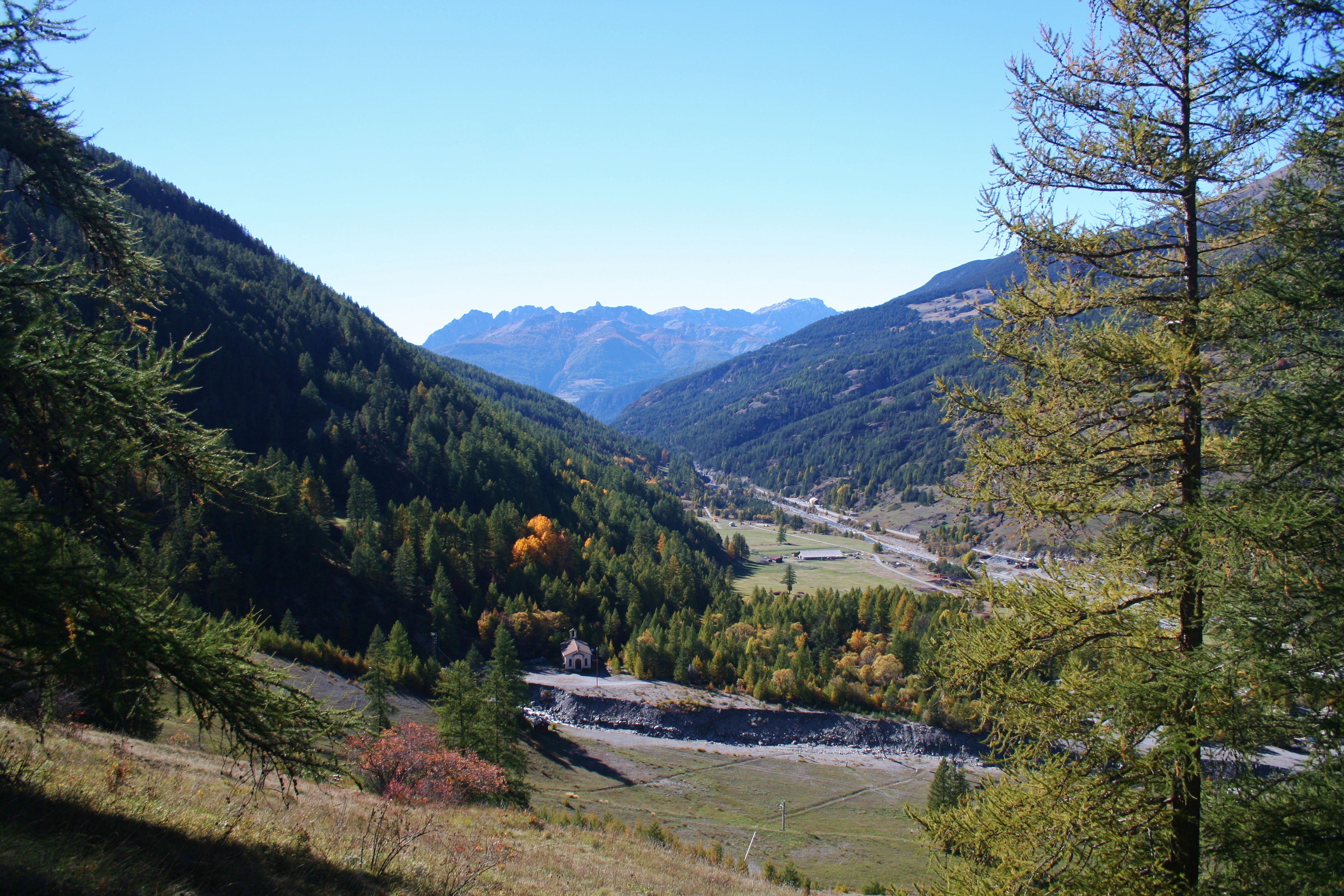
La vallée du Guil - Benjamin Musella - PNR Queyras  Panorama
The Guil valley
Going up the forest trail, views of the Guil valley reveal themselves. In the background, you can see the peaks of La Plate and Croseras bounded by the Dent du Ratier mountain. Closer, on the right, the peak of Agrenier overlooks the Guil valley.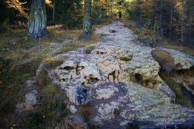
Fontaine pétrifiante - ©Benjamin Musella - PNR Queyras  Geology
A petrifying fountain
Water always finds a way! It seeps into the ground, it moves, it erodes and carves. When the rocks are too hard, the water turns away and looks for an easier way. By its actions, the water erodes rocks and dissolved minerals and carries them away in an anarchic movement. Enriched with gypsum and limestone, water can be in the open here. The limestone will bring forward and trap all kinds of elements (leaves, pines, dead branches).)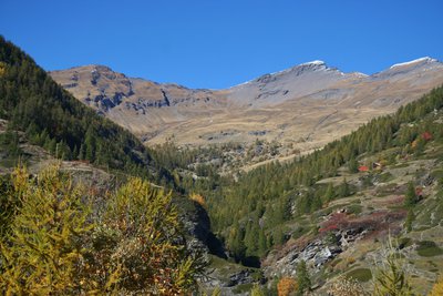
Le vallon du Lombard - ©Benjamin Musella - PNR Queyras PanoramaThe Lombard valley
Nice view of the Lombard valley. To the right, we see Mounts Serre de l'Aigle and Petit Rochebrune at the bottom of the valley.
Description
Cross one of the two bridges, turn left and head up the Guil on a forest track.
1 - Take a right at the first intersection. Turn right again at the next crossing. Continue up the forest road until an intersection at an altitude of 1 740m.
2 - A track does a hairpin bend and another goes on straight. Continue straight. The path alternates between ascending and descending false flats.
3 - After a slightly longer descent, at a height of 1,730m take the correct track on the left. Ignore a forest road coming from the right and continue the descent towards Aiguilles.
4 - Regain the Gouret campsite, cross it and 200m later, take the large gravel path on the right. Continue until you reach the fields.
5 - Cross, turn right and reach the Guil. Cross the river by a bridge and take a left onto the road. Reach Aiguilles and the point of departure taking the D947.
- Departure : Aiguilles
- Arrival : Aiguilles
- Towns crossed : Aiguilles and Abriès-Ristolas
Forecast
Altimetric profile
Information desks
House of the Queyras Regional Nature Park
3580 Route de l’Izoard, 05350 Arvieux
The House of the Queyras Regional Nature Park is closed to the public.
OTI du Guillestrois et du Queyras
Maison du Tourisme du Queyras, 05350 Château-Ville-Vieille
Transport
05 Voyageur: 04 92 502 505 Tourist Office of Queyras : 04 92 46 76 18
Access and parking
As you go up the valley of the Guil, reach Aiguilles and turn right directly at the village entrance. Park on the car park of the recreation area.
Parking :
More information
Report a problem or an error
If you have found an error on this page or if you have noticed any problems during your hike, please report them to us here: