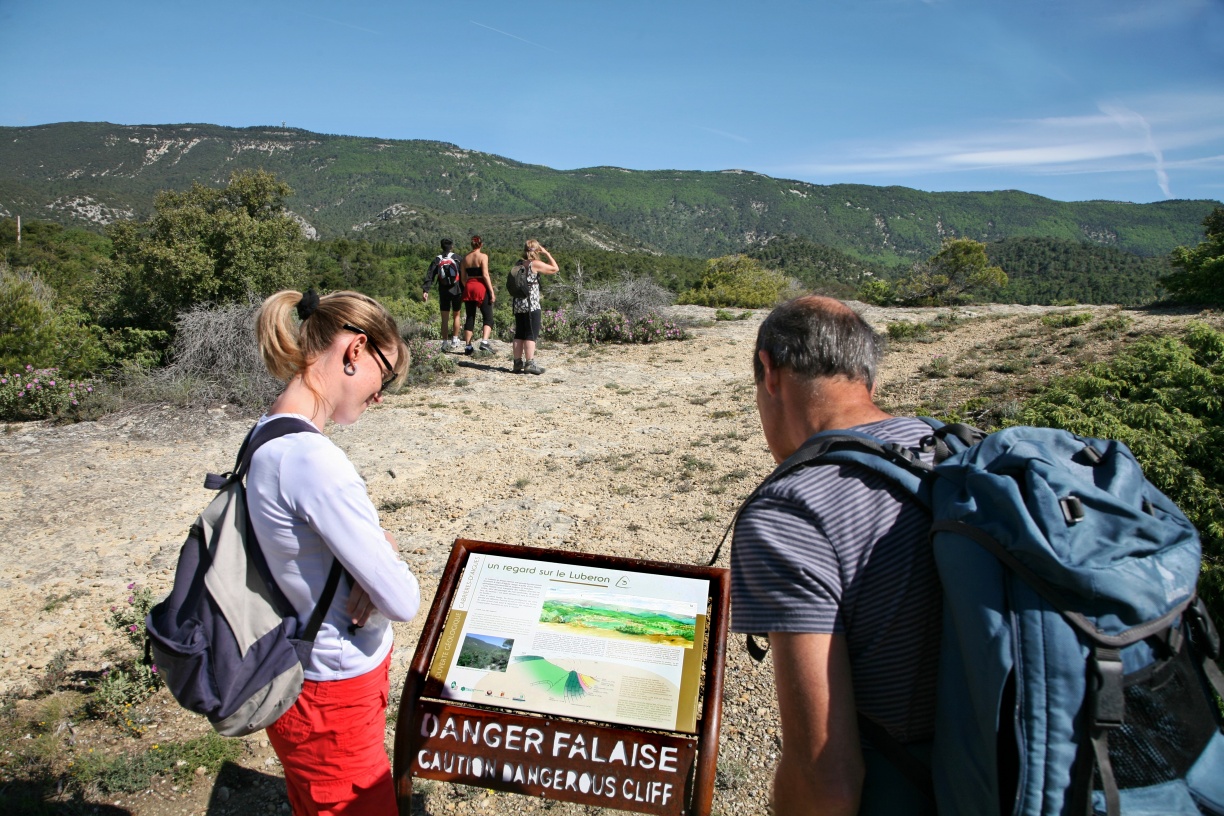
Geological trail
« Cabrières d'Aigues is a favourable location to discover geology. We have designeda geological trail to answer a few simple questions: What type of rock is this? When and how was it formed? What is the origin of landscapes? Here, the hiker travels through millions of years, from the ocean from the Mesozoic era, responsible for the limestone of the Grand Luberon, to the use of these same limestone by man in the 19th century. ». Stéphane Legal, geologist of the Luberon RNP.
8 points of interest

La petite fontaine - ©Stéphane Legal - PNR Luberon  Geology
The little fountain
Down the street, lies a fountain directly carved in the rock. The stone wall located above the basin closes the entrance of an horizontal tunnel, a water pit, which was dug several metres. This drains the seepage water until the pipe. The excavated rock is a limestone, relatively hard, made up of many fragments of organisms (shells, corals ...). This rock, called molasse, allows the seepage water to flow: it is permeable (spongelike).

Affleurement de molasse - ©Stéphane Legal - PNR Luberon GeologyTropical sea in Cabrières-d'Aigues
The cliff that dominates the Règue valley is made of limestone. It outcrops westward almost continuously, on nearly 15km until Vaugines, through Cucuron. Geologists have called this geological formation the Molasse de Cucuron. This rock is very rich in sand grains, gravel and fossil remains (scallops, oysters, corals ...). Fossils evidence the presence of a warm sea right here, about 10 million years ago.

Galets perforés par des pholades - ©Stéphane Legal - PNR Luberon GeologyThe Durance river
Many pebbles cover the ground. Some are black, green, red. They share the same composition with some rocks in the Alps. They were transported to Cabrières by powerful streams: the ancestor of the Durance, 10 million years ago!
Some pebbles have small holes. This is the result from the activity of marine molluscs, the Angelwings (Piddocks), which dig a hole in the rock to live in it. These bivalves live today in coastal areas.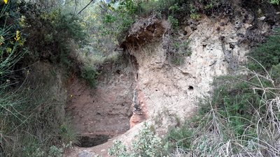
Four à chaud - ©Eric Garnier - PNR Luberon GeologyHeating limestone to make whitewash.
On the roadside, the bank is hollowed out by a hole with reddened walls at the top and varnished in the lower part. This is a lime kiln which has no doubt been used for local purposes. We don't know how old it is. Several days were needed to dig this type of kiln, build a corbel arch just like the bories, and place the limestone blocks. Cooking it, around 1000 °C, required constant monitoring for about 4 days.

Anticlinal du sud Luberon - ©Eric Garnier - PNR Luberon GeologyThe Luberon: a mountain with a tender heart
On the right, a track lets you follow a little escarpment which highlights the rift in the passage and marks the northern border of a line of hills. The limestone that make up these hills is as old as those of the Luberon ridges. In between, the marly rocks are more recent. These information help in the outlining of the geometry of the Luberon: an asymmetrical arch-shaped bend (anticlinal). The heart of the massive, much more gentle, has been hollowed out by erosion and forms a valley.

Patou - ©DR-Animalaxy  Fauna
FaunaThe Patou (Pyrenean Mountain Dog), a faithful keeper!
In these grazing areas, you can come across a patou between January and April. This big white dog is an impressive keeper. His task is not the easiest: he has to protect his flock against wolves. The patou takes his role very seriously, so no threats or shouts, keep your dogs on a leash and do not dare cross his flock! Go around it and walk quietly, the patou will sniff you and go back quietly to his task.
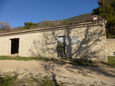
La bergerie du Jas du Pécou - Bénédicte Beylier - CERPAM  Elevage et pastoralisme
The Jas de Pécou, a precious sheepfold
These foothills were heavily grazed and cultivated before the agricultural decline, the pine forest has since taken over. This sheepfold serves today as a shelter for a herd in late winter or spring. In addition to the bush clearing provided by man, this sheepfold maintains this strategic firebreak. It dates back to the 1980s and it was established on the southern slope of the massif on either side of the track and is equipped with a water point.
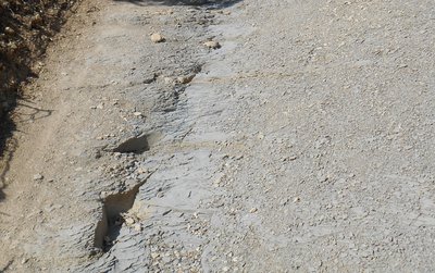
Gélifracts - ©Marie Grenouilleau - PNR Luberon GeologyShaping of the landscapes
Here, many pebbles cover the ground. It is limestone fragments torn from the Luberon due to repeated freezing and thawing during the last cold phase of the quaternary. These deposits, called "gélifracts" are very common in the limestone mountains where they can reach up to 40m of thickness! In this quaternary period, the mountain streams have also shaped the landscape, by either deeply digging their beds or by accumulating sediments, under the influence of climatic variations.
Description
From the town hall, go up the slope of the Gaye, then take a left at the fountain. At the crossroads "Cime de Vière", turn right and take the rise. The tar gives way to a track. Take the track and head towards the massif along the farmlands. Then, 350m after a left turn, reach a small mountain pass. Continue straight on the track.
1 - At the crossroads "Le Couleron" (point 586), continue on the track to the right. Pass the sheep pen Jas de Pécou, then the "Ravin du Loup", and finally reach a tank (point 609).
2 - At the tank, turn right and go down the path. Lower down, go back on the track and continue down to reach a paved road. Continue straight along several croplands and reach the altitude point 439, 1km / less than a mile further.
3 - Take a right onto the path. After the grove, move forward between two fields, go straight at the next intersection, then cross the "Ravin du Loup" to the right. Continue by passing several houses, turn left once and come out on the upper streets of Cabrières d'Aigues.
4 - At the crossroads, turn right and take an immediate right again. At the bottom of the ramp, turn left to return to the starting point.
- Departure : Facing the town hall of Cabrières d'Aigues
- Arrival : Town hall of Cabrières d'Aigues
- Towns crossed : Cabrières-d'Aigues and La Motte-d'Aigues
Forecast
Altimetric profile
Recommandations
After point 2, caution with your ankles in the descent.
Follow carefully the specific markings of the geological trail, made up of arrows on wrought iron stands.
Information desks

Luberon UNESCO Global Geopark
60, place Jean Jaurès, 84400 Apt

House of the Luberon Regional Nature Park
60, place Jean Jaurès, 84400 Apt
In the heart the old town centre of Apt, the House of the Luberon Regional Nature Park welcomes you in a town house of the 18th century. The permanent exhibition of the geology museum has a rich collection of fossils evidencing the geological history of the Luberon.
On sale at the shop: books, maps, guidebooks, games, posters...
Open Monday to Friday from 8:30 am to 12:00 pm and from 1:30 pm to 6 pm (and on Saturday, depending on the program). Free admission.

OTI Luberon Sud Tourisme
128 chemins des vieilles vignes (siège administratif), 84240 La Tour d'Aigues
Access and parking
At 11km from Pertuis (A51), through the D9.
Parking :
Access
- Emergency number :
- 114
Source

Report a problem or an error
If you have found an error on this page or if you have noticed any problems during your hike, please report them to us here: