The plague wall
"The heat is tough, feet tingle on the stones, but I love this land where the stone is everywhere; in landscapes, in its history, in its vocabulary I also like the smell of pine trees uprooted by the mistral and hearing the evening breeze blowing on the peaks of cliffs. One might think that the sea is right there! However, these places have not always been a paradise ". says Eléa de Robert, a 2nd year Master intern at the Luberon RNP.
14 points of interest
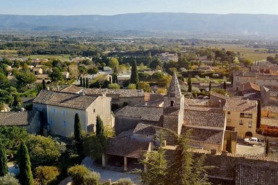
Cabrières-d'Avignon - ©OTI Destination Luberon  Patrimony and history
Cabrières-d'Avignon
On the side of the Monts de Vaucluse, this village with a rich historical past has a name that can refer to the old "quarries" that were found in the area. Another version would like Cabrières to be translated as "goat country", the origin coming from the word "Cabro", goat in Provençal. The "d'Avignon", (official version) comes from its belonging to the Comtat Venaissin and was used to differentiate this Cabrières of Cabrières-d'Aigues, also in the department of Vaucluse.
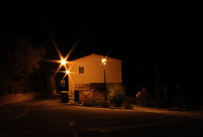
A droite, nouvelle lanterne moins éblouissante - ©Matthieu Simonneau - PNR Luberon  Savoir-faire
Night Sky Protection
The town of Cabrières d'Avignon is very involved in the actions of energy management. With the support of the Park, it has optimized all of its consumption items. Public lighting has been changed and has made the common practice of a night off all street lights in the middle of the night. Low energy bulbs do not dazzle as much. Energy consumption has beencut in half! And these measures are actively involved in protecting the night sky.
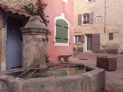
©Eric Garnier - PNR Luberon Patrimony and historyThe low-fountain and the washhouse
Dating back to the 19th century, the low-fountain consists of a lock wall (basin) in a semi-octagonal shape formed with large stones hooked together. Note also the large size of the iron bucket holders. Originally, its overflow fed the washhouse which was located a little lower, which is not the case today. The latter is composed of three basins which were used for washing and rinsing. The wooden beam, in turn, was used to spin-dry the clothes.
Tour sud-est du Château de Cabrières d'Avignon - ©Eric Garnier- PNR Luberon Patrimony and historyCastle of Cabrières d'Avignon
The castle of Cabrières Avignon dates from the eleventh or twelfth century. It is a historical place that served as shelter to Vaudois in spring 1545. During the massacre of the Vaudois, the village is razed; the castle was rebuilt in the late sixteenth century. Ranked as a historical monument, this private castle can be visited only during Heritage Days in September.
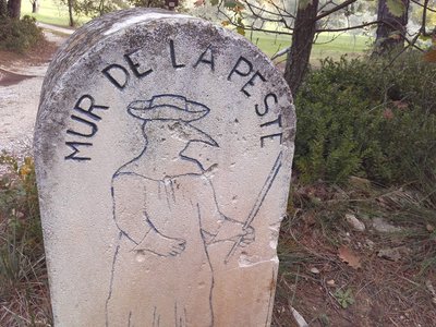
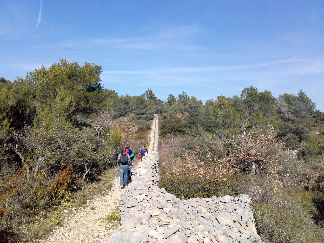
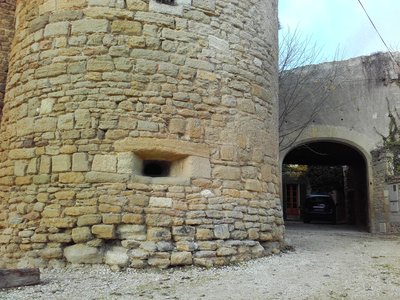
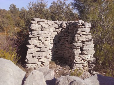
Stèle en bord de sentier - ©Eric Garnier - PNR Luberon Patrimony and historyThe plague wall
This wall of about twenty kilometers went from Monieux to Cabrières passing through Methamis, Venasque, Le Beaucet, Saumane and Lagnes. It was built in just a few months, between March and July 1721 by 500 men, masons and laborers. This sanitary barrier had watchtowers, guard-houses, food and fodder supply storehouses. The wall was guarded by a thousand men who had orders to shoot anyone crossing the wall without permission.
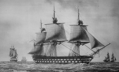
Vaisseau du XVIIIe s. - ©DR Patrimony and historyThe arrival of the plague!
Two months after the docking of the ship Le Grand Saint-Antoine on May 25, 1720 in Marseille, the plague spread, reached the working-class areas of the city to then spread along the coast upto Toulon; after passing the Durance, it reached Pertuis, Cucuron and Apt. For a better protection of the Venaissin County and the State of Avignon, two papal lands, it was decided to build a wall of dry stone of about 2m high.
Gravures en bord de sentier - ©Eric Garnier - PNR Luberon Patrimony and historyChanging Sides!
In August 1721, the plague was declared in Avignon, whereas apt got rid of it! The roles were now reversed: French troops are positioned on the wall to protect the Provence. After making more than 7000 victims in the Venaissin County and at least 83,000 in Provence, the disease became extinct in January 1723 and the wall was forgotten. Today registered under the Historic Monuments, it is the subject to regular restoration campaigns.
Guérite en bord de sentier - ©Eric Garnier - PNR Luberon Patrimony and historyStone shelters
There are constructions on either side of the wall. Regularly spaced, guardhouses (semicircular huts) were used to house a sentry in the event of inclement weather and were certainly covered with a roof in branches or tiles. The huts attached to the wall, housed the units but also the equipment and provisions. On the most isolated places of the plateau, the pens served as warehouses for food and fodder for mules transporting water and provisions.
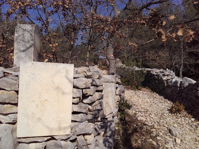
Sur le GR6-GRP® - ©OTI Destination Luberon Patrimony and historyAfter the plague ...
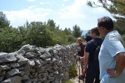
From 1723, the wall no longer had any sanitary utility and the stones were re-used for other constructions. Since 1986, a campaign of restoration and valorization is in place through the association "Pierre sèche en Vaucluse". You can see the wall here, between Cabrières-d'Avignon and Lagnes, as well as in Murs. Today, nearly 6 kilometers have been restored.
Amont du vallon des Esperacons - ©OTI Destination Luberon  Flora
FloraLong live the cedar!
In August 1989, the fire started from the bottom of the Oule valley located a little further north, and ravaged 338ha of forest in Cabrières d'Avignon and Fontaine-de-Vaucluse. Here, some islands of cedars from the Algerian Atlas still bear the scars of that fire, but most have resisted. Others were replanted in 1991.
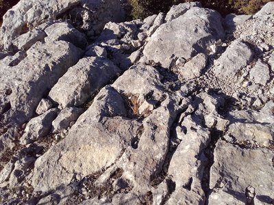
Lapiaz - ©Eric Garnier- PNR Luberon  Geology
Karstic trail
A limestone formation with an original topography is characterized as karstic, characterized by underground drainage which causes corrosion of the rock. Here we see a lapiaz. This surface geological formation is created by the runoff of rainwater that dissolves the rock or by cryoclasty (freezing and thawing of the water infiltrated in the rock). It is what forms this impressive rocky entablature traversed by faults and fissures.
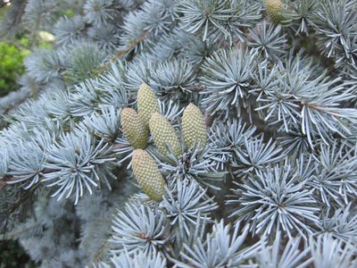
Cônes de cèdre bleu de l'Atlas - DR FloraSilver conifers
Conifers of majestic and imposing appearance, the cedars are distinguished by their bluish or silver color. These large cedars were planted in 1860 to the north of the village and extend over five hectares on the slopes of the Monts de Vaucluse. It is an important forest species, its fine, light and aromatic wood is used in woodwork or as a framework.
Lapin de garenne - ©DR  Fauna
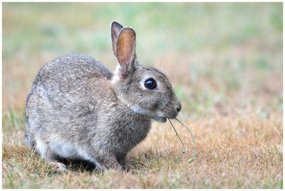
FaunaThe European (wild) rabbit
The wild rabbit lives in colonies in burrows which forms what is called a warren. A grass eater, it can eat away the bark of young trees in winter when grass is scarce. The wild rabbit is able to reproduce 4 to 6 times per year with 3 to 8 kittens per litter, this explains its reputation as "horny bunny". Its population has declined sharply in the Luberon from diseases such as myxomatosis or VHD (Viral Hemorrhagic Disease).
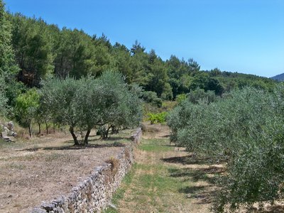
Oliviers et restanques en Luberon - DR Patrimony and historyThese other walls ...
Naturally arid and occupied by the forest, the hills had to be cultivated to meet a large rural population increase. Terracing to limit erosion and to cultivate the foothills, retaining walls were necessary: the restanque walls, a Provençal term for retaining. "Tanquer" in Provençal means "hold firmly, block", these walls can retain dirt while allowing water to pass. An ingenious stack of limestones built without a mortar!
Description
From the car park, reach the Avenue Jean Giono and take a left. Continue to the right on Grand Rue to the center of the village ("Mur de la peste" arrow). Pass the church. In front of the fountain, go left onto the Rue du Château. Pass the wash house, go straight and take the Chemin de la Pourtalette. At the calvary, go straight and 50m further, continue across on the Chemin de Muscadelle ("Mur de la peste" arrow). After the paved path, climb straight onto the stony path and the mountain pass (Croix de Lagnes), continue on the path opposite to the Plague wall.
1- Take a sharp right and go along the Plague wall. Upstream, the path deviates somewhat from the wall and goes along it again. Reach under the pines, the crossroads "La Peithe".
2- Turn left, pass through the forest track and at the signpost "Citerne", take the road to the left (GR ®). At the two successive croissing trails, continue straight and head to the valley. Pass one well rocky section and head down again. At the crossroads "Vallon des Esperacons", leave the GR® and climb the left trail (PR).
3 - At the intersection ''Esperacons'', continue on the balcony trail to the right (PR). Pass an edge (panoramic viewpoint at 20m to the right) and continue the path to the left.
4- At the crossroads "Le Soldat" take a left and 50m further, continue to the right. At the Y (point 285), follow the right track. Pass a hairpin bend and descend. At the entrance of a right turn (large pine tree), rush on a path to the left. Below after a right turn, stay on the right track. At the track, reach the D100 to the left. Take the road to the left for 150m and reach the parking area.
5- Take the track that starts to the left along the parking lot. 300m further, leave the trail leading to a house and embark on the path in front. Go down and reach point 1 at the Plague Wall. From there, return to Cabrières d'Avignon through the same route used to go.
- Departure : Car park below the town hall, Cabrières d'Avignon
- Arrival : Cabrières d'Avignon
- Towns crossed : Cabrières-d'Avignon and Lagnes
Forecast
Altimetric profile
Recommandations
Be careful with your ankles on the very stony or rocky sections (between points 2 and 3).
Information desks

OTI Luberon Coeur de Provence
Place François Tourel, 84300 Cavaillon
Access and parking
At 12km Northeast of Cavaillon by the D2, D110 and D148.
Parking :
More information
Source


Report a problem or an error
If you have found an error on this page or if you have noticed any problems during your hike, please report them to us here: