A Mediterranean bird festival
"I love to walk on the old transhumance route that connects the Alpilles to Crau. The simplicity and beauty of the landscape seem to amaze me every time, and here we can find an extraordinary biodiversity. All the beauty and richness of the site are seen through the beautiful light of a spring morning with the concert of bird songs and watching rare species: Black-eared wheatear, Southern grey hrike, Bonelli's Eagle ... " Lisbeth Zechner, project manager of LIFE at the RNP of the Alpilles.
4 points of interest
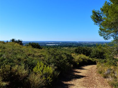
Vue sur la plaine de la Crau - ©Rémi Sérange - PNR Alpilles  Panorama
View on the Crau lowland
The Crau lowland forms a triangle with an estimated surface area of 550 km2. It is an arid pastoral lawn, forming a specific vegetation, named "coussoul". The south is called "Dry Crau", a remarkable steppe habitat. Today there are 95 km2;of intact steppe. The northern part of Crau, irrigated from the 16th century. through the Craponne canal and put into cultivation, forms the "Crau humide", where the Crau hay is produced, the first forage to obtain an AOC.

Vue sur le domaine et ses vignes - ©Jason Gaydier - PNR Alpilles  Produits du terroir
Gauges Valley Estate
The Glauges valley estate has a total surface area of ??72 hectares, 45 of which are dedicated to wine production and 4 to olive oil. Their distribution, between valleys, slopes and plateaus, allows to have wines with diversified character. The estate also strives to have a reasoned culture, combining the needs of the vines and the protection of the ecosystem, as evidenced by the 23 hectares of woods and garrigue preserved.

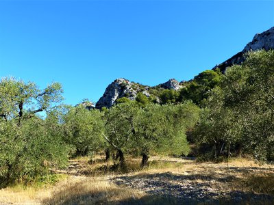
Vue sur les Opies - ©Rémi Sérange - PNR Alpilles  Patrimony and history
Opies view
This relief is characterized by a set of ridges where is the highest point of the territory of the Park: the Opies, at 498 m altitude. From the tower that symbolizes the summit, it is possible to see up to the alpine massifs. This tower was a watchtower, built at the dawn of the twentieth century, to prevent the fire in the massif. It is now used to house the Mistral adventurers who have reached the summit.
Plantation d'oliviers - ©Rémi Sérange - PNR Alpilles Produits du terroirThe olive tree
Emblematic culture of the territory of the Alpilles, the olive tree is the symbol of the dry Mediterranean climate. Its multiple trunks are the result of a release at the strain level following a significant frost in 1956. Today, some of the olives and oils produced in the Alpilles are recognized nationally and internationally, benefiting from the Protected Designation of Origin (PDO).
Description
Arriving at the cemetery, cross the gate to take the GR6 marked trail leading away from the village and follow it. Continue straight ahead, leaving the various small paths aside at multiple intersections Stay on this trail that continues to the foothills of the mountain on the left. Arriving to the sheep pen, go straight for 500 m.
1 – Pass the gate which cuts the road and at the crossroads, follow the second marked trail PR (yellow marking) which starts on the left. 400 metres further, turn on the right to go remain on the marked trail going up the hill.
2 – Reaching to the gate, turn to the right, leaving the private property and turn left, to go down the path leading to the domaine du vallon des Glauges.
3 – Reaching to the domaine, continue straight on the road the tour of the wine estate.
4 – At the intersection, turn right and continue for 1.5 km on the gravel path between the vineyards, visible on the right side of the cliff overlooking on the left.
5 – Arriving back on the road, turn right and return to the domaine. (Traffic!)
3 – Turn left at the intersection represented by the reference point number 3 to start the route back.
- Departure : Car park of the cemetery, in Aureille
- Arrival : Car park of the cemetery, in Aureille
- Towns crossed : Aureille, Saint-Martin-de-Crau, and Eyguières
Forecast
Altimetric profile
Recommandations
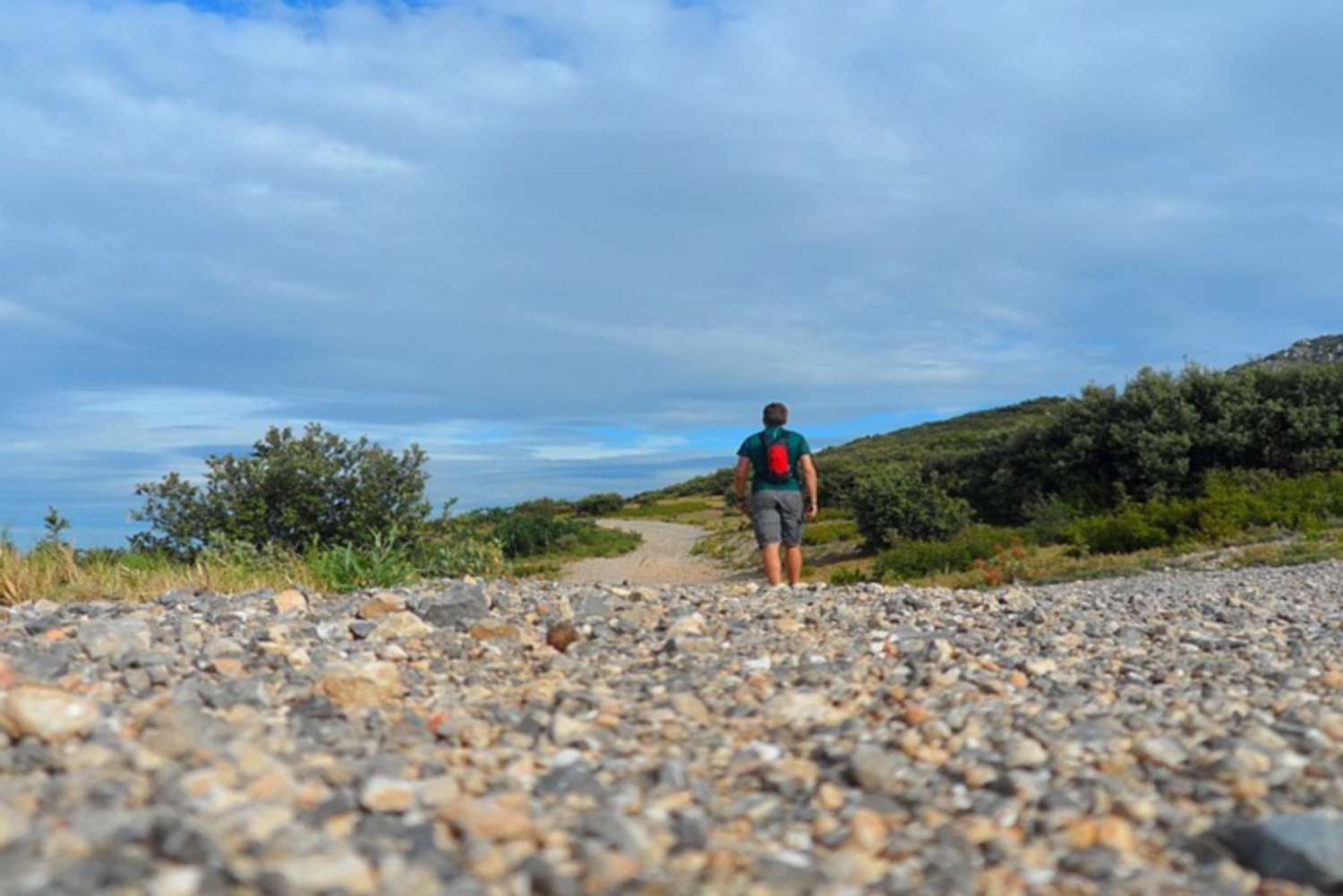
Very little shade on the trail, make sure to take a cap.Come rather early in the morning (7.00) or late afternoon (18.00) to enjoy the tranquillity of the area and to see and hear the birds sing. Bring a pair of binoculars..
Information desks
House of the Alpilles Regional Nature Park
2, boulevard Marceau, 13210 Saint-Rémy-de-Provence
Located in the heart of the city centre of Saint-Rémy-de-Provence, the House of the Alpilles Nature Park welcomes you to its completely renovated premises. This new vibrant place is multifunctional: it accommodates the Park's engineering team but also has a public reception space and showrooms. A true resource centre of the Park's heritage, it aims to support and promote locals, visitors and tourists on all 16 municipalities of the Park.
Open Monday to Friday, from 9 am at 12:30 pm and from 1:30 pm to 5 pm.
Free admission.

OTI Alpilles-en-Provence
Place Jean Jaurès, 13210 Saint-Rémy-de-Provence
Transport
Consult the timetable for Aureille on the website www.lepilote.com
Access and parking
On the D25b, enter Aureille. Turn right towards the cemetery at the end of the Avenue de la Gare.
Parking :
Report a problem or an error
If you have found an error on this page or if you have noticed any problems during your hike, please report them to us here: