Les Crottes d'Aubert
"It is nice to walk along quiet, shady paths lined with pine forests, scrubland and olive groves, which testify to a rich biodiversity. Also discover, during this rejuvenating walk, the beautiful landscapes that make you enjoy the best spots in the town of Fontvieille. " Baptiste Follot, student at the agricultural school of Saint-Rémy-de-Provence..
7 points of interest
Petit amandier sur la route des moulins - ©Rémi Sérange - PNR Alpilles  Flora
FloraThe almond tree
The almond tree is the first tree of the year to bloom, it is the symbol of the arrival of spring. Originally from the Middle East, it arrived in France in the 5th century and became, with the Olive Tree, the symbol of Provence. Nevertheless, its number has greatly diminished in recent decades Actions are now being put in place to permanently reintroduce it into the landscape of the Alpilles.
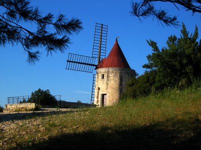
Moulin de Daudet - Romain Blanc_PNRA  Patrimony and history
The mill of Daudet
The mill Ribet or St Peter was built in 1814 and functioned until 1915, when the wheat was requisitioned for war. It is the newest of the four mills of Fontvieille. In 1935, it was the mill, which is now the best preserved, as the Society of Friends of Alphonse Daudet restores. This is why it is commonly called Daudet's windmill.
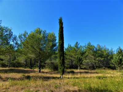
Cyprès de Provence - ©Rémi Sérange - PNR Alpilles FloraProvence Cypress
Native to Minor Asia, the Provence Cypress has acclimatized very well around the Mediterranean basin, until becoming one of its symbols. It can reach 20 to 30 m high and 2 m of tower, it withstands -20 ° C and tolerates a relative drought. Its dense wood is appreciated by cabinetmakers since ancient times ;The Phoenicians, Romans and Greeks used it for the construction of ships, temple doors and coffins. ;

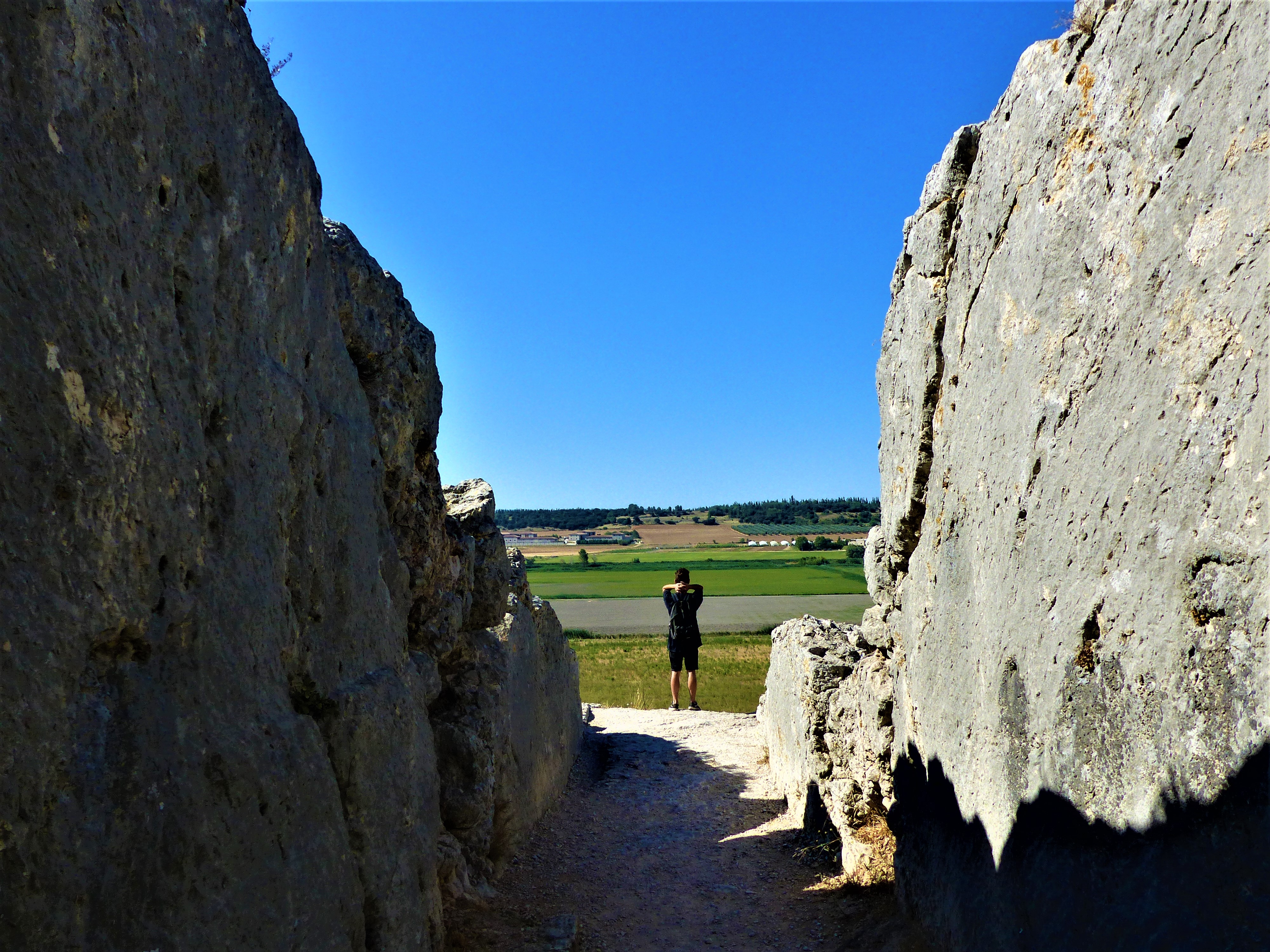
Aqueduc de Barbegal - ©Rémi Sérange - PNR Alpilles Patrimony and historyRoman aqueduct of Barbegal
In the 1st century AD, the Romans built two parallel aqueduct bridges, which converged in a basin from which a single conduit leading to Arles. The Barbegal aqueduct was diverted in the 2nd century. AD to feed the Barbegal mill, while the western branch continued to supply the city of Arles. The modified bridge trenched the link of the Pene to feed the mill. The waters were then collected by a channel that evacuated them into marshes.
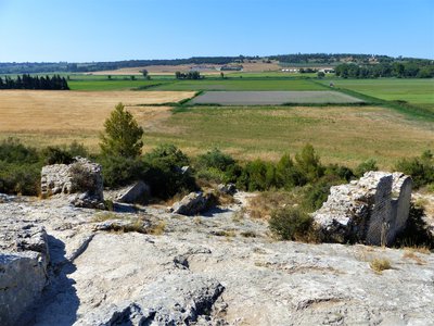
Vestiges de la meunerie de Barbegal - ©Rémi Sérange - PNR Alpilles Patrimony and historyBarbegal hydraulic mill
This mill was built in the 2nd century. and would have served 100 years. Built in a hillside on a slope of 30 ° and fed by the eastern branch of the Barbegal aqueduct, this mill consisted of two parallel rows of eight water wheels that operated sixteen mills. It formed a rectangle measuring 42 by 20 meters and produced about 4.5 tons of flour a day.
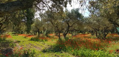
Parcelle d'oliviers au printemps - Anne-Catherine Privat-Madelin  Produits du terroir
The olive tree
Emblematic culture of the territory of the Alpilles, the olive tree is the symbol of the dry Mediterranean climate. Its multiple trunks are the result of a release at the strain level following a significant frost in 1956. Today, some of the olives and oils produced in the Alpilles are recognized nationally and internationally, benefiting from the Protected Designation of Origin (PDO).
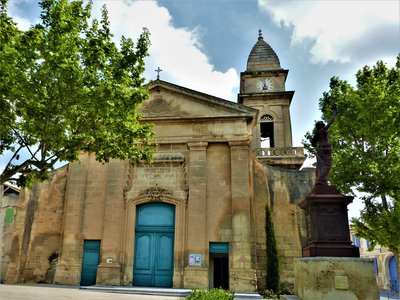
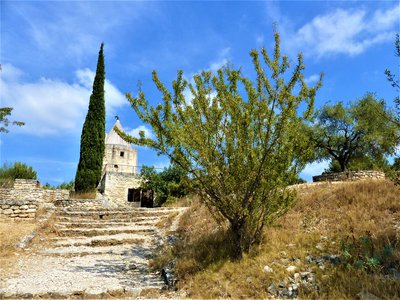
Façade de l'église Saint-Pierre-ès-Liens - ©Rémi Sérange - PNR Alpilles Patrimony and historySaint-Pierre-ès-Liens Church
In the classical style, the parish church of Fontvieille, Saint Pierre-ès-Liens has two bell towers. Its construction began in 1695, the old parish church having become too small to accommodate the inhabitants of the village. From 1790 and throughout the post-revolutionary period, the building was transformed into a communal hall. It regains its original vocation in the early nineteenth century and its second tower was built in 1866, which explains the difference in style.
Description
From the parking, follow the path that runs along the road from the south and join the Daudet mill on the left.
1- At the mill, go down to the left then take a yellow and blue marked path on the right (follow this double yellow and blue markings to point no. 3). At the crow's feet, stay on your left. Pass the barrier before a picnic area, then a second barrier on the left.
2- 200 m further, at the sign, follow to the right the direction "Les Baux-de-Provence". Pass a barrier and continue on the roadside path to another barrier. Then take the path on the left, then 350 m further the second path on the right (signposting on the ground!).
3- On this yellow and blue marked path, join a barrier from where you can see the road. Take the path on the right and join this road passing an irrigation canal. Follow the road on the right for 300 m (Caution, traffic!) To the Roman aqueduct and the mill at the end of the path that runs along the latter.
4- return by the same itinerary up to the channel. A few meters higher, climb to the right by the blue marked path (follow this blue marking until the end of the hike) and continue to a barrier.
5- After this one, take the path on the left towards the north. Go to a buried cistern. At this junction, take the path that goes north-east. Arrive at a junction where you can see a rock wall.
6- turning left toward the old quarries of Fontvieille. Stay on this path lined with a fence (Caution, quarry holes!) To the entrance of the quarries and the first houses of Fontvieille. Take the road on the left.
7- Turn right just after the fenced garden and before the water retention pond. Follow this path through woods to a small road, following the communal signs. Take it on the right and join the Montauban castle from behind. Exit through the front door and cross the village to reach the parking lot of the pine alley.
- Departure : Tourism Office, Fontvieille
- Arrival : Fontvieille
- Towns crossed : Fontvieille
Forecast
Altimetric profile
Recommandations
For your safety, and for the preservation of forest areas, access to natural areas is regulated from June to September. Inquire during the summer period on 08 11 20 13 13 (price of a local call) or on www.bouches-du-rhone.pref.gouv.fr Download the application for free MYPROVENCE ENVIE DE BALADE (available on Appstore and Android Market).
Information desks
House of the Alpilles Regional Nature Park
2, boulevard Marceau, 13210 Saint-Rémy-de-Provence
Located in the heart of the city centre of Saint-Rémy-de-Provence, the House of the Alpilles Nature Park welcomes you to its completely renovated premises. This new vibrant place is multifunctional: it accommodates the Park's engineering team but also has a public reception space and showrooms. A true resource centre of the Park's heritage, it aims to support and promote locals, visitors and tourists on all 16 municipalities of the Park.
Open Monday to Friday, from 9 am at 12:30 pm and from 1:30 pm to 5 pm.
Free admission.

OTI Alpilles-en-Provence
Place Jean Jaurès, 13210 Saint-Rémy-de-Provence
Transport
Look for transit times on the site www.lepilote.com in the town of Fontvieille.
Access and parking
Parking :
Access
- Emergency number :
- 114
Report a problem or an error
If you have found an error on this page or if you have noticed any problems during your hike, please report them to us here: