The burnt farm
3 points of interest
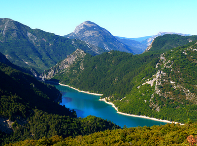
Retenue de Chaudanne - DR  Panorama
Chaudanne restraint
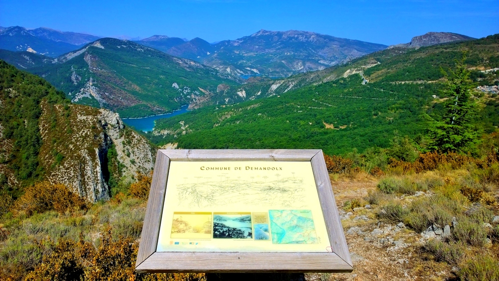
Leaned on the rocky barrier of the Crémon, the village of Demandolx overlooks the lakes Chaudanne and Castillon, offering a magnificent panorama which recalls the Norwegian fjords where the deep blue lakes sparkle in a green mountain.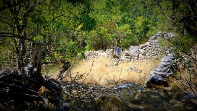
Ruines de la ferme brulée - Alessandra Sulea - PNR Verdon  Patrimony and history
The burnt farm
The burnt farm, place with the strange name, we find in fact the ruins of an old building, but no one knows that at what time the farm was destroyed or burned.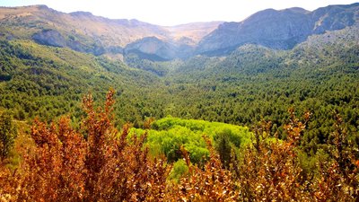
Fôret de peupliers tremble - Alessandra Sulea - PNR Verdon PanoramaLandscape
Admire the aspen forest previously crossed, forming a bright green spot in the landscape
Description
Exit the car park and follow the Avenue du Teillon towards Castellane then turn left, chemin de Thuveras. Go down the road on the right, continue straight on the farm path. At the end of the road at the place called La tour, continue in the same direction
1- At the intersection take the path on the right and go down to the creek. Cross the wooden bridge and go up the trail to an intersection.
2- Turn left towards GR®4 and Saint Barnabé. Go up the path and join an esplanade, under a high voltage line. Follow the trail (GR®4 red and white markings).
3- At the fork near the pylon turn right and descend for about 700 m until the track splits in two.
4- Leave the GR®4, and go down the track to the right. At the foot of the ruined farm, go up on the right by the path, passing over two terraces. Climb through the boxwood, up to "Cognas", an orientation table on a beautiful point of view. Then continue on the path below the table and join point 2 of the hike. Go down on the left and return to the village by the route taken on the way.
- Departure : Thuveras Road, Demandolx
- Arrival : Demandolx
- Towns crossed : Demandolx
Forecast
Altimetric profile
Recommandations
avoid the hot summers, leave early.
Allow 2 L of water per person, a hat and hiking shoes.
Information desks
House of the Verdon Regional Nature Park
Domaine de Valx, 04360 Moustiers-Sainte-Marie
House of the Verdon Regional Nature Park
Transport
Access and parking
14 km east of Castellane, by the D4085 and D102.
Parking :
Report a problem or an error
If you have found an error on this page or if you have noticed any problems during your hike, please report them to us here: