Mountain of the Audibergue
"A stunning ski resort with breathtaking panoramas on the Mercantour and the Côte d'Azur, appreciable in all seasons. " says Julien Lageat - Préalpes d'Azur RNP.
4 points of interest
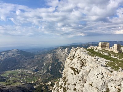
Tables d'orientation - ©Julien Lageat - PNR Préalpes d'Azur  Panorama
Earth and Sea
Not one but two viewpoint indicator maps on the crest help identify the various elements which are characteristic of the breathtaking landscapes.
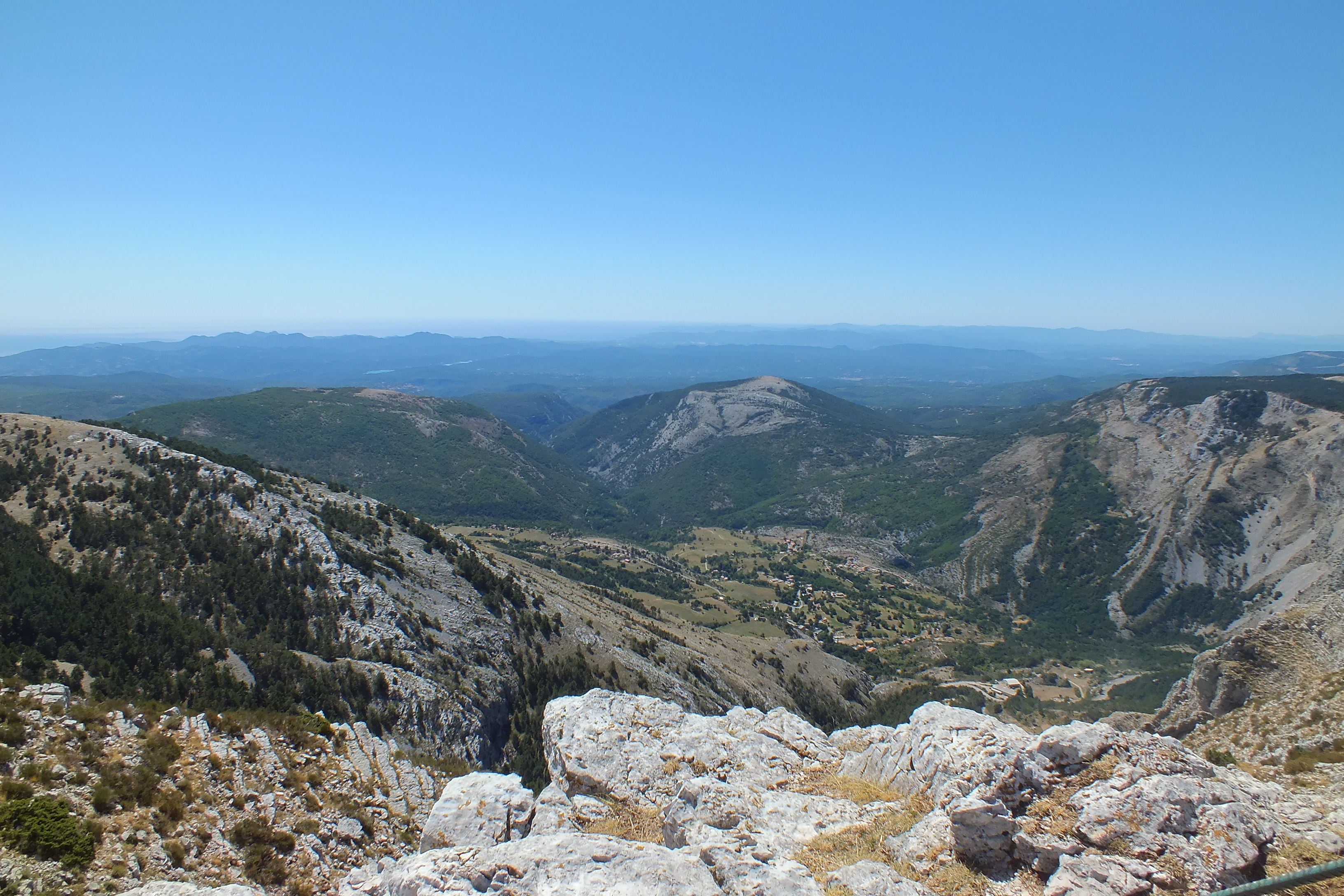
Sommet de l'Audibergue - ©Julien Lageat - PNR Préalpes d'Azur PanoramaAudibergue Summit
The arrival at the summit offers a unique panorama at 360° revealing the French Riviera, Var, Esterel and Alps mountain range in the distance.
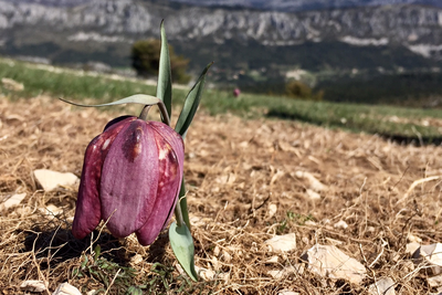
La Fritillaire du Dauphiné - ©Julien Lageat - PNR Préalpes d'Azur  Flora
FloraThe bulb of the Alps
The Fritillary of the Dauphiné or Fritillaria tubiformis is a rare and protected plant. It gives a large reddish purple flower and grows in small colony on limestone soil in meadows up to an altitude of 2,000m. It flowers from April to July.
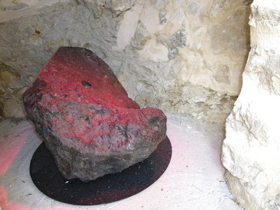
Météorite découverte à Audibergue - ©Mairie de Caille  Geology
You have said alien?
A meteorite of 625kg was discovered in the 17th century on the summit of the Audibergue. This stone is composed of 90.9% iron and 9.1% nickel. In 1828, it was recognized by scientists who carried it to the Natural History Museum in Paris. Today a moulding made of its original look is exhibited in the Town hall of Caille.
Description
From the Parc de la Moulière climb up to the end of the chairlift by the green slope of the Marcassin.
1- Bypass a slope on the right and join the orientation table on the nearby ridge.
2- Cross the ridge on the trail (PR marking), to the top of the Audibergue (1,642m)
3- Go north, under the ski lifts to find the beacon 173.
4- Take the trail (PR marking) towards Parc de la Moulière and easily reach the parking lot via the 174 beacon.
- Departure : Park of the Moulière, Caille
- Arrival : Park of the Moulière
- Towns crossed : Caille, Escragnolles, and Andon
Forecast
Altimetric profile
Recommandations
The Moulière chairlift, which is open from May to September, can facilitate climbing.
After point 3: take your time, stony descent
Information desks

Prealpes of Azur Regional Nature Park
Bienvenue dans le Parc naturel régional des Préalpes d’Azur !
Découvrez la richesse unique de la géologie, de la faune et de la flore, du patrimoine, des produit locaux… du Parc en le parcourant à pied, à vélo ou à cheval grâce aux différents itinéraires de cheminsdesparcs.
Profitez d’autres activités nature proposées dans le Parc.
Recevez la newsletter du Parc.
Access and parking
47km north of Grasse, by the RD6085, RD79, RD81 (direction of Caille), and RD281.
Parking :
Source

Report a problem or an error
If you have found an error on this page or if you have noticed any problems during your hike, please report them to us here: