LE PARADOU - Défends de Sousteyran
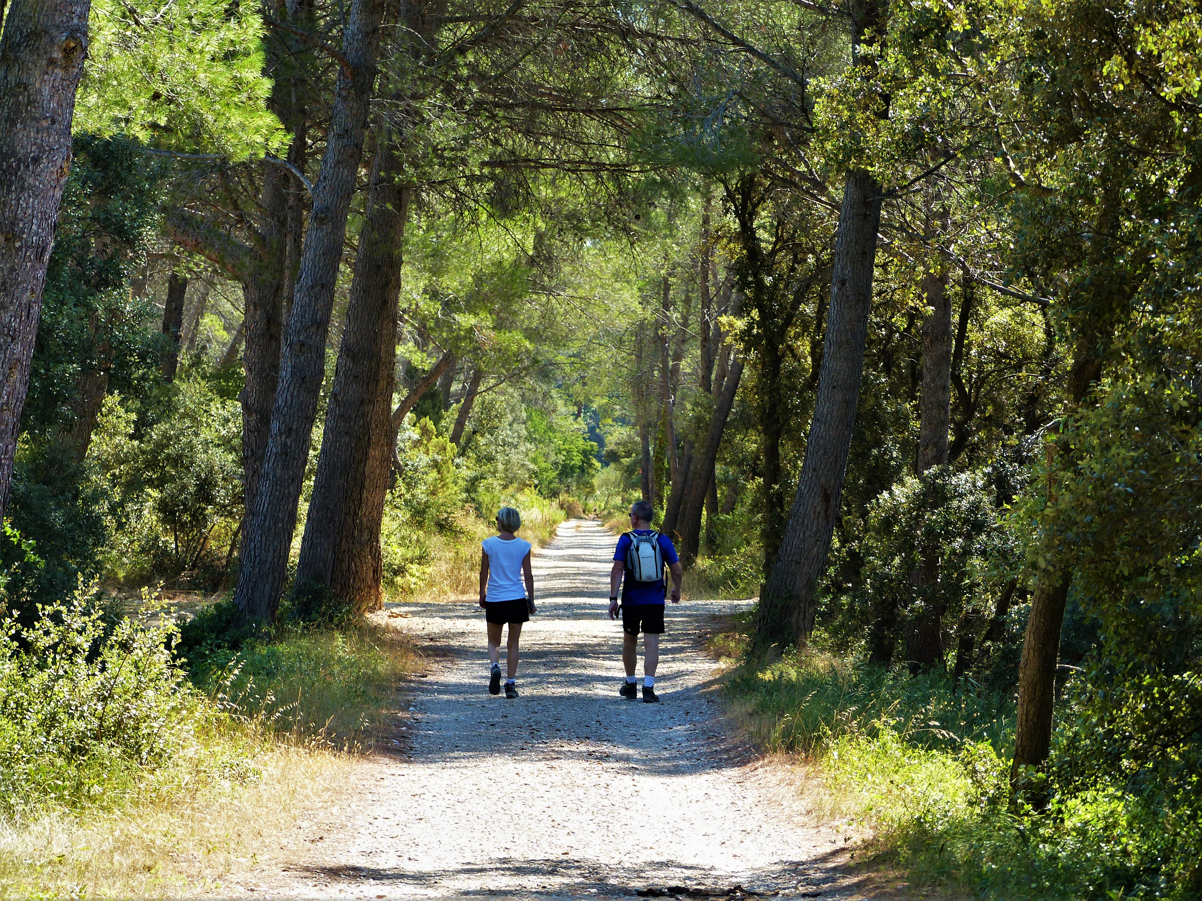
The tranquillity of the paths and roads of the Paradou commune will take you from the Défends de Sousteyran, to the superb Rochers de la Pène. These include the Tours du Castillon, a small heritage treasure of the Alpilles, as well as magnificent views of the southern foothills of the massif, including their highest point les Opies.
11 points of interest
Tracé de l'ancienne ligne ferroviaire - ©Rémi Sérange - PNR Alpilles  Patrimony and history
Old railway line
Started in 1868, the construction of the Arles-Salon railway line was completed in 1887. In 1900, a traffic evaluation shows that the number of passengers and goods (cereals, wine, coal) is small. Although the prosperity of the villages benefited from connection to the rail network, the line was finally closed in 1950, in a context favorable to road traffic.
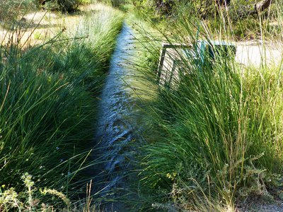
Canal de la vallée des Baux - ©Rémi Sérange - PNR Alpilles  Water and rivers
Canal of the Baux Valley
This canal, measuring 53 km long, has been the subject of a long process of reflection and design. Started in 1792, the canal will be put in water a century later, in 1914. To develop human presence and economic activity in the Alpilles, it was important that a hydraulic network irrigate the territory and allow agriculture to develop. This canal alone feeds the southern part of the massif.
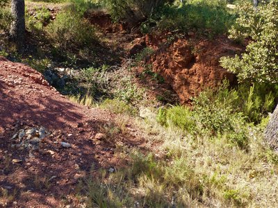
Sol composé de bauxite - ©Rémi Sérange - PNR Alpilles  Geology
Bauxite
Bauxite, the eponymous name of Baux-de-Provence, is an aluminous and ferruginous clay agglomerate, usually red but sometimes tiger or whitish depending on the content of iron oxides and impurities. ;It was discovered in 1821 by the French geologist Pierre Berthier, who came looking for iron ore in the Alpilles. Following a global competition and local protests, its exploitation was stopped in the Alpilles.
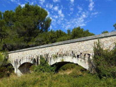
Pont-canal de la vallée des Baux - ©Rémi Sérange - PNR Alpilles Water and riversBridge-canal of the Baux valley
In the Alpilles massif, numerous hydraulic structures have been built to supply all municipalities with water. The canal of the Baux valley, put in operation since July 3, 1914, passes along the southern foothills of the massif. The specificity of this environment associated with that of a canal, which must include a gentle slope allowing the good flow of water, led to the development of several canal bridges in the municipalities of Maussane-les-Alpilles and the Paradou.
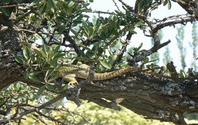
Lézard ocellé perché sur une branche d'arbre - ©Nicolas Sadaillan - Mairie de Sénas  Fauna
FaunaThe spotted dragon of the Alpilles
Ranging from 60 to 90cm long, the Ocellated Lizard (Jewelled Lacerta) is the largest of its kind. This lizard enjoys dry, sunny places such as olive groves or unoccupied rocky areas. It is essentially characterized by its few blue spots along its flanks. Its diet consists of fruits as well as small mammals, through other insects. It is protected and the person that even manages to catch it will be fined.
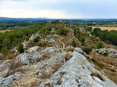
Les rochers de la Pène - ©Rémi Sérange - PNR Alpilles GeologyRocks of Pène
The rocks of the Pène, which shelter the Castillon Towers, belong to the narrow chain of "Hills" extending for 15 km from west to east, in the Alpilles massif. Traveling Fontvieille, Paradou, Maussane-les-Alpilles and Mouriès, it ends at the Caisses de Jean-Jean. The rocks of the Pène peak at 58 meters altitude south of Paradou. They have a marked southward slope and consist of calcareous beds of the Upper Cretaceous.
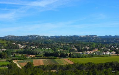
Vue sur le massif des Alpilles - ©Jason Gaydier - PNR Alpilles  Panorama
An island in the middle of the plains
The Chaîne des Alpilles stretches over 30km, culminating at 498m at the top of the Opies. At the whim of peaks, cliffs, valleys and foothills, this very Mediterranean limestone massif is home to remarkable environments. The Alpilles are composed of emaciated soils of which the white limestone was formed 125 million years ago by the accumulation of microorganisms in the ocean which covered it here. It was the collision of the African and European tectonic plates that created these mountainous areas.
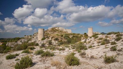
Les tours, reliées par un rempart, protégeaient une agglomération d'une quarantaine de foyers - ©Orlane Fougeroux Patrimony and historyThe Castillon Towers
Occupied for the first time since the Iron Age, the Castillon site grew considerably in the 11th century, when the Lords of Baux made it a strategic location for the defence of their territory and a surveillance station of the communication routes. The castle, now gone, had four towers at the time. The site that you are discovering only has three today.
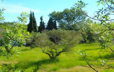
Un olivier aux multiples troncs - ©Jason Gaydier - PNR Alpilles  Produits du terroir
The territory's symbol
The olive tree is an iconic culture of the territory and is the symbol of the dry Mediterranean climate. Its multiple trunks are the result of a grafting near the stump following a long lasting frost in 1956. Today, olives and oils produced in the Alpilles are products recognized nationally and internationally, benefiting from the Appelation d'Origine Protégée - AOP (European quality logo attesting regional origin), which marks its uniqueness.
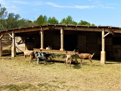
Chèvres laitières de l'Atelier Fromager des Calans - ©Rémi Sérange - PNR Alpilles Produits du terroirL'Atelier Fromager des Calans
L'Atelier Fromager des Calans is a small farm, specializing in the artisanal production of goat cheese. The owner, Nathalie Feurer, owns a farm of 50 dairy goats, which provide all the milk needed to make her cheese. Anchored in a local approach, it sells its products for direct sale on the farm, or at the hut "Le petit Paysan", a place of sale for independent producers in Maussane-les-Alpilles.

Centre ville du Paradou - ©Jason Gaydier - PNR Alpilles Patrimony and historyThe village of Paradou
Formerly kniwn as Saint-Martin-de-Castillon, the current name "Paradou" comes, not from "Paradise" although it may seem like one to inhabitants or visitors, but the name of the old water mills of the Arcoule river which enabled weavers to "decorate" the sheets.
Description
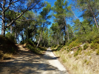
Back to the car park, turn right on the road to Saint-Roch and join the crossing with the D17. (Caution, traffic) Cross it and follow the path of Burlande, signposted PR. 500 m further, leave the first road on the left to follow the second, following the sign "Fontvieille 10.3 km". Continue for 1 km.
1- At the intersection, turn left, following the sign "Fontvieille 9.2". (Caution, traffic) Reversing the D17 and take the path to Constemple, signposted GR® and PR. Climb on this marked path for 800 m, to join a DFCI track.
2- Take this track on the left, still signposted GR® and PR, passing a barrier. Continue for 500 m until you reach an intersection. Toggle on your left and follow for 1 km this path, marked PR, to reach a channel bridge
3- Join the D78e road and follow it straight ahead. After turning left, continue for 1 km along this road. Pass some houses, then take the asphalt road of Pas de Loche on the right.
4- At the level of a small pass, turn left on a path, marked blue on the ground. Continue for 1.7 km on this blue marked path, to reach les Tours de Castillon, passing through the summit surmounted by a cross.
5- Just after les Tours de Castillon, turn left and join an asphalt road. Walk on its left on 400 m, then in the bend turn left the path of Crèmades and the Pène.
6- At the end of the road, turn right to follow the D78e. Continue straight on for 1.2 km to the center of Paradou. At the intersection with a cross, take the road on the left and reach the starting point 150 m further.
- Departure : Parking des écoles, Le Paradou
- Arrival : Le Paradou
- Towns crossed : Paradou and Fontvieille
Forecast
Altimetric profile
Recommandations
For your safety, and for the preservation of forest areas, access to natural areas is regulated from June to September. Inquire during the summer period on 08 11 20 13 13 (price of a local call) or on www.bouches-du-rhone.pref.gouv.fr Download the application for free MYPROVENCE ENVIE DE BALADE (available on Appstore and Android Market).
Information desks
House of the Alpilles Regional Nature Park
2, boulevard Marceau, 13210 Saint-Rémy-de-Provence
Located in the heart of the city centre of Saint-Rémy-de-Provence, the House of the Alpilles Nature Park welcomes you to its completely renovated premises. This new vibrant place is multifunctional: it accommodates the Park's engineering team but also has a public reception space and showrooms. A true resource centre of the Park's heritage, it aims to support and promote locals, visitors and tourists on all 16 municipalities of the Park.
Open Monday to Friday, from 9 am at 12:30 pm and from 1:30 pm to 5 pm.
Free admission.

OTI Alpilles-en-Provence
Place Jean Jaurès, 13210 Saint-Rémy-de-Provence
Transport
Access and parking
Parking :
Report a problem or an error
If you have found an error on this page or if you have noticed any problems during your hike, please report them to us here: