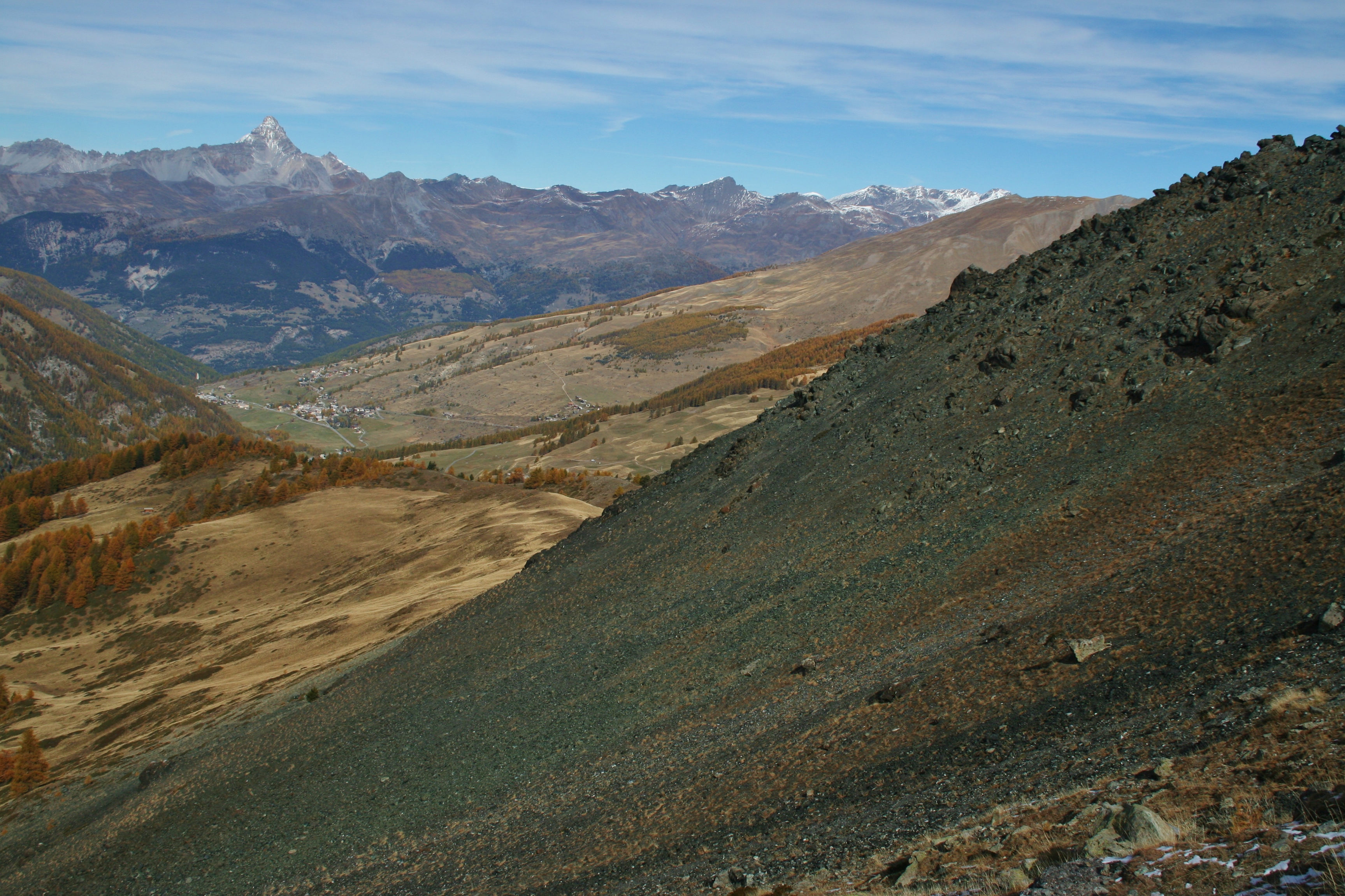
Crête de Curlet
When leaving the larch forest, the trek continues on a breezy ridge offering unobstructed views. Surrounded by greenstone, no major difficulty but be careful all the same, the end of the climb is a little more alpine.
5 points of interest
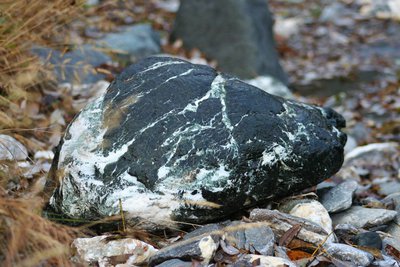
Serpentine - Benjamin Musella - PNR Queyras  Geology
Serpentine
The serpentine is a family of metamorphic rocks which includes around twenty mineral species. Serpentine is soft which makes it easy to carve. Some varieties can even be worked with a knife. The "noble" Serpentine is light olive green and translucent. It is used in the design of jewellery and small sculpture. Serpentines are used in crystal healing for conditions involving the heart or lungs. They also help with concentration and meditation.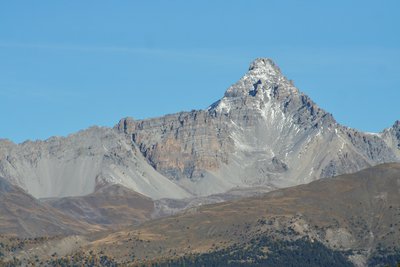
Pic de Rochebrune - Benjamin Musella - PNR Queyras  Panorama
View of the Pic de Rochebrune
The Pic de Rochebrune is omnipresent in the Queyras. Its isolation and altitude (3320m) makes it, like Mount Viso, one of the most visible peaks of the territory. For experienced hikers (top part with some climbing sections), the ascension offers an exceptional 360° view. The Mercantour, the Mont Blanc, the Massifs des Ecrins, the Mont Rose, the Grande Casse, the Aiguilles d'Arves, the Massif de la Font Sancte, the Bric Bouchet and the Mount Viso are examples of the many visible massifs and peaks from the top of the great Rochebrune.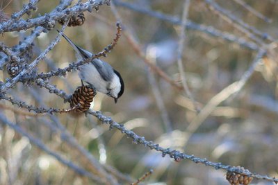
Mésange alpestre - Benjamin Musella - PNR Queyras  Fauna
FaunaAlpine Tit
The alpine tit, subspecies of the willow tit, prefers dense underbush. It is found in deciduous (shedding-leaves trees) and mixed forests. It digs its nest in dead or senescent (ageing) wood. Wood chips, feathers, grass and hairs are used to line the nest. Every year, between 6 and 9 eggs are laid at once. The tit sits on them for almost 2 weeks. Sedentary, it keeps reserves during the "beautiful" season to survive the winter.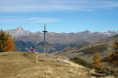
La croix de Curlet - Benjamin Musella - PNR Queyras PanoramaView from the Croix de Curlet
The Croix de Curlet marks the beginning of the crest of the same name. It offers a beautiful view of the village of Saint-Véran and the valley of Aigue Blanche. And a view of the great Rochebrune and part of the Guil valley.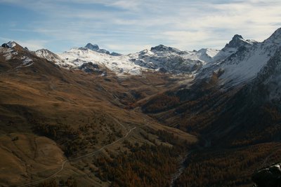
Vallée de l’Aigue blanche - Benjamin Musella - PNR Queyras PanoramaView of the upper valley of Aigue Blanche.
The bottom of the Aigue Blanche valley from right to left: Tête des Toillies, Rocca Bianca, Pic de Caramantran and Pointe des Sagnes Longues.
Description
From the Pont du Moulin Go up the track in continuity of the bridge, quickly leave a path on the right and remain on this track. The trail rises by a few bends and crosses a track and skid knives, carefully follow the yellow markings. Reach to a meadow, continue climbing and reach the point of Cabanes de Lamaron.
1 - From here, turn left into a slightly ascending traverse which leads to the Croix de Curlet. From there, take a right and follow the wide ridge which leads to the bottom of the Pic de Cascavelier.
2 - Once at the foot of the peak, go around it while remaining on level and reach the edge on the other side of the peak, continue on a few metres left to reach the summit.
3 - From the top, turn back and descend along the edge, pass a little bump and go down the valley to the right. Follow the valley until reaching the trough you came across during the climb. Here, follow the reverse path and reach to the Pont du Moulin.
- Departure : Pont du Moulin
- Arrival : Pont du Moulin
- Towns crossed : Saint-Véran
Forecast
Altimetric profile
Information desks
House of the Queyras Regional Nature Park
3580 Route de l’Izoard, 05350 Arvieux
The House of the Queyras Regional Nature Park is closed to the public.
OTI du Guillestrois et du Queyras
Maison du Tourisme du Queyras, 05350 Château-Ville-Vieille
Transport
05 Voyageur: 04 92 502 505 Tourist Office of Queyras: 04 92 46 76 18
Access and parking
Follow the D5 until the Saint-Véran village. Park at the entrance of the village.
Parking :
Report a problem or an error
If you have found an error on this page or if you have noticed any problems during your hike, please report them to us here: