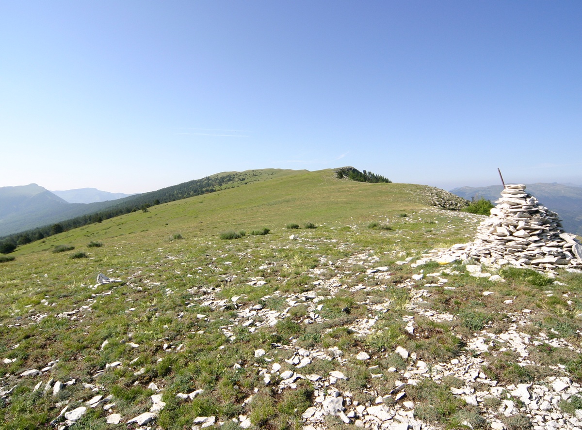
Crête des Serres
Leaving the village square to reach, at 1,778m, the pastures of the Crête des Serres mountain, to discover an exceptional panorama, fine lavender plants, Verdon. This hike is a real change of scenery!
1 point of interest
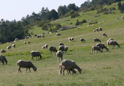
Troupeau sur les crêtes des Serres - Christian Peuget  Geology
Haute Provence has no shortage of salt
Essential to the men and their cattle feed, salt came mostly from saline. There is another salt resource, closer to people: they are the salt springs that are found everywhere in Provence. This precious salt demonstrates the presence of a marine environment in these places during the Mesozoic era, 220 million years ago. The Saint-André is rich in sources of this type.
Description
From the Place de Verdun, head to the church, go across to reach the Grand'Rue then take the first right (Rue du Moulin). Take the village road No.2 of Méouilles. Continue on this road until the Verdon and cross it. Continue on the left bank of the road and 200m before the restored castle of Méouilles, across from the entrance to the Deux Saints tourist site, take the path going left towards the mountain.
1- Go along the trail with craggy black rocks then a clearing before heading into the woods. At 400m, reach a road in a curve. Keep going and 200m further, follow the trail down to the right. Go up the trail. When exiting the woods, pass through the clearing and, below a cottage, reach the track from the house of Villard. Continue on the track to the state-owned forest.
2- Climb the path that rises with switchbacks interspersed with a train. Follow the less steep and more enjoyable trail. After 1.5km of walk, reach a forest track. Take the path rising on the opposite side. Make the final climb through a rising trail with long crossings to the ridge. Reach the top of Serre Gros 100m to the right.
3- At the top, head down the same path.
- Departure : Rue du Moulin, Saint André les Alpes
- Arrival : Rue du Moulin, Saint André les Alpes
- Towns crossed : Saint-André-les-Alpes, Angles, and Allons
Forecast
Altimetric profile
Recommandations
Avoid high summer temperatures, leave early. We recommend: 2L of water per person, a hat and proper hiking shoes. Careful, snow in the winter. Preferred seasons: Spring, autumn (fall).
Information desks
House of the Verdon Regional Nature Park
Domaine de Valx, 04360 Moustiers-Sainte-Marie
House of the Verdon Regional Nature Park

OT Saint André les Alpes - Barrême
Place Marcel Pastorelli, 04170 Saint-André-les-Alpes
Transport
Access and parking
At 21km North of Castellane through the D955 and the N202.
Parking :
Report a problem or an error
If you have found an error on this page or if you have noticed any problems during your hike, please report them to us here: