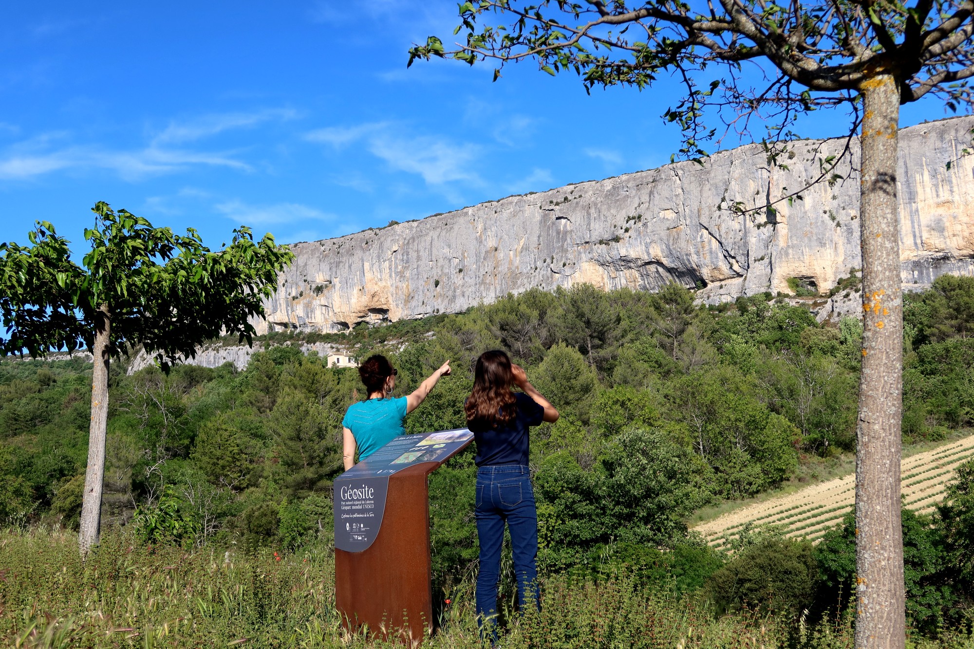
Cliff of the Madeleine
10 points of interest
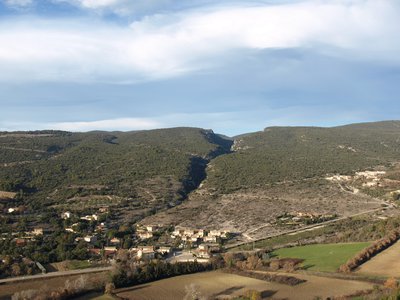
Plan de faille de la Madeleine - ©OTI Pays d'Apt Luberon  Geology
A fault and a cliff
The Earth is an active planet, alive, animated by movements. This results in soft deformations (folds), or brittle (fractures and faults). The Madeleine cliff corresponds to one of these faults. The northern compartment of the fault is sunk several tens of meters. It is the ditch of Lioux where the village settled. The southern compartment, made of very hard limestones, remained in relief. Thus the cliff highlights exactly the layout of this fault in the landscape
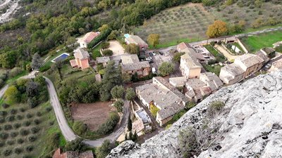
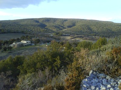
Village de Lioux - ©Eric Garnier - PNR Luberon  Patrimony and history
The Lioux village
The Lioux municipality covers nearly 4,000 ha! This gives it very contrasting landscapes between scrubland, old castles and dark forest. Lioux is separated into two parts: the old village with the Romanesque church at the foot of the cliff and the "low village", in the valley. It is said that Hannibal, accompanied by his war elephants, crossed Lioux before reaching the road to the Alps. This explains the presence of an elephant on the coat of arms of the municipality.
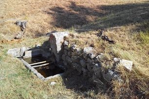
La Fontaine Verger - ©Christine Balme - PNR Luberon  Water and rivers
The canal and the fountain
See on the road this channel, trace of an old canal which brought the water, without doubt to the village. Shortly after, when you get to the first houses, you will find a source, the Orchard Fountain and its wash house below. The water, in Provence, was rare and valuable. This is still the case ; !
La Verrerie - ©Eric Garnier - PNR Luberon Patrimony and historyThe glass factory
This bastide is called "La Verrerie", the only remnant of a distant past where glass was made. For this, it takes sand, lime and especially a lot of wood to feed the furnaces. From the Middle Ages, the glass works are implanted in the region, because of the magnificent forests that cover Monts-de-Vaucluse and Luberon, which they gradually raze! In 1701, the Simiane council begs to "suppress the glass factory which is the forest chancre". The last glass factory of the country of Apt will close in 1889.
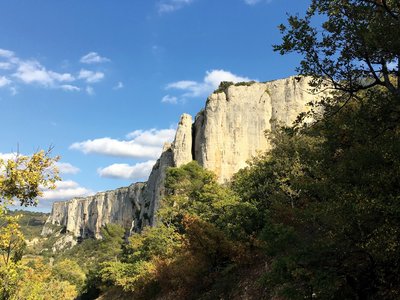
Combes de la Sigalière et rocher de l'Aigle au fond - ©Eric Garnier - PNR Luberon GeologyThe Monts-de-Vaucluse
See also the massive massif of Monts-de-Vaucluse, large limestone slab very thick (more than 1000 m). It collects, in depth, the rainwater that will come out in Fontaine-de-Vaucluse, 1st source of France by its flow. On their southern edge, the Monts-de-Vaucluse are cut canyons like the one from combe of Lioux, opposite or of Vaumale, in the west, allowing to connect the waters circulation of the plateau with the one of Apt bassin .
Combe de Lioux - ©Eric Garnier - PNR Luberon GeologyBelvedere to the north
To the north, below, we can find hills of gray clays. Insignificantly, these clays and the fossils they contain allowed the creation, in 1840, of one of the stages of the international stratigraphic scale which breakdown the history of the Earth, in eras, period, stages .. . Since its formation more than 4 billion years ago. This floor is the Aptian, which takes its name from Apt, of course, between -125 and -113 million years ago.
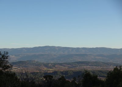
La Gardette, les Claparèdes et le Mourre Nègre - ©Eric Garnier - PNR Luberon  Panorama
Belvedere to the south, south-east
On the south-south-east side, the view emerges on the hills of the massive ocrieres, the Claparèdes plateau and the Saignon rock, then the Grand Luberon massif and its summit, the Mourre Nègre (1,125 m). The birth of the Grand Luberon is linked to that of the Pyrenees about 40 million years ago. Just like those massifs oriented east-west (Alpilles, Ste-Baume, Ste-Victoire ...). Subsequently, the formation of the Alps will enhance this relief then erosion will mold it.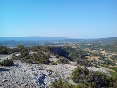
Gorde à droite et le Petit Luberon au fond - ©Christine Balme - PNR Luberon PanoramaBelvedere to the south west
Magnificent and grandiose belvedere to the south west on the Petit Luberon massif and its vast summit plateau. Full west, the village of Gordes is well located, built and nested on the edge of the molasse plateau, the "Pierre du Midi". Further south, a part of the ocher massif is discovered, with its red and yellow sands. These sands of alteration are the index of a tropical Provence 100 million years ago.
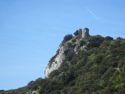
Ruines du château de Bézaure - ©Eric Garnier - PNR Luberon Patrimony and historyThe Lioux castles
North facing, overlooking the valley of Lioux, the majestic ruins of Castellas enthroned on their rocky peak. This castle in the defensive position is only one of the 5 castles of the town;! Why such an abundance;? Parrotier Castle is located in the lower village of Lioux but those of Bezaure, Saint-Lambert and Javon are further away. They were once attached to municipalities of the same name that joined Lioux in 1793, adding 3 castles on the perimeter of the town.
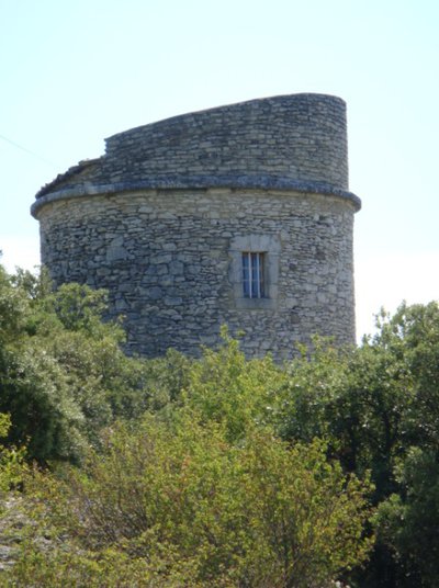
Moulin de Lioux (privé, ne se visite pas) - ©DR Patrimony and historyThe Lioux old mill
The Luberon mills originally used the strength of man or animals. Then it was replaced by the force of the water and finally that of the wind. Provence was the first French region to build windmills, because of its relief and strong winds that cross it. The first were attested in 1180, allowing to grind grain and olive. The tower that is observed is the remnant of an old windmill, it is currently inhabited (private, can not visit).
Description
Take a left at the exit of the parking and join the road junction. Take the D60 on the left towards Lioux and its cliff.
1-At the exit of the first right turn (tank), turn left onto a dirt road (PR). Get out higher on the D60 and take it to the left. At the entrance of the bend, turn right on a footpath at the foot of the cliff (PR). At the height of the first houses of Lioux, join again the D60 on the left (not marked), then reach the nearby church and the wash house opposite. Continue the road, exit the village of Lioux and continue to the right on a stony path (PR). Walk along the foot of the cliff and climb a steep ramp. Unblock between two houses, turn left and immediately right then continue the path between vineyards, truffle and lavender (PR).
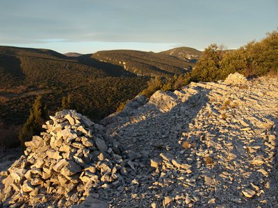
2- - At the mas of La Verrerie, turn right and climb the ancestral path to the crests. Take a bend, turn right and continue 20 m further on the right path (PR). Start to descend along the ridges, then 150 m lower, to sneak right on a path that approaches the edge of the cliff of La Madeleine (local PR, green mark up dots). Get out on the path more marked then repeat twice this escapade right on the edge of cliff. Follow the rocky trail in the scrubland, descend and climb a rock jump (walk) to reach the top of a shoulder (cairn).
3- Continue the path along the ridges. Further on, continue on the path on the right to follow the cliff edge (green dots). Join again the main rocky path (PR and green dots) and go straight up to the top of a bump. Sneak behind on the trail that skirts left over the grove of trees (green dots), then 30 m lower, dive on the right path (PR and green dots).
4- Unclog on an esplanade near the old mill. Go down the paved path and walk along the foot of the cliff. Pass the cemetery and reach the D60. Turn left and go down the road to the hamlet of La Combe.
- Departure : Combe, Lioux hamlet car park
- Arrival : Lioux
- Towns crossed : Lioux and Saint-Saturnin-lès-Apt
Forecast
Altimetric profile
Recommandations
Extreme vigilance along the path that runs along the cliff (between points 2 and 4).
Watch out for the ankles in the many rugged rocky passages (lapiaz).
Stay attentive to follow the mark-up (many diverticula).
Information desks

Luberon UNESCO Global Geopark
60, place Jean Jaurès, 84400 Apt

House of the Luberon Regional Nature Park
60, place Jean Jaurès, 84400 Apt
In the heart the old town centre of Apt, the House of the Luberon Regional Nature Park welcomes you in a town house of the 18th century. The permanent exhibition of the geology museum has a rich collection of fossils evidencing the geological history of the Luberon.
On sale at the shop: books, maps, guidebooks, games, posters...
Open Monday to Friday from 8:30 am to 12:00 pm and from 1:30 pm to 6 pm (and on Saturday, depending on the program). Free admission.

OTI Pays d’Apt Luberon
788 avenue Victor Hugo, 84400 Apt
Du 1er avril au 30 septembre
Ouvert du lundi au samedi de 9h30 à 12h30 et de 14h à 18h.
Juillet et août : Ouvert dimanche et jours fériés de 9h30 à 12h30
Du 1er octobre au 31 mars
Ouvert du lundi au mardi et du jeudi au samedi de 9h30 à 12h30 et de 14h à 18h.
Fermé le mercredi, dimanche et jours fériés.
Access and parking
18 km north-west of Apt by the D900, D4 and D60.
Parking :
More information
Source

Report a problem or an error
If you have found an error on this page or if you have noticed any problems during your hike, please report them to us here: