The Mule Trail
Between the history of the Verdon, the flora, and the landscapes, you will also discover traces of the old agriculture, (small sheds, dry-stone wall terraces...) and recent agriculture (cereal production and lavender on the plateau) not to mention magnificent view on the lake of Sainte Croix.
6 points of interest
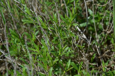
La Sarriette ou Pèbre d'ai ou Pèbre d'ase - Stefano Blanc - PNR Verdon  Flora
FloraAir-conditioning
Plants sweat! But the aromatics invented their own air conditioning. By killing two birds with one stone, these Mediterranean species solved the problem of waste disposal and survival in the summer heat. They store their waste in volatile form in small vesicles in the thickness of the leaves or tissues that cover the stem or flower. At the hottest hours, these vesicles open. The evaporation of their contents refreshes the plant.
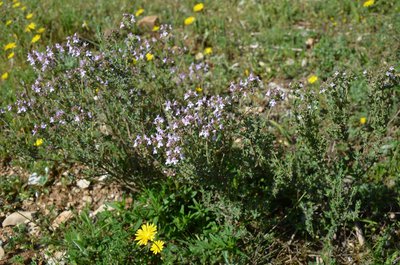
Thym ou farigoulette - Stefano Blanc - PNR Verdon FloraThyme Thyme
Thyme? Does everyone know thyme? Yes and no. My grandmother did not make me thyme tea, but "farigoulette" infusions! And for her stew, when she was done skinning the rabbit, what she put in her bouquet garni (mixed herbs) was not thyme, nor wild thyme, it was farigoulette (farigoulo in Provençal)! Wild thyme and Farigoulette are some types of thyme. The farigoulette is the occitan name for Thymus vulgaris and the wild thyme is Thymus serpyllum.
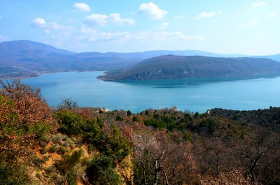
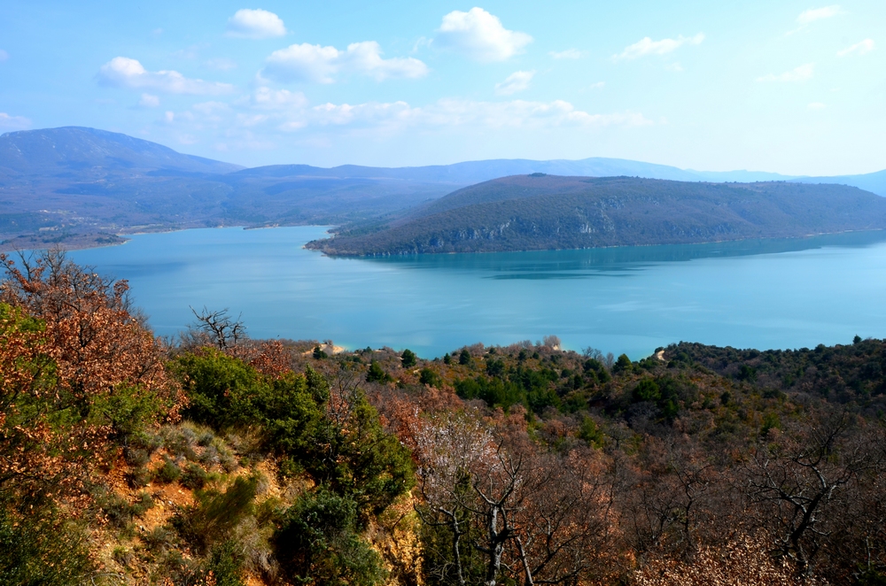
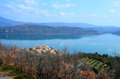
Vue panoramique - Stefano Blanc - PNR Verdon  Panorama
A panoramic view of Lake Sainte-Croix.
A panoramic view of the lake of Sainte-Croix after a stony climb on the mule track. On the left, you can see the youngest village in France (Les Salles-sur-Verdon), rebuilt in 1974 after being destroyed by the launching of the lake of Sainte-Croix.
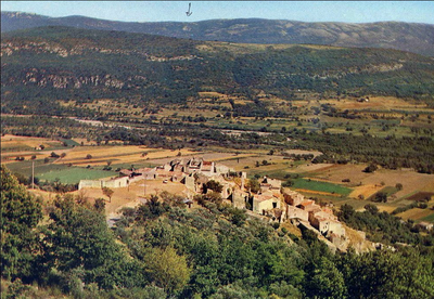
Sainte Croix avec le lac - Stefano Blanc - PNR Verdon  Patrimony and history
Sainte-Croix after the lake
The rumors of the construction of a dam which would drown this generous land, caused the inhabitants to flee from the 1900s. It was not until much later that this project was born, the impoundment of this valley in 1973, spared the village. On the other hand, the remains of a Romanesque church and its crypt where, before 1792, a relic of the Cross of Christ (probably at the origin of the village's name) was buried, as well as 22 farms with ancient buildings.
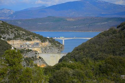
Barrage de Sainte Croix - Stefano Blanc - PNR Verdon Patrimony and historyThe dam of Sainte-Croix
The Sainte-Croix dam is a hydroelectric dam. It belongs to EDF and, retaining 767 million cubic meters of water, it supplies 142 million kWh per year. Built from 1971 to 1974 where it was put put into service, it is a double curvature concrete arch dam. Created by the dam, the lake serves as a reservoir of water and this reservoir is the fourth largest in France by its surface area (about 2,200 ha). It celebrated its 40th anniversary in May 2014.
Sainte Croix avant le lac - DR Patrimony and historyThe Verdon before the dam
In this vast basin laid between the great gorges and the lower gorges, the Verdon benefited from it: It spread in the plain it crossed and provoked a few meanders, marshy areas and a flood from time to time. But the presence of the river offers many advantages, all the communities that had the great chance of having a stream would have told you. It provides the sand and the rocks necessary to build.
Description
From the parking lot, follow the road along the lake towards the nautical base and the campsite (chemin de Paraloup), on the left. Walk along the small road for 800m by the lake. There are a few dry-stone walls, olive trees, and picnic areas.
1- At the intersection, continue on the small road straight ahead. Continue for 800m to the Mule trail on the plateau.
2- Climb to the left the trail along a rump. Higher up (109m in height), at the intersection, go up the road on the left, crossing it.
3- At the end of the climb, go left for about 150m on the trail along the plateau, edge of field. Descend to the left on the marked route (PR). Reach the road at point 1 and return to the starting point by the road taken on the way.
- Departure : From the town hall
- Arrival : In front of the town hall
- Towns crossed : Sainte-Croix-du-Verdon
Forecast
Altimetric profile
Recommandations
Avoid the strong summer heat (south facing path is exposed!). Take 2L of water per person, a hat, and walking shoes. Preferred seasons: spring and fall.
Information desks
House of the Verdon Regional Nature Park
Domaine de Valx, 04360 Moustiers-Sainte-Marie
House of the Verdon Regional Nature Park

OT Sainte-Croix du Verdon
Qua le Village, 04500 Sainte Croix du Verdon
Transport
Access and parking
9.7km southeast of Riez on the D11.
Report a problem or an error
If you have found an error on this page or if you have noticed any problems during your hike, please report them to us here: