Botanical Trail of Cervières
Cervières
Botanical Trail of Cervières
Very easy
1h30
6,2km
+228m
-228m
Boucle
PR local
Embed this item to access it offline
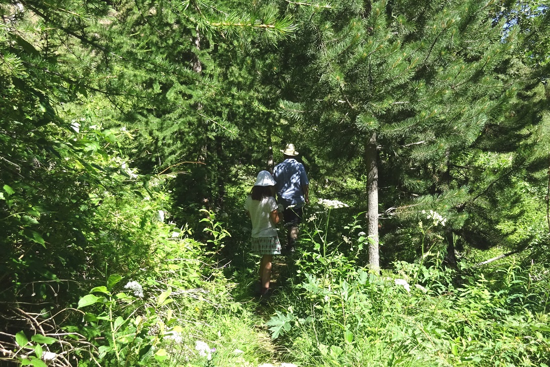
From the Laus, you cross meadows. From the Bletonnet, you enter the site Natura 2000 Rochebrune-Izoard-Valley of the Cerveyrette and in particular in the pine forest of hooks on limestone.
The route climbs in laces until around 1930m of altitude.
Then you will walk along the mountainside to reach a remarkable point of view. There, a landscape awaits you to reveal the history of the panorama you discover and in particular the Lasseron massif.
The route climbs in laces until around 1930m of altitude.
Then you will walk along the mountainside to reach a remarkable point of view. There, a landscape awaits you to reveal the history of the panorama you discover and in particular the Lasseron massif.
6 points of interest
Mélange d'essences forestières - ©Jean-Baptiste Portier - PNR Queyras  Flora
FloraForest diversity
Landmark 32
You arrive here in a forest plot that we name diversified:
- In species: several species of trees are present and in particular some hardwoods
- In age class: trees of all diameters are present.
- In structure: with a treed floor (large trees), a shrub floor (bushes) and a herbaceous floor.
In the end, logging in the mountains aims at diversifying the stands and thus promoting local biodiversity.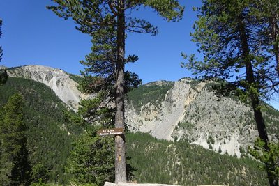
Point culminant et d'observation du sentier - ©Jean-Baptiste Portier - PNR Queyras  Panorama
Belvedere
You arrive here at the end of the botanical path which is concretized by a reading of geological landscape on the ground.
This application provides another vision by comparing past landscapes with those of today. We notice that the forest has gained ground, which has been the case for the whole of France for several decades.
This phenomenon, mainly related to agricultural abandonment (particularly in the mountains), has recently stopped.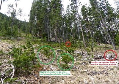
Gestion forestière - ©Jean-Baptiste Portier - PNR Queyras FloraPlot and forest management
Landmark 4
On one of the trees around you you can see a number painted in red on a white background. This is a ";cupboard ;"delimiting the edge of a communal forest plot managed by the NFB. Every 20 or 30 years, an exploitation takes place in this sector. A Natura 2000 zone is therefore not an environmental encapsulation but tries to reconcile human activities and sustainable management of biodiversity. In fact, strains and very young pines testify to the silvicultural activity.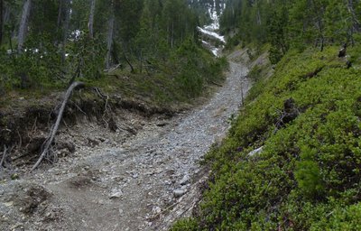
Lave torrentielle - ©Jean-Baptiste Portier - PNR Queyras  Geology
Torrential washing
Landmark 9
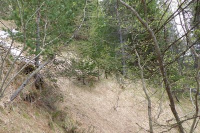
You have just crossed a stony area in a bowl. This is the flow channel of a torrential lava. During violent rains, the scree is loaded with water and sometimes starts moving. The flow carries a lot of elements and can be very fast. Beware of the storms!
On the opposite side, other channels of torrential lava are visible. They can also be used by avalanches in winter. Look for them! Here we see the role of protecting the soil of the forest.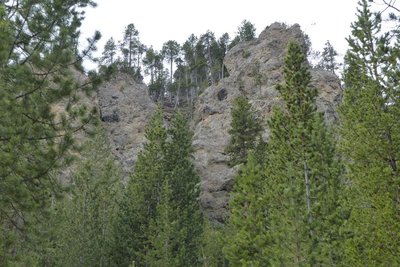
Cargneule - ©Jean-Baptiste Portier - PNR Queyras GeologyCargneule
Landmark 11
The rocky peaks overlooking you are made of a special vacuolar rock: the cargneule.
These cells (or "holes") are formed by the melting of the dolomite constituting the initial rock. This melting is due to acidified waters by the dissolution of gypsum in the immediate vicinity. Since the appearance of these cavities, today, the rainwater continues the erosive work and facilitate the creation of caves: the "balmes" or the "balms".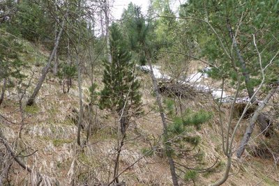
Ubac et son couloir d'avalanche - ©Jean-Baptiste Portier - PNR Queyras FloraUbac/Adret
Landmark 29
Going along the slope, the path is oriented in the North direction Thus, climate change occurs: more cold, more moisture, more persistent snow .. The vegetation responds by adapting. The hooked pine gives way to pine cembro and larch Europe which tolerate more cold. A few sorb trees, enjoying the humidity, make their appearance.
The cold mountain slopes facing north are called Ubacs and are different from the sunnier Adrets.
Description
From the Laus hamlet, enter the Oules valley in the direction of Pic de Rochebrune (3320m) crossing and along the Blétonnet brook, in the middle of meadows mows. For information, these are at their optimum flowering in June.
1- Take the forest track for about 1500 m going past the Blétonnet hamlet.
2- At 1860 m altitude, once you have left the last meadow on your right, take the path on your right.
3- 250 meters further you arrive at a fork which is the point of arrival and departure of the botanical trail in the strict sense. A sign describing the trail and what you can see there is present. Go straight on.
4- Climb in laces, until a new intersection. Then take the path on the right.
5- After approximately 950m of walking on the mountainside, you arrive at the belvedere, the highest point of the hike. A panel with geological landscape reading is installed.
6- Take back the forest trail in your back, right to make a loop, before joining the climb route. The U-turn is possible if you want to revise the plants identified by going up!
- Departure : The Laus, Cervières
- Arrival : The Bletonnet, Cervières
- Towns crossed : Cervières
Forecast
Altimetric profile
Recommandations
Stay safe at the edge of the D902 in summer (road leading to the busy Izoard Pass)
Information desks
House of the Queyras Regional Nature Park
3580 Route de l’Izoard, 05350 Arvieux
The House of the Queyras Regional Nature Park is closed to the public.
OTI du Guillestrois et du Queyras
Maison du Tourisme, 05350 Château Ville-Vieille
Transport
05 Traveller: 04 92 502 505 Tourist Office Guillestrois-Queyras: 04 92 46 76 18
Access and parking
12 km from Briançon, by the D902.
At 17.5 km from Arvieux, by the D902, by the Col d'Izoard. (Parking of the Laus opposite the hostel The Arpelin).
At 17.5 km from Arvieux, by the D902, by the Col d'Izoard. (Parking of the Laus opposite the hostel The Arpelin).
Parking :
Parking du Laus
More information
Report a problem or an error
If you have found an error on this page or if you have noticed any problems during your hike, please report them to us here: