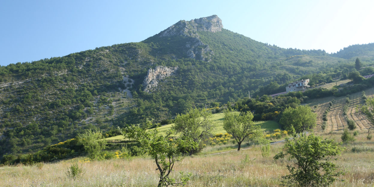
Tour of the Montagne du Buègue
This road proposes to go around themountain of Buègue starting from the plateau of Saint-Laurent and passing by the suspended valley of Léoux. This hike allows you to discover, between passes and valleys, several points of view on the surrounding landscapes and associated with specific traits of the agriculture of drymountain.
4 points of interest
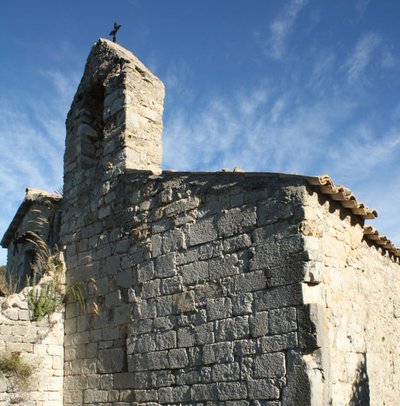
La Chapelle de l'abbaye de Bodon - PNR Baronnies Provençales  Patrimony and history
The Chapel of Saint-Laurent
The Saint-Laurent chapel is one of the remains of the church of the priory of Bodon. Originally from an abbey founded in the 6th century by a holy monk named Mary or May, in the 12th century, this priory controlled forty churches located between La Motte-Chalancon, Lemps and Sainte-Jalle, and was then attached to the abbey of Ile-Barbe, in Lyon. This small chapel was located in the southern apse of the church of which there are vestiges (private property, forbidden access).
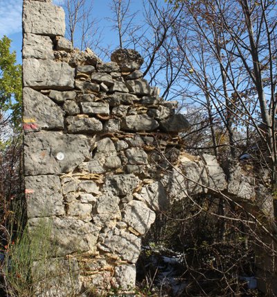
L'arche de la Petite Chaume - PNR Baronnies Provençales  Elevage et pastoralisme
The farm of the small Chaume
These ruins are the last visible remains of the several farms of this side of Buègue, gradually abandoned since the end of the 19th century. The L-shaped building, frames a courtyard bounded by a wall to the south. On the ground floor, it gathered several spaces devoted to animals: A sheepfold for goats and sheeps, a stable for horses, a "pourcieu" for pigs. On the first floor, a part was reserved for living, while the other one was devoted to storing the hay.
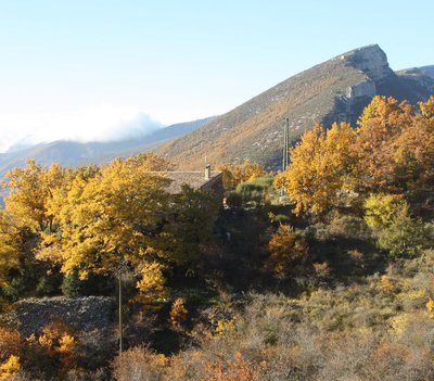
La Bergerie de la Botte - PNR Baronnies Provençales Elevage et pastoralismeThe former sheepfold of La Botte
The former sheepfold of La Botte is one of the most visible scenery markers of the pastoral activity which reigned on the mountain of Buègue until the post-war period. Now rehabilitated as a dwelling, the building was built with the slope: The level offset made it a ground floor destined to the animals and a first floor devoted to the hay. On the other hand, the sheepfold had been positioned on a sunny slope and near a creek.
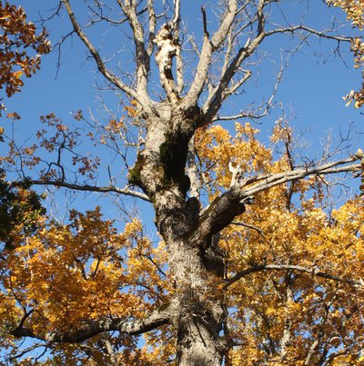
Un chêne têtard - PNR Baronnies Provençales Elevage et pastoralismeTadpole oak trees
Above the road towards the Bugeue ridge, a wood of old oaks with crooked trunks, was used to feed the flocks. Young twigs were regularly cut to feed the animals with the leaves of the trees. With each cut and each regrowth of these branches, the scars of the wood formed balls that the bark would overlay little by little. These trees are called "tadpole oaks" (with a head) because of their very specific shape.
Description
From the parking lot of the Croix de Bodon, turn right onto the tarmac road to Bodon Abbey, 250m away. After the abbey, go past the roadside house and take the paved road up towards the top of the plateau.
1 - Go up on the winding tar path to the highest farm where the small road turns into a dirt road. Follow this path for 2km to reach the lavender field at the top of the plateau. The signpost of Col de Saint-May is located 30m east of the lavender field.
2 - At the Col de Saint-May (975m) take the first trail to the right descending in ubac towards "Rémuzat" by the "Ravine du Col". (Be careful shortly after departure, passing overhanging and sloping on the side of amarl!) Follow the path along the creek until you come to a path that you follow to the left. Cross the little brook to go up steeply on a road that you leave in the first turn to take a path on the right that passes in front of the ruins of an old farm with a linden planted in front. Continue up the trail, past another ruin on the way to the Col de Pensier (1002m), which you will reach a little further.
3 - Go down the wide trail to reach the valley of Léoux and reach the road after a farm. At the bridge, do not cross the creek, turn left along the river. In the turn that leads to a farm, turn right and follow the trail which gradually rises above the stream until losing it and join a house at the place "Bergerie de la Botte". Stay behind the house, continue along the trail which slopes to the left, change slopes, and join the shoulder of themountain in front.
4 - Upon arriving on the ridge, leave the path for a path down left on the south flank. The trail joins the small road from Saint-May to the Plateau Saint-Laurent. Climb back up and rejoin the starting point.
- Departure : Croix de Bodon
- Arrival : Croix de Bodon
- Towns crossed : Saint-May, Rémuzat, Cornillon-sur-l'Oule, and Villeperdrix
Forecast
Altimetric profile
Information desks
Maison du Parc naturel régional des Baronnies provençales
575 Route de Nyons – La plaine du Pont, 26510 Sahune
Les locaux du Parc naturel régional des Baronnies provençales ne sont pas ouverts au public.

OT Baronnies en Drôme Provençale - Nyons
Place de la Libération, 26110 Nyons
Access and parking
26km east of Nyons on the RD94 (route de Gap). In the Gorges de l'Eygues leave the D94 for the D562 going up to the village of Saint-May then follow the small road indicating "Vautours" for 2km.
Parking :
More information
Report a problem or an error
If you have found an error on this page or if you have noticed any problems during your hike, please report them to us here: