The Pelenc forest from Régusse
The circuit around the state-owned Pelenc forest is done on wide and relatively flat paths. Once on your way, you will go back up the history of this forest and discover the trails left by mankind and his activities; the traces of coal, the members of the French Resistance, farmers, or officers of Water and Forestry
6 points of interest
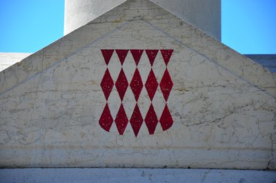
Blason sur le monument aux morts - Stefano Blanc - PNR Verdon  Patrimony and history
A little heraldry
It could be that the coat of arms of Régusse reminds you of something. These red and white diamonds (called tapered reds in heraldry) are indeed the coat of arms of the Grimaldi family who rules the Principality of Monaco today. A branch of this family from Genoa bought the domain of Régusse in the 17th century and kept it until the Revolution, when their property was confiscated. But the town of Régusse stills holds the arms of the family on its coat of arms.
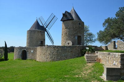
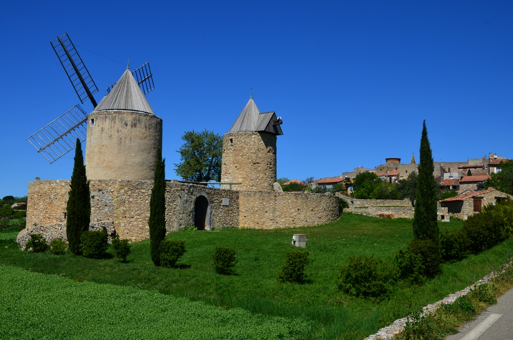
Les Moulins de Régusse - Stefano Blanc - PNR Verdon Patrimony and historyThe Windmills
Provence is a chosen land for windmills that were introduced in this region in the 13th century. Mistral offers here a powerful and constantly renewed energy. The two windmills of Régusse were already indicated on Cassini’s map in the 13th century. Their construction may date from the 18th century – a period of expansion for windmills. But it is possible that their origin dates back to the Templars who helped to spread this technique and had a commandery in Régusse in the 13th century.
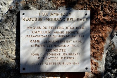
La stéle de la résistance - ©Stefano Blanc - PNR Verdon Patrimony and historyMemorial to the Resistance
The Var department played an important role in the liberation of France since it was on its beaches that French and American troops landed. But if during this winter 1942-1943 liberation was a distant hope, the Resistance was preparing it and getting organized. Thus the site of the forest of Pelenc received a group of parachutists 4 May 1944. They were dispersed by the Germans on 18 May, and then reconstituted by Lt. Abiven. The memorial recalls this glorious episode of the member of the Resistance of the forest of Pelenc.
Cuve de cuisson - Stefano Blanc - PNR Verdon  Savoir-faire
Go to coal
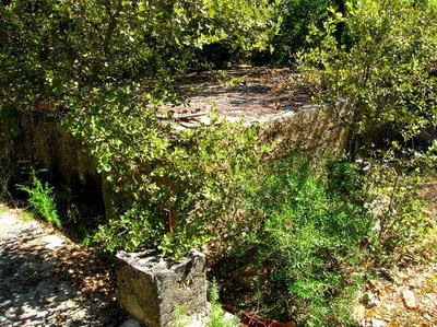
This is a profession forgotten today: charcoal burner. In Provence, we say "carbounié". Its origin dates back to the mid-19th century when energy needs transformed the industry and domestic life. The artisanal technique of producing charcoal is long and requires expertise. It is necessary, needless to say, to cut wood. On communal properties, this activity was subject to authorization and, in order to allow the forest to regenerate, cutting and rest are alternated.
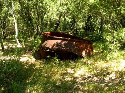
La Citerne des Maquisards - ©Stefano Blanc - PNR Verdon Patrimony and historyThe Maquisards’ Tank
In Pelenc, tanks were used as water reserves at the beginning of last century. One of them is called: the "Maquisards’ Tank". This name refers to a forest site located in the woods during the Second World War. The little troop consisting of forty men were not a kind of "maquis", active and armed people, as it often existed in the Haut-Var at the same time. Most charcoal burners exercised this ancient and traditional activity here.
Petit point d'eau - ©Stefano Blanc - PNR Verdon  Water and rivers
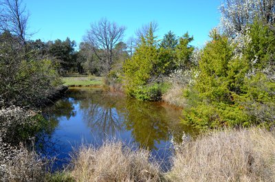
Emergency WaterEmergency water
The ponds are real havens of peace and places where wildlife comes to drink especially during the hot summers. If you are discreet, it is not uncommon to see animals that quench their thirst.
Description
Cross the village by the Grand Rue and head down to the windmills by the Rue des Moulins. Pass the two mills and follow the small road (CD 260) for 800m. Continue straight to the intersection with the Chemin de la Sine. Take a right on the Avenue Jean Giono (paved road on 600m). Continue on a dirt road in the middle of the forest for 2.3km.
1- In the woods, reach by the track the Commemorative Rock of the maquis of Pélenc. Turn left on the "Piste de Moissac". The roadside is lined with stone markers indicating the limits of the state-owned forest. At the "Valley de Bolle" track (not shown), reach by the route the intersection between Moissac and Régusse.
2- Follow the direction of Moissac. Leave a first track behind, then proceed on the second one ("Piste du Cadastre "). Follow the path that passes by the old coal burners in front of the Maquis tank. Go down for 500m to the "Baquis" track. Follow it to a tank. Continue straight in the middle of the pines. At the next intersection (800m), leave to the right the "Piste de l'Auviduery" (not shown) and take the second path to the left. Go back up the plateau (viewpoint of the village) and reach at a barrier a junction of the routes to Moissac and Régusse.
3 - Turn left on Chemin de Régusse. Leave a path starting on the left, past a ruin then, at the forest exit, reach a small road. Follow it for 100m and at the intersection turn left on the road. Come out at the St. Eloy oratory on the Avenue Frédéric Mistral. Enter the village by the road (for your security, walk on the left side of the road).
- Departure : At the village, Cours Alexandre Gariel
- Arrival : Village center
- Towns crossed : Régusse and Moissac-Bellevue
Forecast
Altimetric profile
Recommandations
Avoid high summer temperatures, leave early. Remember to pack at least 2L of water per person, a hat and proper walking shoes. In summer time, find out whether the forests are open to the public (fire risk) by calling 04 89 96 43 43 (answering machine of the Direction Départementale des Territoires et de la Mer) or by visiting the website of the Prefecture by clicking the tab "For more information".
Information desks
House of the Verdon Regional Nature Park
Domaine de Valx, 04360 Moustiers-Sainte-Marie
House of the Verdon Regional Nature Park

OTI Lacs et gorges du Verdon
Place Martin Bidouré, 83630 AUPS
Access and parking
At 9.5km West of Aups, through the D9 and the D30.
Parking :
Report a problem or an error
If you have found an error on this page or if you have noticed any problems during your hike, please report them to us here: