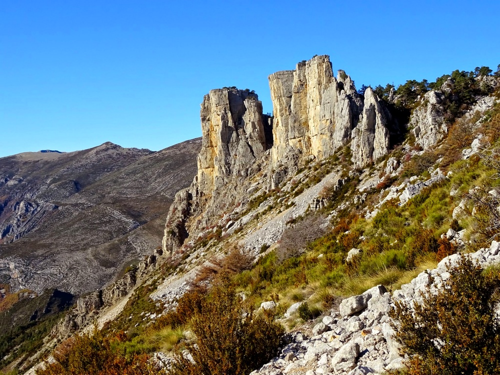
Cadières de Brandis
Dominating the Verdon at over 1545m, the cliffs of Cadières de Brandis mark the landscape (Cadiero meaning chair in the Occitan language, therefore "cadières de brandis" could mean "wobbly chairs"). This walk offers remarkable views of this geological curiosity and the surrounding peaks.
1 point of interest
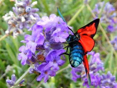
Zygéne sur lavande sauvage - ©Stefano Blanc - PNR Verdon  Fauna
FaunaThe Zygaena
Zygaenas are Lepidoptera insects of the Zygaenidae family. They are divided into several genus. There are nearly 800 species of zygaenas worldwide, including 60 in Europe and 35 in France.
Description
From the car park of the col des Lèques, take the track heading south. You can park a little further away (there’s a parking lot at the tennis court or at the small mountain pass at 400m). Follow the track towards Cadières de Brandis.
1 - At the first intersection, leave the Chemin de Taulane on the right (return path) and continue up the forest track on the left. Gradually go up the track for about 1km until the intersection with the path descending on Castellane.
2 - Continue on the rising track. At 100m, leave a descending track on the left. Continue on the rising track for another 300m, then follow the route of the trail at the first turn. Reach to the peak of the Colle Bernaiche and regain the trail coming from Villars Brandis.
3 - Continue on the track heading towards the pylon and at the end of it, follow the path starting from the hillside and heading towards Cadières. Continue on this route which is relatively flat for 500m then. When you have reached a fruit tree, leave this route in direction of Cadières, which is glimpsedat the back and follow the path that goes right up the hill. Meander between the rocks and under the pine trees, reach the highest point of the trek (1 550m).
4 – Between pines and cleared passages, go down the path leading to the plateau. After about 900metres, turn right at the bottom of a depression (an area where the air pressure is low), then go through the rocky passages (not dangerous, but some steep passages; pay attention to the marking!) and cross a small rock tunnel before starting the descent to the forest. In the woods, (a steep downhill!) continue to pass through until you reach another marked path.
5 - Leave behind the path descending to Taulane on the left and follow the path on the right going towards the col des Lèques. At 900m, regain point ( 1 )
1 - Enter the car park via the route taken initially.
- Departure : Col des Lèques, Castellane
- Arrival : Col des Lèques, Castellane
- Towns crossed : Castellane
Forecast
Altimetric profile
Recommandations
Avoid high summer temperatures, leave early. We recommend: 2 L of water per person, a hat and proper hiking shoes.
Information desks
House of the Verdon Regional Nature Park
Domaine de Valx, 04360 Moustiers-Sainte-Marie
House of the Verdon Regional Nature Park

OTI Verdon Tourisme
Rue nationale, 04120 Castellane
Transport
« Limitons les déplacements en voiture, pensons aux transports en commun ! Prenez la ligne régionale BV1bis entre Riez et Castellane du 1er Juillet au 11 octobre. Depuis Riez, départ 8h35, retour 16h00. Depuis Castellane, départ à 7h30, retour 16h20 et 19h30. Retrouvez tous les horaires sur https://zou.maregionsud.fr/ ».
Access and parking
D4085 for Castellane
Parking :
Report a problem or an error
If you have found an error on this page or if you have noticed any problems during your hike, please report them to us here: